
County Westmeath is a county in Ireland. It is in the province of Leinster and is part of the Midlands Region. It originally formed part of the historic Kingdom of Meath. It was named Mide because the kingdom was located in the geographical centre of Ireland. Westmeath County Council is the administrative body for the county, and the county town is Mullingar. At the 2016 census, the population of the county was 88,770.

County Cavan is a county in Ireland. It is in the province of Ulster and is part of the Border Region. It is named after the town of Cavan and is based on the historic Gaelic territory of East Breffny (Bréifne). Cavan County Council is the local authority for the county, which had a population of 76,176 at the 2016 census.

Castlepollard is a small town in north County Westmeath, Republic of Ireland. It lies west of Lough Lene and northeast of Lough Derravaragh and Mullingar.
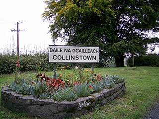
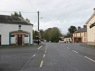
Collinstown is a village in north County Westmeath, situated on the R395 regional road overlooking Lough Lene. It lies 18 km (11 mi) northeast of the county town of Mullingar and had a population of 356.

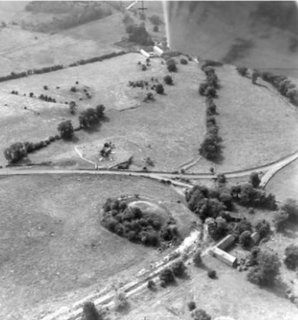
Lough Lene is a lake situated in north County Westmeath, Ireland, between the villages of Castlepollard, Collinstown and Fore.
Lough Lene Gaels is a Gaelic Athletic Association club, based in Collinstown, County Westmeath, Ireland.

The River Inny is a river within the Shannon River Basin in Ireland. It is 88.5 kilometres (55.0 mi) in length, and has a number of lakes along its course.

Lough Sheelin, in standard Irish Loch Síleann, is a limestone freshwater lough (lake) in central Ireland. The lake is a part of the River Inny course, and ultimately of the Shannon system.
Mountnugent, historically known as Dalysbridge, is a village in southern County Cavan, Ireland. It is located on the R194 regional road on a river crossing near Lough Sheelin.

Corkaree is a barony in north County Westmeath, in the Republic of Ireland. It was formed by 1672. It is bordered by three other baronies: Fore, Moyashel and Magheradernon and Moygoish.

Moygoish is a barony in north County Westmeath, in the Republic of Ireland, formed by 1672. It is bordered by County Longford to the west and four other Westmeath baronies: Corkaree, Fore, Moyashel and Magheradernon and Rathconrath to the south–west.

Moyashel and Magheradernon is a barony in the centre of County Westmeath, in the Republic of Ireland, formed by 1672. It is bordered by eight other baronies: Corkaree and Fore, Delvin and Farbill, Fartullagh and Moycashel and Rathconrath and Moygoish. .

Kilkenny West, previously Maherquirke or Dillons country, is a barony in west County Westmeath, Ireland. It was formed by 1542. It is bordered by County Longford to the west; it is also bordered by three other Westmeath baronies: Rathconrath, Brawny and Clonlonan. The largest centre of population in the barony is the village of Glassan.
Brawny is a barony in south–west County Westmeath, Ireland. It was formed by 1672. It is bordered by County Roscommon to the west. It also borders two other Westmeath baronies: Kilkenny West and Clonlonan. The largest centre of population in the barony is the town of Athlone.
Fartullagh, previously Tyrrells country, is a barony in south–east County Westmeath, in the Republic of Ireland. It was formed by 1542. It is bordered by County Offaly to the south and three other baronies: Moycashel, Moyashel and Magheradernon and Farbill.

Multyfarnham is a civil parish in County Westmeath, Ireland. It is located about 12.3 kilometres (8 mi) north of Mullingar on the southwestern shore of Lough Derravaragh.

Rathgarve, is a civil parish, religious parish, and townland, in County Westmeath, Ireland. It is located about 19.24 kilometres (12 mi) north of Mullingar. It takes in parts of the modern town of Castlepollard, and it forms part of the religious parish of St. Michael's Parish, Castlepollard. Historically it has been linked to the 8th century monk Dicuil, according to Monasticon Hibernicum. However, he is also associated with Rathgar, in Dublin, which may indicate a misassociation with one of these sites.
Lickbla, is a historic monument, civil parish, religious parish, and townland, in County Westmeath, Ireland. It is located about 23.05 kilometres (14 mi) north of Mullingar. St. Bladma is listed in the Martyrology of Oengus as a saint: "Bladma, i.e. from Blad son of Conmac Cas Clothach, grandson of Tachall son of Cermait, son of the Dagda, a quo nominatur. Or Blad son of Breogan, a quo Sliab Bladma" whose feastday is the 7th April and 20th November.

Clonava is a townland in County Westmeath, Ireland. It is located about 16.31 kilometres (10 mi) north of county town Mullingar.

Lough Kinale is a freshwater lake in the north midlands of Ireland. It is located on the borders of Counties Longford, Westmeath and Cavan. Lough Kinale forms part of the River Inny. The lake's inflow is from Lough Sheelin and the outflow is to Lough Derravaragh. The neighbouring Derragh Lough is also connected by a river to Lough Kinale.


