Related Research Articles
Kianggeh is a mukim (subdistrict) in the Brunei-Muara District of Brunei. It is located in the central part of the district, bordering the mukims of Berakas A and Berakas B to the north, Kota Batu to the east and south, the Kampong Ayer mukims and Lumapas to the south, Kilanas to the south-west and Gadong B to the west. Kianggeh is also part of the municipal area of Bandar Seri Begawan, the capital of Brunei. The population was 8,228 in 2016.
Berakas 'A' is a mukim or subdistrict of Brunei-Muara, Brunei. It borders the mukims of Mentiri and Berakas 'B' to the east, Kianggeh to the south, Gadong 'B' to the south-west and Gadong 'A' to the west, as well as the South China Sea to the north. The population was 27,223 in 2016. The community of Berakas 'A' is headed by a penghulu and the incumbent is Abdul Ahmad bin Husain.
Berakas 'B' is a mukim or subdistrict in the Brunei-Muara District of Brunei. It is located in the north-east centre of the Brunei-Muara district, bordering Mukim Mentiri to the north and east, Mukim Kota Batu to the east and south, Mukim Kianggeh to the south and Mukim Berakas 'A' to the west and north. The population was 40,710 in 2016. The community leader of Berakas 'B' is a penghulu and the incumbent is Pengiran Ali bin Pengiran Maon.
Kilanas is a mukim (subdistrict) in the Brunei-Muara District of Brunei. It is located in the southwestern part of the district, bordering the mukims of Gadong 'B' and Kianggeh to the north-east, Lumapas to the east and south, Pengkalan Batu to the south-west and Sengkurong to the west and north. The population was 22,492 in 2016.
Gadong 'A' is a mukim (subdistrict) in Brunei-Muara District of Brunei. The population was 34,049 in 2016.

Rimba is a settlement on the outskirts of Bandar Seri Begawan, the capital of Brunei. It is officially a village under Gadong 'A', a mukim (subdistrict) of Brunei-Muara District. Rimba comprises the original Rimba settlement area but it also sometimes refer to the greater area which includes the Rimba public housing estates of the Landless Indigenous Citizens' Housing Scheme and the National Housing Scheme.

A village is the third and lowest administrative division of Brunei. It is headed by a village head. Villages are subdivisions of the subdistricts of Brunei. A village may have a population ranging from a few hundreds to less than ten thousand people.
Tungku, locally known in Malay as Kampung Tungku or Kampong Tungku, is a village administrative division in Brunei-Muara District of Brunei. It is one of the village subdivisions under the mukim or subdistrict Gadong 'A'. The community of Tungku is jointly administered with that of Katok where both are headed by a ketua kampung or village head; the incumbent is Ismail bin Rajab. Tungku is also a designated postcode area with the postcode is BE2119.
The Area 1 of Tungku Landless Indigenous Citizens' Housing Scheme is a village administrative division in Brunei-Muara District of Brunei. It is a village subdivision under the mukim or subdistrict of Gadong 'A'. The community is headed by a ketua kampung or village head and the incumbent is Hassan bin Ali. The area is a cluster of public housing under the government's Landless Indigenous Citizens' Housing Scheme in the vicinity of the original settlement of Tungku. It is subsequently a designated postcode area with the postcode BE2519.
Katok 'A', officially Katok 'A' Landless Indigenous Citizens' Housing Scheme, also Area 3 of Tungku Landless Indigenous Citizens' Housing Scheme, is a village administrative division in Brunei-Muara District of Brunei. It is a village subdivision under the mukim or subdistrict of Gadong 'A'. Katok 'A' has an area of 69.15 hectares and, as of 2014, the population is 1,776. The community of Katok 'A' is headed by a ketua kampung or village head and the incumbent is Adanan bin Bagol. Katok 'A' is also a designated postcode area with the postcode BE2919.
Area 2 of Tungku Landless Indigenous Citizens' Housing Scheme is a village administrative division in Brunei-Muara District, Brunei. It is a subdivision under the mukim or subdistrict of Gadong 'A'. The area comprises a public housing cluster of Landless Indigenous Citizens' Housing Scheme, a government housing programme. Its community is headed by a ketua kampung or village head and the incumbent is Pengiran Hamzah bin Pengiran Matali. Tungku is also a designated postcode area with the postcode BE2719.
Mata-Mata, locally known in Malay as Kampung Mata-Mata or Kampong Mata-Mata, is a populated place in Brunei-Muara District, Brunei. It is a group of settlements on the outskirts of Bandar Seri Begawan, the capital of Brunei, comprising the original settlement of Mata-Mata, the Perpindahan Mata-Mata settlement and the Mata-Mata public housing areas of the Landless Indigenous Citizens' Housing Scheme.
Katok, locally known in Malay as Kampung Katok or Kampong Katok, is a village administrative division in Brunei-Muara District, Brunei. It is a village subdivision under the mukim or subdistrict of Gadong 'A'. The community of Katok is jointly led with that of Tungku subdivision by a ketua kampung or village head, and the incumbent is Ismail bin Rajab. Katok is also a designated postcode area with the postcode BE2319.
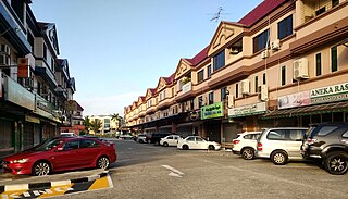
Kiulap is a neighbourhood and commercial area in Bandar Seri Begawan, the capital of Brunei. It is officially a village-level subdivision of Brunei under Gadong 'B' of Brunei-Muara District. Kiulap has an area of 176.53 hectares ; it has a population of 1,788.
Kiarong is a neighbourhood and commercial area in Bandar Seri Begawan, the capital of Brunei. It is officially a village subdivision under Gadong B, a mukim (subdistrict) of Brunei-Muara District. Kiarong has an area of 383.43 hectares and a population of 5,556. The community is led by a ketua kampung or village head and the incumbent is Omarsidi bin Ahmad. The postcode for Kiarong is BE1318.
Katok 'B', also known as Mata-Mata Landless Indigenous Citizens' Housing Scheme or the abbreviated Malay name STKRJ Mata-Mata, is a public housing estate on the outskirts of Bandar Seri Begawan in Brunei-Muara District, Brunei. It is officially designated as three villages, the third- and lowest-level subdivisions of Brunei. Katok 'B' is one of the estates in the country under the Landless Indigenous Citizens' Housing Scheme, a public housing programme.
Perpindahan Mata-Mata is a settlement on the outskirts of Bandar Seri Begawan, the capital of Brunei. It is officially a village subdivision under Gadong 'B', a mukim (subdistrict) of Brunei-Muara. Perpindahan Mata-Mata comprises the public housing estate under the National Resettlement Programme, as well as the original Landless Indigenous Citizens' Housing Scheme estate of Mata-Mata. The postcode for Perpindahan Mata-Mata is BE1918.
Lambak Kiri Landless Indigenous Citizens' Housing Scheme is a public housing estate in Lambak Kiri, a populated place in Brunei-Muara District, Brunei. It is officially a village subdivision of Berakas A. Lambak Kiri Landless Indigenous Citizens' Housing Scheme is one of the housing estates in the country for the Landless Indigenous Citizens' Housing Scheme which is a government housing programme for the rakyat jati or indigenous citizens of Brunei.
Rimba National Housing Scheme is a public housing estate on the northern outskirts of Bandar Seri Begawan, the capital of Brunei. It officially consists of five village subdivisions which are under Gadong 'A', a mukim (subdistrict) in Brunei-Muara District. Rimba National Housing Scheme is one of the housing estates under the National Housing Scheme, a government housing programme for the citizens of Brunei. It is de facto a suburb of the capital.
Rimba Landless Indigenous Citizens' Housing Scheme is a public housing estate near Rimba on the outskirts of Bandar Seri Begawan, the capital of Brunei. It is officially a village under Gadong 'A', a mukim (subdistrict) of Brunei-Muara District. As a village, it has an area of 69.15 hectares and the population of 6,800. Rimba Landless Indigenous Citizens' Housing Scheme is one of the public housing estates in the country under its namesake, which is a government housing programme for the rakyat jati or indigenous citizens of Brunei.
References
- 1 2 "Population and Housing Census Update Final Report 2016" (PDF). www.deps.gov.bn. Statistics Department. December 2018. Retrieved 27 June 2021.
Coordinates: 4°31′34″N114°37′09″E / 4.5262°N 114.6193°E
| | This Brunei location article is a stub. You can help Wikipedia by expanding it. |