Gagetown was created in 1765 as Gage Township in Nova Scotia.
In 1786 the township formed the core of Gagetown Parish when New Brunswick erected its counties and parishes.[6] The parish added territory back to the Charlotte County line.[7][8]
In 1838 the rear of Gagetown was included in the newly erected Petersville Parish.[9]
on the southeast by the southern line of a grant to Nathaniel Jarvis, which forms the southern boundary of the village of Gagetown, and running southwesterly to the rear of the grant, then turning left and running south 52º west,[a] crossing Route 102 and into CFB Gagetown, about 12 kilometres to the southernmost corner of a grant to Robert Nelson at the corner of Lawfield Road and Kerr Road in the former community of Summer Hill;
on the southwest by the southwestern line of the Nelson grant prolonged to the Sunbury County line;
on the northwest by the Sunbury County line;
including Gagetown Island and Grimross Island.
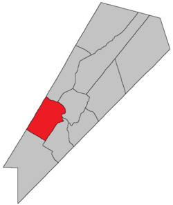
Communities
Communities at least partly within the parish.[10][11][15]bold indicates an incorporated municipality; italics indicate a community expropriated for CFB Gagetown
↑ By the magnet of 1850,[12] when declination at the starting point was about 18º 20' west of north.[13] The Territorial Division Act clause referring to magnetic direction bearings was omitted in the 1952[14] and 1973 Revised Statutes.[2]
1 2 3 4 5 "No. 127". Provincial Archives of New Brunswick. Department of Natural Resources and Energy Development. Retrieved 19 June 2021. Remainder of parish on maps 138, 139, and 148 at same site.
1 2 3 4 5 "392"(PDF). Transportation and Infrastructure. Government of New Brunswick. Retrieved 19 June 2021. Remainder of parish on mapbooks 393, 411, 412, 429, and 430 at same site.
↑ "13 Vic. c. 51 An Act to consolidate all the Laws now in force for the division of the Province into Counties, Towns and Parishes.". Acts of the General Assembly of Her Mjaesty's Province of New Brunswick, Passed in the Year 1850. Fredericton: Government of New Brunswick. 1850. pp.142–152, 145–149. Book was poorly proofread, resulting in title typo and reuse of page numbers 145–152.
↑ "Chapter 227 Territorial Division Act". The Revised Statutes of New Brunswick 1952 Volume III. Fredericton: Government of New Brunswick. 1952. pp.3725–3771.
This page is based on this Wikipedia article Text is available under the CC BY-SA 4.0 license; additional terms may apply. Images, videos and audio are available under their respective licenses.