Adelaide Metro is the public transport system of Adelaide, the capital city of South Australia. It is an intermodal system offering an integrated network of bus, tram, and train service throughout the metropolitan area. The network has an annual patronage of 79.9 million, of which 51 million journeys are by bus, 15.6 million by train, and 9.4 million by tram. The system has evolved heavily over the past fifteen years, and patronage increased dramatically during the 2014–15 period, a 5.5 percent increase on the 2013 figures due to electrification of frequented lines.

Rundle Mall is a pedestrian street mall located in Adelaide, South Australia. It was opened as a pedestrian mall in September 1976 by closing the section of Rundle Street between King William Street and Pulteney Street, to vehicular traffic. The street continues as Rundle Street to the east and Hindley Street to the west.

North Terrace is one of the four terraces that bound the central business and residential district of Adelaide, the capital city of South Australia. It runs east–west, along the northern edge of "the square mile". The western end continues on to Port Road, and the eastern end continues across the Adelaide Parklands as Botanic Road.

King William Street is the part of a major arterial road that traverses the CBD and centre of Adelaide, continuing as King William Road to the north of North Terrace and south of South Terrace. At approximately 40 metres (130 ft) wide, King William Street is the widest main street of all the Australian State capital cities. Named after King William IV in 1837, it is historically considered one of Adelaide's high streets, for its focal point of businesses, shops and other prominent establishments. The Glenelg tram line runs along the middle of the street through the city centre.
The South Australian Company, also referred to as the South Australia Company, was formed in London on 9 October 1835, after the South Australia (Foundation) Act 1834 had established the new British Province of South Australia, with the South Australian Colonization Commission set up to oversee implementation of the Act.
This is a timeline of Adelaide history.

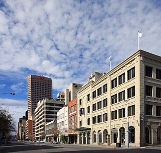
Adelaide city centre is the inner city locality of Greater Adelaide, the capital city of South Australia. It is known by locals simply as "the City" or "Town" to distinguish it from Greater Adelaide and from the City of Adelaide local government area. The population was 15,115 in the 2016 census.
Rundle Park / Kadlitpina, also known as Park 13, is a part of the Adelaide Park Lands in Adelaide, South Australia. It was known as Rundle Park until its Kaurna name was assigned as part of the dual naming initiative by Adelaide City Council in 2003. The park is bounded by East Terrace, Botanic Road (north), Dequetteville Terrace (east) and Rundle Road (south).
Peacock & Son was a tanning and wool-brokering business in the early days of South Australia. Three members of the family were notable public figures: William Peacock was a successful businessman and one of the colony's first parliamentarians. His eldest son Joseph Peacock carried on the family business and was a member of parliament. His youngest son Caleb Peacock was a member of parliament and Mayor of Adelaide from 1875 to 1877, the first such born in the Colony.

Grenfell Street is a major street in the north-east quarter of the Adelaide city centre, South Australia. The street runs west-east from King William Street to East Terrace. On the other side of King William Street, it continues as Currie Street. Its intersection with Pulteney Street is encircled by Hindmarsh Square.

East Terrace marks the eastern edge of the Adelaide city centre. It is one of the main north–south thoroughfares through the east side of the city. Although the terrace essentially runs north–south between North Terrace and South Terrace, unlike Adelaide's other three terraces, its path is far from a straight line; travelling the entire length of East Terrace requires turning at right angles at most intersections from Pirie Street onwards. These days however, the traffic flow, after a swerve to the east between Grenfell and Pirie Streets, continues southwards over the Pirie intersection into Hutt Street and on down to South Terrace.
Currie Street is a main street in the Adelaide city centre, South Australia. It runs east–to–west from King William Street, through Light Square, to West Terrace on the western edge of the city centre.
Adelaide Educational Institution was a privately run non-sectarian academy for boys in Adelaide founded in 1852 by John Lorenzo Young.
He avoided rote learning, punishment and religious instruction, but taught moral philosophy, physiology, political economy and mechanical drawing ... (and) surveying on field trips.

James Shaw was a Scottish painter, photographer, engraver, lithographer, surveyor, and lawyer. He was also an early colonist of South Australia.
William Paxton was a South Australian colonist who arrived in the Province of South Australia in 1840, became one of the investors in the Burra copper mines and returned to England in July 1855, a wealthy man.
The South Australian Vigneron and Gardeners' Manual was the first gardening book published in the newly founded colony of South Australia.

Adelaide Arcade is a heritage shopping arcade in the centre of Adelaide, South Australia. It is linked to, and closely associated with, Gay's Arcade.

Thomas Greaves Waterhouse JP was a prominent businessman, investor and philanthropist in early colonial South Australia arriving soon after the start of official settlement. He was one of the early shareholders of the Burra Burra Mine, and for a long time held a seat on the Directorate. He was also involved in the establishment of the Bank of Adelaide.

Pilgrim Uniting Church is a church in the heart of the City on Flinders Street, Adelaide, South Australia. It is a church of the Uniting Church in Australia.
Robert Haining was the first Church of Scotland minister in South Australia.

