
Sturt Highway is an Australian national highway in New South Wales, Victoria, and South Australia. It is an important road link for the transport of passengers and freight between Sydney and Adelaide and the regions along the route.
Port Wakefield Highway is an important South Australian highway, connecting Adelaide to the Yorke Peninsula, Port Augusta, northern and western South Australia, the Northern Territory and Western Australia. It is designated National Highway A1 and a part of the National Highway. It is named after Port Wakefield, the first government town north of Adelaide.

Main North Road is the major north–south arterial route through the suburbs north of the Adelaide City Centre in the city of Adelaide, South Australia, and linking to Gawler on Adelaide's outer north-eastern fringes.
South Road and its southern section as Main South Road outside of Adelaide is a major north–south conduit connecting Adelaide and the Fleurieu Peninsula, in South Australia. It is one of Adelaide's most important arterial and bypass roads. As South Road, it is designated part of route A2 within suburban Adelaide. As Main South Road, it is designated part of routes A13 and B23.
Portrush Road is a major arterial route through the eastern suburbs of Adelaide, the capital of South Australia. This name covers many consecutive streets and is not widely known to most drivers except for the southernmost section, as the entire allocation is still best known as by the names of its constituent parts: Hampstead Road, Taunton Road, Ascot Avenue, Lower Portrush Road, and Portrush Road proper. This article will deal with the entire length of the corridor for sake of completion, as well to avoid confusion between declarations. Portrush Road is designated route A17.

Goodwood Road is a major north–south arterial road, approximately 10 kilometres long, in Adelaide, South Australia. It runs between the Adelaide city centre and Adelaide's southern suburbs of Pasadena and Panorama.

Largs Bay is a suburb in the Australian state of South Australia located on the Lefevre Peninsula in the west of Adelaide about 16 kilometres (9.9 mi) northwest of the Adelaide city centre.
Grand Junction Road is the longest east–west thoroughfare in the Adelaide metropolitan area, traversing through Adelaide's northern suburbs approximately 8 kilometres north of the Adelaide city centre.
Port River Expressway is a 5.7-kilometre (3.5 mi) freeway-grade road. The expressway links Port Adelaide and the Lefevre Peninsula across the north-western suburbs of Adelaide to major interstate routes via North-South Motorway.

The Lefevre Peninsula is a peninsula located in the Australian state of South Australia located about 15 kilometres (9.3 mi) northwest of the Adelaide city centre. It is a narrow sand spit of about 30 square kilometres (12 sq mi) running north from its connection to the mainland.
Northern Expressway, also known as the Fatchen Northern Expressway, is a 21 kilometre long controlled-access highway in Adelaide, South Australia. Since March 2020, the North–South Motorway continues west of Port Wakefield Highway and intersects the Port River Expressway to reach the harbour at Port Adelaide. These are the northernmost two parts of the North–South Corridor.
Salisbury Highway is a 15 kilometre major connecting road in the northern suburbs of the Adelaide metropolitan area. It is designated part of route A9.

Torrens Road is an arterial road in the northwestern suburbs of Adelaide, Australia. The road is aligned southeast to northwest and is parallel with Port Road for most of its length.

Sir Donald Bradman Drive is a major arterial road that travels east–west through the western suburbs of Adelaide, South Australia. It is the main route from the Adelaide city centre to the Adelaide Airport.

Tapleys Hill Road is a section of the north–south arterial road which runs parallel to the coast through western Adelaide, Australia. This entire allocation is best known as by the names of its constituent parts: Tapleys Hill Road proper, Brighton Road, Ocean Boulevard, Lonsdale Road, Dyson Road, Murray Road, and Gawler Street. This article deals with the entire length of the corridor for sake of completion, as well to avoid confusion between declarations. The section Tapleys Hill Road is a remnant of an historic road, and no longer runs to the geographic feature Tapleys Hill.
Victor Harbor Road is a major road in South Australia that runs south from Main South Road at Old Noarlunga on the southern fringes of suburban Adelaide to Victor Harbor on the Fleurieu Peninsula. It is designated part of route A13.
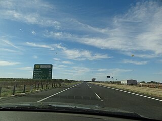
Gawler Bypass is a major north–south route in the outer northern suburbs of the city of Adelaide, South Australia, connecting Main North Road to the Sturt Highway, bypassing Gawler. The route was built in 1963 in an attempt to redirect traffic on the national highway out of Gawler town centre. It has been upgraded and realigned several times since then.
Marion Road is a north–south arterial road through the western suburbs of Adelaide, South Australia, named after its traversal through the suburb of Marion and the local government area of City of Marion. It is designated part of route A14.
Regency Road is a main east-west road forming a continuous connection between the inner northern suburbs of Adelaide, South Australia. Located approximately 6 kilometres (3.7 mi) north of the city centre, Regency Road carries a large amount of freight traffic, being located near Regency Park and the Churchill Road industrial area.
McIntyre Road is an arterial road crossing through northern and northeastern suburbs of Adelaide in South Australia. It is designated route A18.