South Eastern Freeway is a 73 km (45 mi) freeway in South Australia (SA). It is a part of the National Highway network linking the state capital cities of Adelaide, SA, and Melbourne, Victoria, and is signed as route M1. It carries traffic over the Adelaide Hills between Adelaide and the River Murray, near Murray Bridge, where it is connected via the Swanport Bridge to the Dukes Highway, which is the main road route to Victoria.
Southern Expressway is an 18.5 km (11.5 mi) freeway through the southern suburbs of Adelaide, South Australia. It is the southern part of the North–South Corridor which extends the full length of Adelaide and is being built to urban freeway standard. It is designated part of route M2.

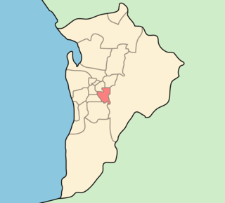
The City of Burnside is a local government area in the South Australian city of Adelaide stretching from the Adelaide Parklands into the Adelaide foothills with an area of 2,753 hectares. It was founded in August 1856 as the District Council of Burnside, the name of a property of an early settler, and was classed as a city in 1943. The LGA is bounded by Adelaide, Adelaide Hills Council, Campbelltown, Mitcham, Norwood Payneham and St Peters and Unley.
Mount Osmond is a small suburb of 2,497 people in the South Australian capital city of Adelaide. It is part of the City of Burnside local government area and located in the foothills of the Adelaide Hills, five kilometres south east of the city centre. The suburb is high on the hill of the same name, which is the last hill on the right when approaching Adelaide down the South Eastern Freeway before the road levels out onto the Adelaide Plains. It is bounded to the north by the suburb of Beaumont, to the north-east by Burnside, to the east by Waterfall Gully, to the south by Leawood Gardens/Eagle On The Hill, to the south-west by Urrbrae, to the west by Glen Osmond and to the north-west by St Georges.

Glen Osmond is a suburb of Adelaide, South Australia in the City of Burnside which is in the foothills of the Adelaide Hills. It is well known for the road intersection on the western side of the suburb, where the South Eastern Freeway from the Adelaide Hills and the main route from Melbourne splits into National Route A17 Portrush Road, Glen Osmond Road, Adelaide and state route A3 Cross Road west towards the coast and southern suburbs.
Greenhill Road is a major road in Adelaide, South Australia, that provides a connection to the eastern and hills suburbs. Its western section, running along the south side of Adelaide Parklands, forms part of Adelaide's City Ring Route.

Eastwood is a small triangular inner-southern suburb of Adelaide, South Australia in the City of Burnside.
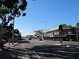
Frewville is a small suburb in the South Australian city of Adelaide. It is three kilometres south-east of Adelaide's central business district (CBD).

Parkside is an inner southern suburb of Adelaide, South Australia. It is located in the City of Unley.
Portrush Road is a major arterial route through the eastern suburbs of Adelaide, the capital of South Australia. This name covers many consecutive streets and is not widely known to most drivers except for the southernmost section, as the entire allocation is still best known as by the names of its constituent parts: Hampstead Road, Taunton Road, Ascot Avenue, Lower Portrush Road, and Portrush Road proper. Formerly, there were also sections known as Kensington Terrace and Wellington Road. This article will deal with the entire length of the corridor for sake of completion, as well to avoid confusion between declarations. Portrush Road is designated route A17.

Goodwood Road is a major north–south arterial road, approximately 10 kilometres long, in Adelaide, South Australia. It runs between the Adelaide city centre and Adelaide's southern suburbs of Pasadena and Panorama.
Fullarton Road is a main road in the South Australian capital city of Adelaide.

Cross Road is a major arterial road that travels east–west through the inner southern suburbs of the Australian city of Adelaide. It is designated route A3.

Anzac Highway is an 8.7-kilometre-long (5.4 mi) main arterial road heading southwest from the city of Adelaide, the capital of South Australia, to the beachside suburb of Glenelg.
Adelaide–Mannum Road is a road that runs through the northern Adelaide Hills between the South Australian capital, Adelaide and Mannum on the Murray River. It is designated route A10 in the metropolitan area and B10 in rural areas, and is 79 kilometres in length. This name covers many consecutive streets and is not widely known to most drivers, as the entire allocation is still best known as by the names of its constituent parts: Northcote Terrace, North East Road, Torrens Valley Road, Randell Road and Adelaide Road. This article will deal with the entire length of the corridor for sake of completion, as well to avoid confusion between declarations.

Sir Donald Bradman Drive is a major arterial road that travels east–west through the western suburbs of Adelaide, South Australia. It is the main route from the Adelaide city centre to the Adelaide Airport.
Lower North East Road is an arterial road in the northeastern suburbs of Adelaide, South Australia. It links the north-eastern corner of Adelaide to Houghton in the Adelaide Hills, and is an urban alternative to North East Road.

Mount Barker Road was once the main road from Adelaide through the Adelaide Hills to Mount Barker on the eastern slopes of the Mount Lofty Ranges. The main route has now been replaced, or subsumed into, the South Eastern Freeway, but two sections of it remain, and are still classified as state roads.

Unley Road is a road in the City of Unley, located south of the City of Adelaide, the capital of South Australia. It runs from South Terrace to Cross Road, where it becomes Belair Road. The road was named after the family name of the wife of Thomas Whistler, owner of land in Unley which was laid out around 1857.


