Port Wakefield Highway is an important South Australian highway, connecting Adelaide to the Yorke Peninsula, Port Augusta, northern and western South Australia, the Northern Territory and Western Australia. It is designated National Highway A1 and a part of the National Highway. It is named after Port Wakefield, the first government town north of Adelaide.

The Glenelg tram line is a tram/light rail line in Adelaide. Apart from a short street-running section in Glenelg, the line has its own reservation, with minimal interference from road traffic.
Greenhill Road is a major road in Adelaide, South Australia, that provides a connection to the eastern and hills suburbs. Its western section, running along the south side of Adelaide Parklands, forms part of Adelaide's City Ring Route.
South Road and its southern section as Main South Road outside of Adelaide is a major north–south conduit connecting Adelaide and the Fleurieu Peninsula, in South Australia. It is one of Adelaide's most important arterial and bypass roads. As South Road, it is designated part of route A2 within suburban Adelaide. As Main South Road, it is designated part of routes A13 and B23.
Portrush Road is a major arterial route through the eastern suburbs of Adelaide, the capital of South Australia. This name covers many consecutive streets and is not widely known to most drivers except for the southernmost section, as the entire allocation is still best known as by the names of its constituent parts: Hampstead Road, Taunton Road, Ascot Avenue, Lower Portrush Road, and Portrush Road proper. Formerly, there were also sections known as Kensington Terrace and Wellington Road. This article will deal with the entire length of the corridor for sake of completion, as well to avoid confusion between declarations. Portrush Road is designated route A17.

Goodwood Road is a major north–south arterial road, approximately 10 kilometres long, in Adelaide, South Australia. It runs between the Adelaide city centre and Adelaide's southern suburbs of Pasadena and Panorama.

Cross Road is a major arterial road that travels east–west through the inner southern suburbs of the Australian city of Adelaide. It is designated route A3.

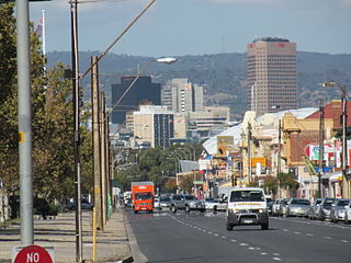
Anzac Highway is an 8.7-kilometre-long (5.4 mi) main arterial road heading southwest from the city of Adelaide, the capital of South Australia, to the beachside suburb of Glenelg.

Daws Road is a major arterial road in the central southern suburbs of Adelaide. It runs east–west between Marion Road in the west and Goodwood Road in the east. Pasadena High School and the Repatriation Hospital are on Daws Road.
Port Road is a major road in Adelaide, South Australia connecting the Adelaide city centre with Port Adelaide. It is 12 km (7.5 mi) long, and is designated part of route R1 within central Adelaide, and beyond as route A7.
Glenelg Highway is a rural highway in south-eastern Australia, linking the major regional centres of Mount Gambier in south-eastern South Australia with Ballarat in western Victoria.

Torrens Road is an arterial road in the northwestern suburbs of Adelaide, Australia. The road is aligned southeast to northwest and is parallel with Port Road for most of its length.

Sir Donald Bradman Drive is a major arterial road that travels east–west through the western suburbs of Adelaide, South Australia. It is the main route from the Adelaide city centre to the Adelaide Airport.

Tapleys Hill Road is a section of the north–south arterial road which runs parallel to the coast through western Adelaide, Australia. This entire allocation is best known as by the names of its constituent parts: Tapleys Hill Road proper, Brighton Road, Ocean Boulevard, Lonsdale Road, Dyson Road, Murray Road, and Gawler Street. This article deals with the entire length of the corridor for sake of completion, as well to avoid confusion between declarations. The section Tapleys Hill Road is a remnant of an historic road, and no longer runs to the geographic feature Tapleys Hill.
Victor Harbor Road is a major road in South Australia that runs south from Main South Road at Old Noarlunga on the southern fringes of suburban Adelaide to Victor Harbor on the Fleurieu Peninsula. It is designated part of route A13.
Lower North East Road is an arterial road in the northeastern suburbs of Adelaide, South Australia. It links the north-eastern corner of Adelaide to Houghton in the Adelaide Hills, and is an urban alternative to North East Road.
Copper Coast Highway is a highway in South Australia which branches off from the Augusta and Port Wakefield Highways 2 km north of Port Wakefield, and heads northwest across the top of Yorke Peninsula to Kadina, ending at the Spencer Gulf town of Wallaroo.
Yorke Highway is the main road from Adelaide to the southern parts of the Yorke Peninsula in South Australia. It runs from the northeast to the southwest of the peninsula. It branches off Copper Coast Highway after rounding the top of Gulf St Vincent, runs down the coast to Ardrossan then inland through Maitland to the Spencer Gulf coast at Hardwicke Bay then through Warooka to the south coast at Marion Bay and Stenhouse Bay on Investigator Strait.
Grange Road is an arterial road in the western suburbs of Adelaide, South Australia. It runs from the coast at Grange to South Road, close to the city centre.

Flagstaff Road is an arterial road in the southern suburbs of Adelaide in South Australia, Australia. It is one of the roads that carries commuter traffic between the city on the coastal plain and residential suburbs in the Adelaide Hills.
