Geography of Wyoming

Last updated
A map of the counties and capital city of Wyoming Wyoming counties map.png
A map of the counties and capital city of Wyoming

The U.S. state of Wyoming lies in the Mountain West subregion of the Western United States and has a varied geography. It is bordered by Montana to the north and northwest, South Dakota and Nebraska to the east, Idaho to the west, Utah to the southwest, and Colorado to the south. Wyoming is the least populous U.S. state [1] and has the second-lowest population density behind Alaska.

Contents

Wyoming's western half is covered mostly by the ranges and rangelands of the Rocky Mountains, while the eastern half of the state is high-elevation prairie called the High Plains. It is drier and windier than the rest of the country, being split between semi-arid and continental climates with greater temperature extremes. Almost half of the land in Wyoming is owned by the federal government, generally protected for public uses. The state ranks 6th by area and fifth by proportion of a state's land owned by the federal government. [2] Federal lands within Wyoming include two national parks (Grand Teton and Yellowstone), two national recreation areas, two national monuments, several national forests, historic sites, fish hatcheries, and wildlife refuges.

Climate

Koppen climate types of Wyoming, using 1991-2020 climate normals. Koppen Climate Types Wyoming.png
Köppen climate types of Wyoming, using 1991-2020 climate normals.
On Interstate 80, leaving Utah Wyoming.JPG
On Interstate 80, leaving Utah
Autumn in the Bighorn Mountains Autumn in the Bighorn Mountains.JPG
Autumn in the Bighorn Mountains

Wyoming's climate is generally semi-arid and continental (Köppen climate classification BSk ), and is drier and windier in comparison to most of the United States with greater temperature extremes. Much of this is due to the topography of the state. Summers in Wyoming are warm with July high temperatures averaging between 80 and 90 °F (27 and 32 °C) in most of the state. With increasing elevation, however, this average drops rapidly with locations above 9,000 feet (2,700 m) averaging around 70 °F (21 °C). Summer nights throughout the state are characterized by a rapid cooldown with even the hottest locations averaging in the 50–60 °F (10–16 °C) range at night. In most of the state, most of the precipitation tends to fall in the late spring and early summer. Winters are cold, but are variable with periods of sometimes extreme cold interspersed between generally mild periods, with Chinook winds providing unusually warm temperatures in some locations. [3]

Wyoming is a dry state with much of the land receiving less than 10 inches (250 mm) of rainfall per year. Precipitation depends on elevation with lower areas in the Big Horn Basin averaging 5–8 inches (130–200 mm), making the area nearly a true desert. The lower areas in the North and on the eastern plains typically average around 10–12 inches (250–300 mm), making the climate there semi-arid. Some mountain areas do receive a good amount of precipitation, 20 inches (510 mm) or more, much of it as snow, sometimes 200 inches (510 cm) or more annually. The state's highest recorded temperature is 114 °F (46 °C) at Basin on July 12, 1900, [4] [5] and the lowest recorded temperature is −66 °F (−54 °C) at Riverside on February 9, 1933. [5]

The number of thunderstorm days vary across the state with the southeastern plains of the state having the most days of thunderstorm activity. Thunderstorm activity in the state is highest during the late spring and early summer. The southeastern corner of the state is the most vulnerable part of the state to tornado activity. Moving away from that point and westwards, the incidence of tornadoes drops dramatically with the west part of the state showing little vulnerability. Tornadoes, where they occur, tend to be small and brief, unlike some of those that occur farther east. The most destructive tornado to occur in Wyoming happened on July 16, 1979 in Cheyenne and caused one death and 40 injuries. [6] [7]

Climate data

Casper climate: Average maximum and minimum temperatures, and average rainfall.
MonthJanFebMarAprMayJunJulAugSepOctNovDecYear
Average max. temperature °F (°C)32
(0)
37
(3)
45
(7)
56
(13)
66
(19)
78
(26)
87
(31)
85
(29)
74
(23)
60
(16)
44
(7)
34
(1)
58
(14)
Average min. temperature
°F (°C)
12
(−11)
16
(−9)
21
(−6)
28
(−2)
37
(3)
46
(8)
54
(12)
51
(11)
41
(5)
32
(0)
21
(−6)
14
(−10)
31
(-1)
Average rainfall
inches (mm)
0.6
(15.2)
0.6
(15.2)
1.0
(25.4)
1.6
(40.6)
2.1
(53.3)
1.5
(38.1)
1.3
(33.0)
0.7
(17.8)
0.9
(22.9)
1.0
(25.4)
0.8
(20.3)
0.7
(17.8)
12.8
(325.1)
Source: [8]
Jackson climate: Average maximum and minimum temperatures, and average rainfall.
MonthJanFebMarAprMayJunJulAugSepOctNovDecYear
Average max. temperature °F (°C)24
(−4)
28
(−2)
37
(3)
47
(8)
58
(14)
68
(20)
78
(26)
77
(25)
67
(19)
54
(12)
37
(3)
24
(−4)
49
(9)
Average min. temperature
°F (°C)
-1
(−18)
2
(−17)
10
(−12)
21
(−6)
30
(−1)
36
(2)
41
(5)
38
(3)
31
(−1)
22
(−6)
14
(−10)
0
(−18)
20
(-7)
Average rainfall
inches (mm)
2.6
(66.0)
1.9
(48.3)
1.6
(40.6)
1.4
(35.6)
1.9
(48.3)
1.8
(45.7)
1.3
(33.0)
1.3
(33.0)
1.5
(38.1)
1.3
(33.0)
2.3
(58.4)
2.5
(63.5)
21.4
(543.6)
Source: [9]
Climate data for Cheyenne Regional Airport, Wyoming (1991–2020 normals, [lower-alpha 1] extremes 1872−present [lower-alpha 2] )
MonthJanFebMarAprMayJunJulAugSepOctNovDecYear
Record high °F (°C)70
(21)
71
(22)
77
(25)
84
(29)
91
(33)
100
(38)
100
(38)
98
(37)
96
(36)
85
(29)
75
(24)
70
(21)
100
(38)
Mean maximum °F (°C)58
(14)
60
(16)
69
(21)
75
(24)
83
(28)
91
(33)
94
(34)
93
(34)
88
(31)
78
(26)
67
(19)
59
(15)
95
(35)
Average high °F (°C)40.0
(4.4)
40.6
(4.8)
49.1
(9.5)
54.8
(12.7)
64.4
(18.0)
76.7
(24.8)
84.1
(28.9)
82.0
(27.8)
73.3
(22.9)
59.1
(15.1)
47.5
(8.6)
39.3
(4.1)
59.2
(15.1)
Daily mean °F (°C)29.2
(−1.6)
29.5
(−1.4)
37.1
(2.8)
42.8
(6.0)
52.3
(11.3)
63.1
(17.3)
70.1
(21.2)
68.1
(20.1)
59.6
(15.3)
46.5
(8.1)
36.1
(2.3)
28.7
(−1.8)
46.9
(8.3)
Average low °F (°C)18.4
(−7.6)
18.4
(−7.6)
25.1
(−3.8)
30.8
(−0.7)
40.2
(4.6)
49.4
(9.7)
56.1
(13.4)
54.3
(12.4)
45.8
(7.7)
33.9
(1.1)
24.7
(−4.1)
18.1
(−7.7)
34.6
(1.4)
Mean minimum °F (°C)−6
(−21)
−4
(−20)
7
(−14)
16
(−9)
27
(−3)
38
(3)
47
(8)
45
(7)
32
(0)
16
(−9)
3
(−16)
−5
(−21)
−13
(−25)
Record low °F (°C)−38
(−39)
−34
(−37)
−21
(−29)
−8
(−22)
8
(−13)
25
(−4)
33
(1)
25
(−4)
8
(−13)
−5
(−21)
−21
(−29)
−28
(−33)
−38
(−39)
Average precipitation inches (mm)0.35
(8.9)
0.52
(13)
0.96
(24)
1.79
(45)
2.44
(62)
2.16
(55)
2.11
(54)
1.52
(39)
1.47
(37)
1.00
(25)
0.61
(15)
0.48
(12)
15.41
(391)
Average snowfall inches (cm)6.3
(16)
9.0
(23)
9.7
(25)
11.3
(29)
3.4
(8.6)
0.0
(0.0)
0.0
(0.0)
0.0
(0.0)
1.0
(2.5)
5.9
(15)
7.5
(19)
8.8
(22)
62.9
(160)
Average precipitation days (≥ 0.01 in)5.16.97.910.612.910.710.510.37.37.16.26.0101.5
Average snowy days (≥ 0.1 in)5.97.36.86.81.90.10.00.00.53.25.86.745.0
Average relative humidity (%)52.554.656.154.355.853.551.351.451.550.053.654.053.2
Mean monthly sunshine hours 190.7202.6253.1271.9291.9303.2317.5297.4262.3237.0178.8175.42,981.8
Percent possible sunshine 64686868656769707069606167
Source: NOAA (relative humidity and sun 1961−1990) [11] [12] [13]
Climate data for Basin, Wyoming (1991–2020 normals, extremes 1898–present)
MonthJanFebMarAprMayJunJulAugSepOctNovDecYear
Record high °F (°C)64
(18)
73
(23)
82
(28)
90
(32)
99
(37)
110
(43)
112
(44)
115
(46)
102
(39)
91
(33)
77
(25)
67
(19)
115
(46)
Mean maximum °F (°C)47.9
(8.8)
55.1
(12.8)
72.3
(22.4)
81.9
(27.7)
89.0
(31.7)
97.4
(36.3)
101.9
(38.8)
99.8
(37.7)
94.7
(34.8)
82.9
(28.3)
64.2
(17.9)
51.3
(10.7)
102.4
(39.1)
Average high °F (°C)32.4
(0.2)
39.1
(3.9)
54.1
(12.3)
63.0
(17.2)
72.8
(22.7)
83.7
(28.7)
92.7
(33.7)
91.0
(32.8)
79.3
(26.3)
62.9
(17.2)
46.4
(8.0)
33.8
(1.0)
62.6
(17.0)
Daily mean °F (°C)20.6
(−6.3)
26.8
(−2.9)
40.7
(4.8)
49.8
(9.9)
59.8
(15.4)
69.2
(20.7)
76.5
(24.7)
74.1
(23.4)
63.4
(17.4)
49.2
(9.6)
34.6
(1.4)
22.6
(−5.2)
48.9
(9.4)
Average low °F (°C)8.8
(−12.9)
14.6
(−9.7)
27.4
(−2.6)
36.5
(2.5)
46.8
(8.2)
54.7
(12.6)
60.3
(15.7)
57.2
(14.0)
47.5
(8.6)
35.5
(1.9)
22.8
(−5.1)
11.4
(−11.4)
35.3
(1.8)
Mean minimum °F (°C)−16.3
(−26.8)
−10.3
(−23.5)
5.1
(−14.9)
19.2
(−7.1)
28.8
(−1.8)
40.4
(4.7)
48.6
(9.2)
43.9
(6.6)
32.0
(0.0)
17.1
(−8.3)
−0.6
(−18.1)
−9.7
(−23.2)
−22.3
(−30.2)
Record low °F (°C)−43
(−42)
−51
(−46)
−31
(−35)
−4
(−20)
18
(−8)
30
(−1)
36
(2)
34
(1)
14
(−10)
−7
(−22)
−28
(−33)
−43
(−42)
−51
(−46)
Average precipitation inches (mm)0.24
(6.1)
0.32
(8.1)
0.31
(7.9)
0.75
(19)
1.37
(35)
1.04
(26)
0.41
(10)
0.32
(8.1)
0.95
(24)
0.79
(20)
0.36
(9.1)
0.30
(7.6)
7.16
(180.9)
Average snowfall inches (cm)3.4
(8.6)
4.1
(10)
2.3
(5.8)
1.5
(3.8)
0.1
(0.25)
0.0
(0.0)
0.0
(0.0)
0.0
(0.0)
0.2
(0.51)
1.5
(3.8)
3.0
(7.6)
4.0
(10)
20.1
(50.36)
Average precipitation days (≥ 0.01 in)3.43.63.15.17.16.03.23.64.74.03.33.350.4
Average snowy days (≥ 0.1 in)2.52.61.40.70.10.00.00.00.10.71.72.312.1
Source: NOAA [14] [15]

Location and size

As specified in the designating legislation for the Territory of Wyoming, Wyoming's borders are lines of latitude 41°N and 45°N, and longitude 104°3'W and 111°3'W (27 and 34 west of the Washington Meridian)—a geodesic quadrangle. [16] Wyoming is one of only three states (the others being Colorado and Utah) to have borders defined by only "straight" lines. Due to surveying inaccuracies during the 19th century, Wyoming's legal border deviates from the true latitude and longitude lines by up to half of a mile (0.8 km) in some spots, especially in the mountainous region along the 45th parallel. [17] Wyoming is bordered on the north by Montana, on the east by South Dakota and Nebraska, on the south by Colorado, on the southwest by Utah, and on the west by Idaho. It is the tenth largest state in the United States in total area, containing 97,814 square miles (253,340 km2) and is made up of 23 counties. From the north border to the south border it is 276 miles (444 km); and from the east to the west border is 365 miles (587 km) at its south end and 342 miles (550 km) at the north end.

Natural landforms

Mountain ranges

Teton Range Barns grand tetons.jpg
Teton Range
Green River valley Cattle Drive near Pinedale, WY (14963962303).jpg
Green River valley

The Great Plains meet the Rocky Mountains in Wyoming. The state is a great plateau broken by many mountain ranges. Surface elevations range from the summit of Gannett Peak in the Wind River Mountain Range, at 13,804 feet (4,207 m), to the Belle Fourche River valley in the state's northeast corner, at 3,125 feet (952 m). In the northwest are the Absaroka, Owl Creek, Gros Ventre, Wind River, and the Teton ranges. In the north central are the Big Horn Mountains; in the northeast, the Black Hills; and in the southern region the Laramie, Snowy, and Sierra Madre ranges.

The Snowy Range in the south central part of the state is an extension of the Colorado Rockies both in geology and in appearance. The Wind River Range in the west central part of the state is remote and includes more than 40 mountain peaks in excess of 13,000 ft (4,000 m) tall in addition to Gannett Peak, the highest peak in the state. The Big Horn Mountains in the north central portion are somewhat isolated from the bulk of the Rocky Mountains.

The Teton Range in the northwest extends for 50 miles (80 km), part of which is included in Grand Teton National Park. The park includes the Grand Teton, the second highest peak in the state.

The Continental Divide spans north–south across the central portion of the state. Rivers east of the divide drain into the Missouri River Basin and eventually the Gulf of Mexico. They are the North Platte, Wind, Big Horn and the Yellowstone rivers. The Snake River in northwest Wyoming eventually drains into the Columbia River and the Pacific Ocean, as does the Green River through the Colorado River Basin.

The Continental Divide forks in the south central part of the state in an area known as the Great Divide Basin where water that precipitates onto or flows into it cannot reach an ocean—it all sinks into the soil and eventually evaporates.

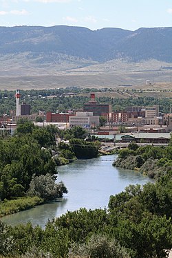
Several rivers begin in or flow through the state, including the Yellowstone River, Bighorn River, Green River, and the Snake River.

Basins

Much of Wyoming is covered with large basins containing different eco-regions, from shrublands to smaller patches of desert. [18] Regions of the state classified as basins contain everything from large geologic formations to sand dunes and vast unpopulated spaces. [19] Basin landscapes are typically at lower elevations and include rolling hills, valleys, mesas, terraces and other rugged terrain, but also include natural springs as well as rivers and artificial reservoirs. [20] They have common plant species such as various subspecies of sagebrush, juniper and grasses such as wheatgrass, but basins are known for their diversity of plant and animal species. [18]

Islands

Wyoming has 32 named islands; the majority are in Jackson Lake and Yellowstone Lake, within Yellowstone National Park in the northwest portion of the state. The Green River in the southwest also contains a number of islands.

Regions and Administration

Counties

The state of Wyoming has 23 counties. Thirteen were there when Wyoming became a state in 1890 and ten more have been created since then. [21]

The 23 counties of the state of Wyoming [22]
RankCountyPopulationRankCountyPopulation
1 Laramie 98,32713 Converse 13,809
2 Natrona 79,54714 Goshen 13,378
3 Campbell 46,24215 Big Horn 11,906
4 Sweetwater 43,53416 Sublette 9,799
5 Fremont 39,80317 Platte 8,562
6 Albany 38,33218 Johnson 8,476
7 Sheridan 30,21019 Washakie 8,064
8 Park 29,56820 Crook 7,410
9 Teton 23,26521 Weston 6,927
10 Uinta 20,49522 Hot Springs 4,696
11 Lincoln 19,26523 Niobrara 2,397
12 Carbon 15,303Wyoming Total579,315
Since 2016, Wyoming license plates feature Squaretop Mountain in the background Wyoming 2020 plate.jpg
Since 2016, Wyoming license plates feature Squaretop Mountain in the background

Wyoming license plates have a number on the left that indicates the county where the vehicle is registered, ranked by an earlier census. [23] Specifically, the numbers are representative of the property values of the counties in 1930. [24] The county license plate numbers are:

License
Plate
Prefix
CountyLicense
Plate
Prefix
CountyLicense
Plate
Prefix
County
1Natrona9Big Horn17Campbell
2Laramie10Fremont18Crook
3Sheridan11Park19Uinta
4Sweetwater12Lincoln20Washakie
5Albany13Converse21Weston
6Carbon14Niobrara22Teton
7Goshen15Hot Springs23Sublette
8Platte16Johnson  

Cities and towns

Cheyenne, Wyoming CheyenneWyoming.jpg
Cheyenne, Wyoming
Casper, Wyoming Casperskyline.jpg
Casper, Wyoming
Rock Springs, Wyoming RockSpringsWY.jpg
Rock Springs, Wyoming
Evanston, Wyoming EvanstonWyoming.jpg
Evanston, Wyoming
Rawlins, Wyoming DowntownRawlins.jpg
Rawlins, Wyoming
Wyoming is home to 12 ski resorts, including Grand Targhee and Jackson Hole. Grand Targhee Ski Resort, February 2021.jpg
Wyoming is home to 12 ski resorts, including Grand Targhee and Jackson Hole.

The State of Wyoming has 99 incorporated municipalities.

Most Populous Wyoming Cities and Towns [25]
RankCityCountyPopulation
1 Cheyenne Laramie 63,957
2 Casper Natrona 57,461
3 Laramie Albany 32,473
4 Gillette Campbell 31,903
5 Rock Springs Sweetwater 23,082
6 Sheridan Sheridan 17,849
7 Green River Sweetwater 11,978
8 Evanston Uinta 11,704
9 Riverton Fremont 10,996
10 Jackson Teton 10,429
11 Cody Park 9,828
12 Rawlins Carbon 8,658
13 Lander Fremont 7,503
14 Torrington Goshen 6,701
15 Powell Park 6,310
16 Douglas Converse 6,273

In 2005, 50.6% of Wyomingites lived in one of the 13 most populous Wyoming municipalities.

Metropolitan areas

The United States Census Bureau has defined two Metropolitan Statistical Areas (MSA) and seven Micropolitan Statistical Areas (MiSA) for the State of Wyoming. In 2008, 30.4% of Wyomingites lived in either of the Metropolitan Statistical Areas, and 73% lived in either a Metropolitan Statistical Area or a Micropolitan Statistical Area.

Metropolitan and Micropolitan Statistical Areas [26]
Census AreaCountyPopulation
Cheyenne Laramie 98,976
Casper Natrona 79,115
Gillette Campbell 46,140
Rock Springs Sweetwater 43,051
Riverton Fremont 39,531
Laramie Albany 38,601
Jackson Teton County, Wyoming 23,081
Teton County, Idaho 11,640
Total34,721
Sheridan Sheridan 30,233
Evanston Uinta 20,299

See also

Notes

  1. Mean monthly maxima and minima (i.e. the expected highest and lowest temperature readings at any point during the year or given month) calculated based on data at said location from 1991 to 2020.
  2. Official records for Cheyenne kept at the City Office from January 1871 to August 1935 and at Cheyenne Regional since September 1935. [10]

Related Research Articles

<span class="mw-page-title-main">Rocky Mountains</span> Major mountain range in western North America

The Rocky Mountains, also known as the Rockies, are a major mountain range and the largest mountain system in North America. The Rocky Mountains stretch 3,000 miles in straight-line distance from the northernmost part of western Canada, to New Mexico in the southwestern United States. Depending on differing definitions between Canada and the U.S., its northern terminus is located either in northern British Columbia's Terminal Range south of the Liard River and east of the Trench, or in the northeastern foothills of the Brooks Range/British Mountains that face the Beaufort Sea coasts between the Canning River and the Firth River across the Alaska-Yukon border. Its southernmost point is near the Albuquerque area adjacent to the Rio Grande rift and north of the Sandia–Manzano Mountain Range. Being the easternmost portion of the North American Cordillera, the Rockies are distinct from the tectonically younger Cascade Range and Sierra Nevada, which both lie farther to its west.

<span class="mw-page-title-main">Wyoming</span> U.S. state

Wyoming is a state in the Mountain West subregion of the Western United States. It is bordered by Montana to the north and northwest, South Dakota and Nebraska to the east, Idaho to the west, Utah to the southwest, and Colorado to the south. With a population of 576,851 in the 2020 United States census, Wyoming is the least populous state despite being the 10th largest by area, with the second-lowest population density after Alaska. The state capital and most populous city is Cheyenne, which had an estimated population of 63,957 in 2018.

<span class="mw-page-title-main">Grand Teton National Park</span> United States National Park in northwestern Wyoming

Grand Teton National Park is an American national park in northwestern Wyoming. At approximately 310,000 acres (1,300 km2), the park includes the major peaks of the 40-mile-long (64 km) Teton Range as well as most of the northern sections of the valley known as Jackson Hole. Grand Teton National Park is only 10 miles (16 km) south of Yellowstone National Park, to which it is connected by the National Park Service–managed John D. Rockefeller Jr. Memorial Parkway. Along with surrounding national forests, these three protected areas constitute the almost 18-million-acre (73,000-square-kilometer) Greater Yellowstone Ecosystem, one of the world's largest intact mid-latitude temperate ecosystems.

<span class="mw-page-title-main">Lander, Wyoming</span> City in Wyoming, United States

Lander is a city in Wyoming, United States, and the county seat of Fremont County. It is in central Wyoming, along the Middle Fork of the Popo Agie River, just south of the Wind River Indian Reservation. It is a tourism center with several nearby guest ranches. Its population was 7,487 at the 2010 census.

<span class="mw-page-title-main">Jackson, Wyoming</span> Town in Wyoming, United States

Jackson is a town in Teton County, Wyoming, United States. The population was 10,760 at the 2020 census, up from 9,577 in 2010. It is the largest town in Teton County and its county seat. Jackson is the principal town of the Jackson, WY-ID Micropolitan Statistical Area, which includes Teton County in Wyoming and Teton County in Idaho. The town, often mistakenly called Jackson Hole, derives its name from the valley in which it is located. Jackson is a popular tourist destination due to its proximity to the ski resorts Jackson Hole Mountain, Snow King Mountain, and Grand Targhee, as well as Grand Teton National Park and Yellowstone National Park.

<span class="mw-page-title-main">Yellowstone River</span> River in the western United States

The Yellowstone River is a tributary of the Missouri River, approximately 692 miles (1,114 km) long, in the Western United States. Considered the principal tributary of upper Missouri, via its own tributaries it drains an area with headwaters across the mountains and high plains of southern Montana and northern Wyoming, and stretching east from the Rocky Mountains in the vicinity of Yellowstone National Park. It flows northeast to its confluence with the Missouri River on the North Dakota side of the border, about 25 miles west of present-day Williston.

<span class="mw-page-title-main">Wind River Range</span> Mountain subrange of the Rocky Mountains in Wyoming, United States

The Wind River Range is a mountain range of the Rocky Mountains in western Wyoming in the United States. The range runs roughly NW–SE for approximately 100 mi (160 km). The Continental Divide follows the crest of the range and includes Gannett Peak, which at 13,802 ft (4,207 m), is the highest peak in Wyoming; and also Fremont Peak at 13,750 ft (4,191 m), the third highest peak in Wyoming. There are more than 40 other named peaks in excess of 12,999 ft (3,962 m). With the exception of the Grand Teton in the Teton Range, the next 19 highest peaks in Wyoming after Gannett are also in the Winds.

<span class="mw-page-title-main">Snake River Plain</span> Geologic feature in Idaho, US

The Snake River Plain is a geologic feature located primarily within the U.S. state of Idaho. It stretches about 400 miles (640 km) westward from northwest of the state of Wyoming to the Idaho-Oregon border. The plain is a wide, flat bow-shaped depression and covers about a quarter of Idaho. Three major volcanic buttes dot the plain east of Arco, the largest being Big Southern Butte.

<span class="mw-page-title-main">Togwotee Pass</span> Mountain pass in Absaroka Mountains, United States

Togwotee Pass is a high mountain pass in the western United States, at an elevation of 9,655 feet (2,943 m) above sea level. On the Continental Divide in the Absaroka Mountains of northwestern Wyoming in Teton County, it is between Dubois and Moran Junction in the Jackson Hole valley.

<span class="mw-page-title-main">Bridger–Teton National Forest</span> Protected area in western Wyoming, US

Bridger–Teton National Forest is located in western Wyoming, United States. The forest consists of 3.4 million acres, making it the third largest National Forest outside Alaska. The forest stretches from Yellowstone National Park, along the eastern boundary of Grand Teton National Park and from there rides along the western slope of the Continental Divide to the southern end of the Wind River Range. The forest also extends southward encompassing the Salt River Range and Wyoming Range mountains near the Idaho border.

<span class="mw-page-title-main">Shoshone National Forest</span> National Forest in Wyoming, US

Shoshone National Forest is the first federally protected National Forest in the United States and covers nearly 2,500,000 acres (1,000,000 ha) in the state of Wyoming. Originally a part of the Yellowstone Timberland Reserve, the forest is managed by the United States Forest Service and was created by an act of Congress and signed into law by U.S. President Benjamin Harrison in 1891. Shoshone National Forest is one of the first nationally protected land areas anywhere. Native Americans have lived in the region for at least 10,000 years, and when the region was first explored by European adventurers, forestlands were occupied by several different tribes. Never heavily settled or exploited, the forest has retained most of its wildness. Shoshone National Forest is a part of the Greater Yellowstone Ecosystem, a nearly unbroken expanse of federally protected lands encompassing an estimated 20,000,000 acres (8,100,000 ha).

<span class="mw-page-title-main">Bridger Wilderness</span>

The Bridger Wilderness is located in Bridger-Teton National Forest in Wyoming, United States. Originally established in 1931 as a primitive area, 428,169-acre (1,732.74 km2) region was redesignated as a wilderness in 1964 and expanded to the current size in 1984. The wilderness lies on the west side of the Continental Divide in the Wind River Range and contains Gannett Peak; at 13,809 feet (4,209 m) it is the tallest mountain in Wyoming. The wilderness is a part of the Greater Yellowstone Ecosystem.

Teton Wilderness is located in Wyoming, United States. Created in 1964, the Teton Wilderness is located within Bridger-Teton National Forest and consists of 585,238 acres (2,370 km2). The wilderness is bordered on the north by Yellowstone National Park and to the west by Grand Teton National Park and the John D. Rockefeller Jr. Memorial Parkway. The Washakie Wilderness is to the east and the remainder of Bridger-Teton National Forest is to the south. The Teton Wilderness is a part of the 20 million-acre (81,000 km2) Greater Yellowstone Ecosystem. Among many other features, Teton Wilderness is notable for having the most remote location of any place in the contiguous 48 states of the US. This location occurs very close to Bridger Lake, near the confluence of the Thorofare and Yellowstone Rivers, not far from the USFS Hawk's Rest Ranger Station.

<span class="mw-page-title-main">Geography of Colorado</span> Overview of the geography of Colorado

The geography of the U.S. State of Colorado is diverse, encompassing both rugged mountainous terrain, vast plains, desert lands, desert canyons, and mesas. Colorado is a landlocked U.S. state. In 1861, the United States Congress defined the boundaries of the new Territory of Colorado exclusively by lines of latitude and longitude, stretching from 37°N to 41°N latitude, and from 102°02'48"W to 109°02'48"W longitude. Starting in 1868, official surveys demarcated the boundaries, deviating from the parallels and meridians in several places. Later surveys attempted to correct some of these mistakes but in 1925 the U.S. Supreme Court affirmed that the earlier demarcation was the official boundary. The borders of Colorado are now officially defined by 697 boundary markers connected by straight boundary lines. Colorado, Wyoming, and Utah are the only states that have their borders defined solely by straight boundary lines with no natural features. The southwest corner of Colorado is the Four Corners Monument at 36°59'56"N, 109°2'43"W. This is the only place in the United States where four states meet: Colorado, New Mexico, Arizona, and Utah.

<span class="mw-page-title-main">Geography of South Dakota</span> Overview of the geography of South Dakota

South Dakota is a state located in the north-central United States. It is usually considered to be in the Midwestern region of the country. The state can generally be divided into three geographic regions: eastern South Dakota, western South Dakota, and the Black Hills. Eastern South Dakota is lower in elevation and higher in precipitation than the western part of the state, and the Black Hills are a low, isolated mountain group in the southwestern corner of the state. Smaller sub-regions in the state include the Coteau des Prairies, Missouri Coteau, James River Valley, the Dissected Till Plains. Geologic formations in South Dakota range in age from two billion-year-old Precambrian granite in the Black Hills to glacial till deposited over the last few million years. South Dakota is the 17th-largest state in the country.

<span class="mw-page-title-main">Geography of Idaho</span> Overview of the Geograpny of Idaho

The U.S. state of Idaho borders six other U.S. states and one Canadian province. The states of Washington and Oregon are to the west, Nevada and Utah are to the south, and Montana and Wyoming are to the east. Idaho also shares a short border with the Canadian province of British Columbia to the north.

<span class="mw-page-title-main">Geography of Montana</span> Overview of the Geography of Montana

Montana is one of the eight Mountain States, located in the north of the region known as the Western United States. It borders North Dakota and South Dakota to the east. Wyoming is to the south, Idaho is to the west and southwest, and the Canadian provinces of British Columbia, Alberta, and Saskatchewan are to the north, making it the only state to border three Canadian provinces.

Wyoming straddles the Continental Divide, and its abrupt topographic relief includes alternating basins and mountain ranges. Major mountain ranges include the Beartooth, Gros Ventre, Teton, Wind River, Bighorn, Sierra Madre, and Medicine Bow. Internal basins and eastern plains are rolling to flat, and in the east are the Great Plains.

<span class="mw-page-title-main">Teton–Yellowstone tornado</span> 1987 F4 tornado in Wyoming, United States

The Teton–Yellowstone tornado was a rare high-altitude tornado which occurred on July 21, 1987, in the U.S. state of Wyoming. Rated at F4 on the Fujita scale, it remains the strongest tornado ever recorded in the state and the only recorded F4/EF4 tornado in Wyoming history. The tornado cut through a 24-mile (39 km) long and 1.5-mile (2.4 km) wide swath of the Teton Wilderness and Yellowstone National Park, and even crossed the Continental Divide. Damage occurred at elevations ranging from 8,500 to 10,000 feet, making it the highest-altitude violent tornado recorded in the United States. No human fatalities or injuries were recorded, but up to 1,000,000 trees were uprooted by the storm. The F4 rating was based on the severity of the tree damage in the worst-affected areas. Huge swaths of trees were flattened, and many were stripped of leaves and limbs, with the trunks debarked. Topsoil was picked up and spattered against the bare trunks. Meteorologist Ted Fujita noted that the only comparable forest damage he had seen associated with an F4 tornado had been in the Appalachian Mountains after the Murphy, North Carolina tornado of the 1974 Super Outbreak. Most of the damaged forest later burned in the Yellowstone fires of 1988.

<span class="mw-page-title-main">Regional designations of Montana</span> Overview of the Regional designations of Montana

The Regional designations of Montana vary widely within the U.S state of Montana. The state is a large geographical area that is split by the Continental Divide, resulting in watersheds draining into the Pacific Ocean, Gulf of Mexico and Hudson's Bay. The state is approximately 545 miles (877 km) east to west along the Canada–United States border and 320 miles (510 km) north to south. The fourth largest state in land area, it has been divided up in official and unofficial ways into a variety of regions. Additionally, Montana is part of a number of larger federal government administrative regions.

References

  1. "2020 Census" (PDF). Census.gov. April 26, 2021. Archived (PDF) from the original on April 26, 2021. Retrieved July 12, 2021.
  2. MainEnvironment.org Archived May 25, 2017, at the Wayback Machine Public Land Ownership by State, 1995 Main Environment.org
  3. Burrows, Alvin T. (c. 1901). "The Chinook Winds". Yearbook of the Department of Agriculture. US Department of Agriculture . Retrieved 6 February 2016.
  4. "Record Highest Temperatures by State". www.infoplease.com. Retrieved 2021-03-24.
  5. 1 2 "Wyoming: Temperature Extremes". www.infoplease.com. Retrieved 2021-03-24.
  6. "Tornado History Project: Maps and Statistics". Tornadohistoryproject.com. Archived from the original on January 17, 2018. Retrieved January 9, 2018.
  7. [ permanent dead link ]
  8. "CountryStudies.us". CountryStudies.us. Archived from the original on June 29, 2011. Retrieved July 31, 2010.
  9. "Countrystudies.us". Countrystudies.us. Archived from the original on June 29, 2011. Retrieved July 31, 2010.
  10. ThreadEx
  11. "NOWData - NOAA Online Weather Data". National Oceanic and Atmospheric Administration. Retrieved December 10, 2021.
  12. "Station: Cheyenne, WY". U.S. Climate Normals 2020: U.S. Monthly Climate Normals (1991-2020). National Oceanic and Atmospheric Administration. Retrieved December 10, 2021.
  13. "WMO Climate Normals for Cheyenne WSFO, WY 1961–1990". National Oceanic and Atmospheric Administration. Retrieved December 10, 2021.
  14. "NOWData - NOAA Online Weather Data". National Oceanic and Atmospheric Administration.
  15. "Summary of Monthly Normals 1991-2020". National Oceanic and Atmospheric Administration . Retrieved October 19, 2021.
  16. Willam J. Gribb; Lawrence M. Ostrech. "Databases and Algorithms to Determine the Boundary of Wyoming" (PDF). University of Wyoming, Department of Geography. Archived from the original (PDF) on December 17, 2008. Retrieved December 14, 2008.
  17. Ivars Peterson. "Rectangular States and Kinky Borders". Archived from the original on July 5, 2008. Retrieved December 14, 2008.
  18. 1 2 "Wyoming Basins Ecoregion". Landscope. June 26, 2012. Archived from the original on February 26, 2020. Retrieved March 11, 2021.
  19. "Level III Ecoregions of the Continental United States". hort.purdue.edu. Purdue University. April 1, 2000. Archived from the original on February 11, 2021. Retrieved March 9, 2021.
  20. "Wyoming Eco-Regions" (PDF). EPA. Jan 1, 2004. Archived (PDF) from the original on May 9, 2022. Retrieved March 9, 2021.
  21. "General Facts About Wyoming". State of Wyoming. Archived from the original on 2007-05-12. Retrieved 2007-07-20.
  22. "County Population Totals and Components of Change: 2010-2017". 2017 Population Estimates. United States Census Bureau, Population Division. March 14, 2019. Archived from the original on March 6, 2019. Retrieved March 14, 2019.
  23. "Historical decennial census population for Wyoming counties, cities, and towns". U.S. Census, State of Wyoming. Archived from the original on July 8, 2017. Retrieved September 24, 2012.
  24. "TetonAT.com—Interesting Wyoming License Plate Fact". Tetonat.com. Archived from the original on September 4, 2017. Retrieved September 4, 2017.
  25. "City and Town Population Totals: 2010-2018". 2018 Population Estimates. U.S. Census Bureau, Population Division. March 1, 2020. Retrieved March 1, 2020.[ dead link ]
  26. "Metropolitan and Micropolitan Statistical Areas Population Totals: 2010-2017". 2017 Population Estimates. U.S. Census Bureau, Population Division. March 14, 2019. Archived from the original on September 26, 2018. Retrieved March 14, 2019.