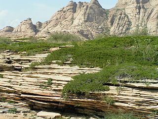
Karakul or Qarokul is an endorheic lake, 25 km (16 mi) in diameter, located within a 52 km (32 mi) impact crater. It is located in the Tajik National Park in the Pamir Mountains in Tajikistan.

The Bartang is a river of Central Asia, and is a tributary to the Panj which itself is a tributary to the Amu Darya. In its upper reaches, it is also known as the Murghab and Aksu; it flows through the Wakhan in Afghanistan, then through the Rushon District of the Gorno-Badakhshan autonomous region, Tajikistan. The river is 528 kilometres (328 mi) long and has a basin area of 24,700 square kilometres (9,500 sq mi).
In early Triassic time, an extensive volcanic arc system called the Sierran Arc began to develop along the western margin of the North American continent. In Southern California, this volcanic arc would develop throughout the Mesozoic Era to become the geologic regions known as the Sierra Nevada Batholith, the Peninsular Ranges Batholith,, and other plutonic and volcanic centers throughout the greater Mojave Desert region.

The Pamir-Alay is a mountain system in Tajikistan, Kyrgyzstan and Uzbekistan, encompassing four main mountain ranges extending west from the Tian Shan Mountains, and located north of the main range of Pamir. They are variously considered part of the Tian Shan, of the Pamir, or a separate mountain system. The term "Pamiro-Alay" is also used to refer to the mountain region encompassing the Pamir, the Pamir-Alay proper and the Tajik Depression.

The main points that are discussed in the geology of Iran include the study of the geological and structural units or zones; stratigraphy; magmatism and igneous rocks; ophiolite series and ultramafic rocks; and orogenic events in Iran.

The geology of Germany is heavily influenced by several phases of orogeny in the Paleozoic and the Cenozoic, by sedimentation in shelf seas and epicontinental seas and on plains in the Permian and Mesozoic as well as by the Quaternary glaciations.
Hungary is in the Pannonian Basin in Central Europe, is surrounded by the Carpathians, Alps and Dinarides, but for the most part dominated by lowlands. Sixty-eight percent of the country is lowlands below 200 meters altitude. Hilly terrain covers 30% of the country, while mountains cover only 2%. The entire Pannonian Basin is in the Danube watershed.

The geology of Lebanon remains poorly studied prior to the Jurassic. The country is heavily dominated by limestone, sandstone, other sedimentary rocks, and basalt, defined by its tectonic history. In Lebanon, 70% of exposed rocks are limestone karst.
The geology of Georgia is the study of rocks, minerals, water, landforms and geologic history in Georgia. The country is dominated by the Caucasus Mountains at the junction of the Eurasian Plate and the Afro-Arabian Plate, and rock units from the Mesozoic and Cenozoic are particularly prevalent. For much of its geologic history, until the uplift of the Caucasus, Georgia was submerged by marine transgression events. Geologic research for 150 years by Georgian and Russian geologists has shed significant light on the region and since the 1970s has been augmented with the understanding of plate tectonics.

The geology of Bosnia & Herzegovina is the study of rocks, minerals, water, landforms and geologic history in the country. The oldest rocks exposed at or near the surface date to the Paleozoic and the Precambrian geologic history of the region remains poorly understood. Complex assemblages of flysch, ophiolite, mélange and igneous plutons together with thick sedimentary units are a defining characteristic of the Dinaric Alps, also known as the Dinaride Mountains, which dominate much of the country's landscape.

The geology of Moldova encompasses basement rocks from the Archean and Paleoproterozoic dating back more than 2.5 billion years, overlain by thick sequences of Neoproterozoic, Paleozoic, Mesozoic and Cenozoic sedimentary rocks.

The geology of Kazakhstan includes extensive basement rocks from the Precambrian and widespread Paleozoic rocks, as well as sediments formed in rift basins during the Mesozoic.

The geology of Afghanistan includes nearly one billion year old rocks from the Precambrian. The region experienced widespread marine transgressions and deposition during the Paleozoic and Mesozoic, that continued into the Cenozoic with the uplift of the Hindu Kush mountains.

The geology of Kyrgyzstan began to form during the Proterozoic. The country has experienced long-running uplift events, forming the Tian Shan mountains and large, sediment filled basins.

The geology of Uzbekistan consists of two microcontinents and the remnants of oceanic crust, which fused together into a tectonically complex but resource rich land mass during the Paleozoic, before becoming draped in thick, primarily marine sedimentary units.
The geology of Turkmenistan includes two different geological provinces: the Karakum, or South Turan Platform, and the Alpine Orogen.

The geology of Slovakia is structurally complex, with a highly varied array of mountain ranges and belts largely formed during the Alpine orogeny in Mesozoic and Cenozoic eras and with relicts of older Variscan structures of Paleozoic age. The internal zones of the West Carpathian orogen collapsed during Paleogene forming the Central Carpathian Paleogne Basin and later in Miocene the Pannonian Basin and Carpathian volcanic chain were formed.
The geology of Lithuania consists of ancient Proterozoic basement rock overlain by thick sequences of Paleozoic, Mesozoic and Cenozoic marine sedimentary rocks, with some oil reserves, abundant limestone, dolomite, phosphorite and glauconite. Lithuania is a country in the Baltic region of northern-eastern Europe.
The geology of Saudi Arabia includes Precambrian igneous and metamorphic basement rocks, exposed across much of the country. Thick sedimentary sequences from the Phanerozoic dominate much of the country's surface and host oil.
The geology of the Norwegian Sea began to form 60 million years ago in the early Cenozoic, as rifting led to the eruption of mafic oceanic crust, separating Scandinavia and Greenland. Together with the North Sea the Norwegian Sea has become highly researched since the 1960s with the discovery of oil and natural gas in thick offshore sediments on top of the Norwegian continental shelf.


