Glencoe, Wisconsin

Last updated

Glencoe, Wisconsin
Glencoe Town Hall.webp
Glencoe Town Hall
WIMap-doton-Glencoe.png
Location of Glencoe, Wisconsin
Coordinates: 44°16′31″N91°35′42″W / 44.27528°N 91.59500°W / 44.27528; -91.59500
Country Flag of the United States.svg  United States
State Flag of Wisconsin.svg  Wisconsin
County Buffalo
Area
  Total44.7 sq mi (115.7 km2)
  Land44.5 sq mi (115.2 km2)
  Water0.2 sq mi (0.5 km2)
Elevation
[1]
1,024 ft (312 m)
Population
 (2010)
  Total485
  Density11/sq mi (4.2/km2)
Time zone UTC-6 (Central (CST))
  Summer (DST) UTC-5 (CDT)
FIPS code 55-29375 [2]
GNIS feature ID1583280 [1]

Glencoe is a town in Buffalo County in the U.S. state of Wisconsin. The population was 485 at the 2010 census. [3] The unincorporated community of Glencoe is located in the town.

Contents

Geography

According to the United States Census Bureau, the town has a total area of 44.7 square miles (115.7 km2), of which 44.5 square miles (115.2 km2) is land and 0.19 square miles (0.5 km2), or 0.42%, is water. [3]

Demographics

As of the census [2] of 2000, there were 478 people, 171 households, and 133 families residing in the town. The population density was 10.7 people per square mile (4.1/km2). There were 180 housing units at an average density of 4.0 per square mile (1.6/km2). The racial makeup of the town was 99.58% White, and 0.42% from two or more races. Hispanic or Latino of any race were 0.42% of the population.

There were 171 households, out of which 38.6% had children under the age of 18 living with them, 70.2% were married couples living together, 5.3% had a female householder with no husband present, and 22.2% were non-families. 20.5% of all households were made up of individuals, and 5.3% had someone living alone who was 65 years of age or older. The average household size was 2.80 and the average family size was 3.23.

In the town, the population was spread out, with 28.9% under the age of 18, 6.5% from 18 to 24, 29.7% from 25 to 44, 26.4% from 45 to 64, and 8.6% who were 65 years of age or older. The median age was 37 years. For every 100 females, there were 111.5 males. For every 100 females age 18 and over, there were 112.5 males.

The median income for a household in the town was $36,750, and the median income for a family was $42,375. Males had a median income of $26,000 versus $19,750 for females. The per capita income for the town was $15,315. About 4.7% of families and 5.3% of the population were below the poverty line, including 2.1% of those under age 18 and 8.0% of those age 65 or over.

Notable people

Related Research Articles

<span class="mw-page-title-main">Frazer Township, Allegheny County, Pennsylvania</span> Township in Pennsylvania, United States

Frazer Township is a township in Allegheny County, Pennsylvania, United States. The population was 1,164 at the 2020 census. The Pittsburgh Mills shopping mall complex is located in the township.

<span class="mw-page-title-main">Broadway, Virginia</span> Town in Virginia, United States

Broadway is a town in Rockingham County, Virginia, United States. The population was 3,691 at the 2010 census. It is included in the Harrisonburg Metropolitan Statistical Area.

<span class="mw-page-title-main">East Wenatchee Bench, Washington</span> Former CDP in Washington, United States

East Wenatchee Bench is a former census-designated place in Douglas County, Washington, United States. Most of the area has been annexed by the city of East Wenatchee. It was part of the Wenatchee–East Wenatchee Metropolitan Statistical Area. The population was 13,658 at the 2000 census, but it was no longer a CDP in the 2010 census.

<span class="mw-page-title-main">Coulee City, Washington</span> Town in Washington, United States

Coulee City is a town in Grant County, Washington. The population was 549 at the 2020 census.

<span class="mw-page-title-main">Sherwood, Wisconsin</span> Village in Wisconsin, United States

Sherwood is a village in Calumet County, Wisconsin, United States. The population was 2,713 at the 2010 census. The former historical unincorporated community of High Cliff is located within present-day Sherwood.

<span class="mw-page-title-main">Levis, Wisconsin</span> Town in Wisconsin, United States

Levis is a town in Clark County in the U.S. state of Wisconsin. The population was 504 at the 2000 census.

<span class="mw-page-title-main">Red Cedar, Wisconsin</span> Town in Wisconsin, United States

Red Cedar is a town in Dunn County, Wisconsin, United States. The population was 1,673 at the 2000 census. The unincorporated communities of Cedar Falls and Rusk are located in the town.

<span class="mw-page-title-main">Tainter Lake, Wisconsin</span> CDP in Wisconsin, United States

Tainter Lake is a census-designated place (CDP) in part of the Town of Tainter, Dunn County, Wisconsin, and part of the Town of Red Cedar, Dunn County, Wisconsin, United States. The population was 2,550 at the 2020 census.

<span class="mw-page-title-main">Price, Wisconsin</span> Town in Wisconsin, United States

Price is a town in Langlade County, Wisconsin, United States. The population was 228 at the 2010 census. The unincorporated communities of Bryant and Sherry Junction and the ghost town of Kent are located in the town. The Bryant post office covers the entire town.

<span class="mw-page-title-main">Norrie, Wisconsin</span> Town in Wisconsin, United States

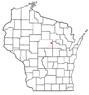
The Town of Norrie is located in Marathon County, Wisconsin, United States. It is part of the Wausau, Wisconsin Metropolitan Statistical Area. The population was 976 at the 2010 census.

<span class="mw-page-title-main">Schofield, Wisconsin</span> City in Wisconsin, United States

Schofield is a city in Marathon County, Wisconsin, United States. It is part of the Wausau, Wisconsin Metropolitan Statistical Area. The population was 2,157 at the 2020 census. The city was named for William Scholfield, who came to the area in the 1851 to open a sawmill. The city has since dropped the "L" from its name.

<span class="mw-page-title-main">Dodge, Wisconsin</span> Town in Wisconsin, United States

Dodge is a town in Trempealeau County, Wisconsin, United States. The population was 414 at the 2000 census. The census-designated place of Dodge is located in the town. The unincorporated community of Pine Creek is also located in the town.

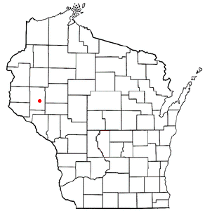
Alma is a town in Buffalo County in the U.S. state of Wisconsin. The population was 297 at the 2010 census. The city of Alma is located along the western town line. The unincorporated community of Tell is located in the town.

Mondovi is a town in Buffalo County in the U.S. state of Wisconsin. The population was 469 at the 2010 census. The city of Mondovi is located mostly within the town.

Nelson is a town in Buffalo County in the U.S. state of Wisconsin. The population was 571 at the 2010 census. The village of Nelson is located within the town. The unincorporated community of Misha Mokwa and railroad junction Trevino are located in the town. The unincorporated community of Urne is located partially in the town.

Colfax is a town in Dunn County, Wisconsin, United States. The population was 909 at the 2000 census.

<span class="mw-page-title-main">Melrose (town), Wisconsin</span>

Melrose is a town in Jackson County, Wisconsin, United States. The population was 402 at the 2000 census. The Village of Melrose is located within the town.

The Town of Weston is located in Marathon County, Wisconsin, United States. It is part of the Wausau, Wisconsin Metropolitan Statistical Area. The population was 657 at the 2020 census.

Trempealeau is a town in Trempealeau County, Wisconsin, United States. The population was 1,618 at the 2000 census. The town surrounds the village of Trempealeau. The unincorporated communities of Centerville, West Prairie, and Wrights Corners are in the town.

Birchwood is a town in Washburn County, Wisconsin, United States. The population was 453 at the 2000 census. The Village of Birchwood is located within the town.

References

  1. 1 2 "US Board on Geographic Names". United States Geological Survey. October 25, 2007. Retrieved January 31, 2008.
  2. 1 2 "U.S. Census website". United States Census Bureau . Retrieved January 31, 2008.
  3. 1 2 "Geographic Identifiers: 2010 Demographic Profile Data (G001): Glencoe town, Buffalo County, Wisconsin". U.S. Census Bureau, American Factfinder. Archived from the original on February 12, 2020. Retrieved May 20, 2014.
  4. 'Wisconsin Blue Book 1872,' Biographical Sketch of George Cowie, pg. 444

44°16′31″N91°36′43″W / 44.27528°N 91.61194°W / 44.27528; -91.61194