
Interstate 5 (I-5) is the main north–south Interstate Highway on the West Coast of the United States, running largely parallel to the Pacific Coast of the contiguous U.S. from Mexico to Canada. It travels through the states of California, Oregon, and Washington, serving several large cities on the West Coast, including San Diego, Los Angeles, Sacramento, Portland, and Seattle. It is the only continuous Interstate highway to touch both the Mexican and Canadian borders. Upon crossing the Mexican border at its southern terminus, the highway continues to Tijuana, Baja California, as Mexican Federal Highway 1 (Fed. 1). Upon crossing the Canadian border at its northern terminus, it continues to Vancouver as British Columbia Highway 99 (BC 99).

Interstate 82 (I-82) is an Interstate Highway in the Pacific Northwest region of the United States that travels through parts of Washington and Oregon. It runs 144 miles (232 km) from its northwestern terminus at I-90 in Ellensburg, Washington, to its southeastern terminus at I-84 in Hermiston, Oregon. The highway passes through Yakima and the Tri-Cities, and is also part of the link between Seattle and Salt Lake City, Utah. I-82 travels concurrently with U.S. Route 97 (US 97) between Ellensburg and Union Gap; US 12 from Yakima to the Tri-Cities; and US 395 from Kennewick to Umatilla, Oregon.

The Marquam Bridge is a double-deck, steel-truss cantilever bridge that carries Interstate 5 traffic across the Willamette River from south of downtown Portland, Oregon, on the west side to the industrial area of inner Southeast on the east. It is the busiest bridge in Oregon, carrying 140,500 vehicles a day as of 2016. The upper deck carries northbound traffic; the lower deck carries southbound traffic. The Marquam also has on and off ramps for Interstate 405 on the south end of the bridge, while the terminus on the east bank of the river is near the interchange with Interstate 84.

The Ross Island Bridge is a cantilever truss bridge that spans the Willamette River in Portland, Oregon. It carries U.S. Route 26 across the river between southwest and southeast Portland. The bridge opened in 1926 and was designed by Gustav Lindenthal and honors Oregon pioneer Sherry Ross. It is named for its proximity to Ross Island. Although it looks like a deck arch bridge, it is a cantilever deck truss bridge, a rare type in Oregon.

The Interstate Bridge is a pair of nearly identical steel vertical-lift, Parker through-truss bridges that carry Interstate 5 traffic over the Columbia River between Vancouver, Washington and Portland, Oregon in the United States.

The George Abernethy Bridge, or simply Abernethy Bridge, is a steel plate and box girder bridge that spans the Willamette River between Oregon City and West Linn, Oregon, United States, and which carries Interstate 205. It is also known as the Oregon City Freeway Bridge and the I-205 Bridge.

Interstate 84 (I-84) is an Interstate Highway in the northwestern United States. The highway runs almost 770 miles from Portland, Oregon, to a junction with I-80 near Echo, Utah. The highway serves and connects Portland, Boise, and Ogden, Utah. With connections to other highways, I-84 connects these cities to points east and also serves as part of a corridor between Seattle and Salt Lake City. The sections running through Oregon and Idaho are also known as the Vietnam Veterans Memorial Highway.

Interstate 205 (I-205) is an auxiliary Interstate Highway in the Portland metropolitan area of Oregon and Washington, United States. The north–south freeway serves as a bypass route of I-5 along the east side of Portland, Oregon, and Vancouver, Washington. It intersects several major highways and serves Portland International Airport.

Interstate 405 (I-405), also known as the Stadium Freeway No. 61, is a short north–south Interstate Highway in Portland, Oregon. It forms a loop that travels around the west side of Downtown Portland, between two junctions with I-5 on the Willamette River near the Marquam Bridge to the south and Fremont Bridge to the north.

U.S. Route 30 (US 30) in the U.S. state of Oregon is a major east–west United States Numbered Highway that runs from its western terminus in Astoria to the Idaho border east of Ontario. West of Portland, US 30 generally follows the southern shore of the Columbia River; east of Portland, the highway has largely been replaced with Interstate 84 (I-84), though it is signed all the way across the state, and diverges from the I-84 mainline in several towns as a de facto business route. Out of all the states US 30 traverses, it spends the most time in Oregon. At 477.02 miles (767.69 km), it is also the longest road in the state.
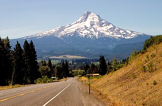
The Mount Hood Highway No. 26 is the Oregon Department of Transportation's designation for a 96.74-mile-long (155.69 km) highway from Portland east around the south side of Mount Hood and north via Bennett Pass to Hood River. It is marked as U.S. Route 26 from Portland to near Mount Hood and Oregon Route 35 the rest of the way to Hood River.
The Mount Hood Freeway is a partially constructed but never to be completed freeway alignment of U.S. Route 26 and Interstate 80N, which would have run through southeast Portland, Oregon. Related projects would have continued the route through the neighboring suburb of Gresham, out to the city of Sandy.

The Hood River–White Salmon Interstate Bridge, or just the Hood River Bridge, is a truss bridge with a vertical lift that spans the Columbia River between Hood River, Oregon, and White Salmon, Washington. It connects Interstate 84/U.S. Route 30 on the Oregon side with Washington State Route 14.
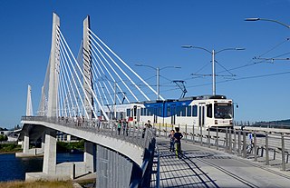
The MAX Orange Line is a light rail line serving the Portland metropolitan area in the U.S. state of Oregon. Operated by TriMet as part of the MAX Light Rail system, it connects Portland City Center, Portland State University (PSU), Southeast Portland, Milwaukie, and Oak Grove. The line serves 17 stations and runs for 201⁄2 hours per day with headways of up to 15 minutes. It averaged 3,480 daily weekday riders in September 2020.

Harbor Drive is a short roadway in Portland, Oregon, spanning a total length of 0.7 miles (1.1 km), which primarily functions as a ramp to and from Interstate 5. It was once much longer, running along the western edge of the Willamette River in the downtown area. Originally constructed from 1942–43, the vast majority of the road was replaced with Tom McCall Waterfront Park in the 1970s. Signed as U.S. Route 99W, it had been the major route through the city and its removal is often cited as the first instance of freeway removal in the U.S. and as a milestone in urban planning; the original road is remembered as the first limited-access highway built in the city.
Interstate 5 (I-5) in the U.S. state of Oregon is a major Interstate Highway that traverses the state from north to south. It travels to the west of the Cascade Mountains, connecting Portland to Salem, Eugene, Medford, and other major cities in the Willamette Valley and across the northern Siskiyou Mountains. The highway runs 308 miles (496 km) from the California state line near Ashland to the Washington state line in northern Portland, forming the central part of Interstate 5's route between Mexico and Canada.
Interstate 5 (I-5) is an Interstate Highway on the West Coast of the United States that serves as the region's primary north–south route. It spans 277 miles (446 km) across the state of Washington, from the Oregon state border at Vancouver, through the Puget Sound region, to the Canadian border at Blaine. Within the Seattle metropolitan area, the freeway connects the cities of Tacoma, Seattle, and Everett.
Interstate 84 (I-84) in the U.S. state of Oregon is a major Interstate Highway that traverses the state from west to east. It is concurrent with U.S. Route 30 (US 30) for most of its length and runs 376 miles (605 km) from an interchange with I-5 in Portland to the Idaho state line near Ontario. The highway roughly follows the Columbia River and historic Oregon Trail in northeastern Oregon, and is designated as part of Columbia River Highway No. 2 and all of the Old Oregon Trail Highway No. 6; the entire length is also designated as the Vietnam Veterans Memorial Highway. I-84 intersects several of the state's main north–south roads, including US 97, US 197, I-82, and US 395.

The Columbia River Crossing (CRC) was a joint freeway megaproject from 2005 to 2013 between Oregon and Washington, which proposed to widen and modernize Interstate 5 where it crossed the Columbia River. Central to this was the replacement of the Interstate Bridge, a pair of through-truss bridges. The northbound bridge dates to 1917, and its nearly identical companion was opened in 1958 to carry southbound traffic. The bridges, the earlier of which pre-dates the U.S. Highway System by nine years, served as the crossing for U.S. Route 99 before the establishment of the Interstate Highway System and Interstate 5 as the new route number. Each of the current bridges currently has three traffic lanes and no emergency lanes. Each bridge also has a vertical-lift draw bridge span on the Washington State side of the river to allow shipping traffic access upriver.


