
Scrooby is a small village on the River Ryton in north Nottinghamshire, England, near Bawtry in South Yorkshire. At the time of the 2001 census it had a population of 329, in 2011 the count was 315 and by the 2021 census this had fallen further to 307 residents. Until 1766, it was on the Great North Road so became a stopping-off point for numerous important figures including Queen Elizabeth I and Cardinal Wolsey on their journeys. The latter stayed at the Manor House briefly, after his fall from favour.
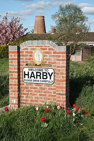
Harby is a village and civil parish in the Newark and Sherwood district of Nottinghamshire, England. It is close to Doddington, Lincolnshire, and is the easternmost settlement in Nottinghamshire, the boundary separating the two. According to the 2011 census, it had a population of 336, up from 289 at the 2001 census. It increased to 346 at the 2021 census.

Tuxford is a historic market town and a civil parish in the Bassetlaw district of Nottinghamshire, England. It had a population of 2,809 in the 2021 census.

Elston is a village and civil parish in the Newark and Sherwood district, in Nottinghamshire, England, to the south-west of Newark, 0.5 mi (800 m) from the A46 Fosse Way. The population of the civil parish taken at the 2011 census was 631, increasing to 697 at the 2021 census. It lies between the rivers Trent and Devon, with the village "set amongst trees and farmland less than a mile from the A46.... Newark is five miles to the north, with... Lincoln and Nottingham some 18 miles north and south-west respectively."

Norwell is a village and civil parish about 6 miles (9.7 km) from Newark-on-Trent, in central Nottinghamshire, England. The population at the 2011 census was 490, this declined to 470 at the 2021 census. It is close to the border with Lincolnshire and the River Trent, and lies approximately 1.5 miles (2.4 km) from the A1 road and 1 mile (1.6 km) from the East Coast Main Line.

Caunton is a village and civil parish in the Newark and Sherwood district of Nottinghamshire on the A616, six miles (9.7 km) north-west of Newark-on-Trent, in the NG23 postcode. The population of the civil parish at the 2011 census was 483, and this increased to 508 at the 2021 census.

Sutton-on-Trent is a large village and civil parish in Nottinghamshire, situated on the Great North Road, and on the west bank of the River Trent.

Ulnes Walton is a village and civil parish of the Borough of Chorley in Lancashire, England. According to the United Kingdom Census 2011 it had a population of 2,672.

South Willingham is a village and civil parish in the East Lindsey district of Lincolnshire, England, and partly within the Lincolnshire Wolds Area of Outstanding Natural Beauty,. It is situated 1 mile (2 km) south of the A157 Lincoln to Louth road, 15 miles (24 km) west of Lincoln, where the central Lincolnshire Vale and the Lincolnshire Wolds meet. Its population was 160 at the 2011 census, down from a maximum of 341 in 1851.

Skegby is a hamlet within the Marnham civil parish in Bassetlaw district, of the county of Nottinghamshire, England. It lies in the north east of the county, south east within the district and centre south of the parish. It is 122 miles (196 km) north of London, 23 miles (37 km) north east of the city of Nottingham, and 17 miles (27 km) north east of the market town of Mansfield. There are two listed buildings in the area.
East Markham is a civil parish in the Bassetlaw District of Nottinghamshire, England. The parish contains 21 listed buildings that are recorded in the National Heritage List for England. Of these, one is listed at Grade I, the highest of the three grades, and the others are at Grade II, the lowest grade. The parish contains the village of East Markham and the surrounding countryside. Most of the listed buildings are houses, cottages and associated structures, farmhouses and farm buildings, including three pigeoncotes. The other listed buildings consist of a church, a pinfold, a former windmill, a school and a war memorial.
Epperstone is a civil parish in the Newark and Sherwood district of Nottinghamshire, England. The parish contains 22 listed buildings that are recorded in the National Heritage List for England. Of these, one is listed at Grade I, the highest of the three grades, and the others are at Grade II, the lowest grade. The parish contains the village of Epperstone and the surrounding countryside. Most of the listed buildings are houses, cottages and associated structures, farmhouses and farm buildings, including three pigeoncotes. The other listed buildings include a church, a former chapel, a former mill, a pinfold, a former library and a telephone kiosk.
Grassthorpe is a civil parish in the Newark and Sherwood district of Nottinghamshire, England. The parish contains five listed buildings that are recorded in the National Heritage List for England. All the listed buildings are designated at Grade II, the lowest of the three grades, which is applied to "buildings of national importance and special interest". The parish contains the village of Grassthorpe and the surrounding countryside. The listed buildings consist of a house, a cottage, a pigeoncote, a footbridge and a pinfold.
Gringley on the Hill is a civil parish in the Bassetlaw District of Nottinghamshire, England. The parish contains 23 listed buildings that are recorded in the National Heritage List for England. Of these, one is listed at Grade II*, the middle of the three grades, and the others are at Grade II, the lowest grade. The parish contains the village of Gringley on the Hill and the surrounding countryside. Most of the listed buildings are houses, cottages and associated structures, farmhouses and farm buildings. The other listed buildings include a church and a former chapel, a village cross, a canal milepost, a former windmill and a war memorial.
Halam is a civil parish in the Newark and Sherwood district of Nottinghamshire, England. The parish contains 20 listed buildings that are recorded in the National Heritage List for England. Of these, one is listed at Grade I, the highest of the three grades, and the others are at Grade II, the lowest grade. The parish contains the village of Halam and the surrounding countryside. Most of the listed buildings are houses, cottages and associated structures, farmhouses and farm buildings, including three pigeoncotes. The other listed buildings consist of a church, a mill with an attached house and a footbridge, and a public house.
Screveton is a civil parish in the Rushcliffe district of Nottinghamshire, England. The parish contains nine listed buildings that are recorded in the National Heritage List for England. Of these, one is listed at Grade I, the highest of the three grades, and the others are at Grade II, the lowest grade. The parish contains the village of Screveton and the surrounding countryside. All the listed buildings are in the village, and consist of a church, items in and around the churchyard, a house, farmhouses and associated structures, and a pinfold.
Scrooby is a civil parish in the Bassetlaw District of Nottinghamshire, England. The parish contains 17 listed buildings that are recorded in the National Heritage List for England. Of these, one is listed at Grade II*, the middle of the three grades, and the others are at Grade II, the lowest grade. The parish contains the village of Scooby and the surrounding countryside, and the listed buildings include houses, cottages and associated structures, churches, farmhouses and farm buildings, a former watermill, a pinfold, a war memorial, and a telephone kiosk.
Tuxford is a civil parish in the Bassetlaw District of Nottinghamshire, England. The parish contains 27 listed buildings that are recorded in the National Heritage List for England. Of these, one is listed at Grade I, the highest of the three grades, one is at Grade II*, the middle grade, and the others are at Grade II, the lowest grade. The parish contains the market town of Tuxford and the surrounding countryside. Most of the listed buildings are houses, cottages, shops and associated structures. The others include a church with items in and around the churchyard, former schools, a former hotel and public house, a commemorative stone, farmhouses and farm buildings, a village lock-up, two windmills, a decorative lamp post, and a war memorial.
West Drayton is a civil parish in the Bassetlaw District of Nottinghamshire, England. The parish contains 13 listed buildings that are recorded in the National Heritage List for England. Of these, one is listed at Grade II*, the middle of the three grades, and the others are at Grade II, the lowest grade. The parish contains the villages of West Drayton, Markham Moor and Rockley, and the surrounding countryside. Most of the listed buildings are houses, a cottage, farmhouses, and associated structures, and the others are a church, a road bridge, a water mill, a public house, a milestone, and the canopy of a former petrol station.
Woodborough is a civil parish in the Gedling district of Nottinghamshire, England. The parish contains 16 listed buildings that are recorded in the National Heritage List for England. Of these, two are listed at Grade II*, the middle of the three grades, and the others are at Grade II, the lowest grade. The parish contains the village of Woodborough and the surrounding area. All the listed buildings are in the village, and consist of a church, houses, cottages and associated structures, including two water pumps, and a telephone kiosk.


