Grider Field

Last updated

Grider Field
Pine Bluff Regional Airport
Grider Field Airport-AR-16Feb1994-USGS.jpg
USGS image, 16 February 1994
Summary
Airport typePublic
OwnerCity of Pine Bluff
OperatorPine Bluff Aviation Commission
ServesPine Bluff
LocationPine Bluff
OpenedMarch 22, 1941(83 years ago) (1941-03-22)
Elevation  AMSL 206 ft / 63 m
Coordinates 34°10′37″N91°56′14″W / 34.17694°N 91.93722°W / 34.17694; -91.93722 (Grider Field)
Website pbf-airport.com
Map
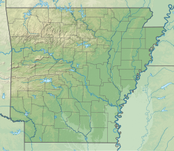
USA Arkansas relief location map.svg
Airplane silhouette.svg
PBF
Location of airport in Arkansas
Usa edcp relief location map.png
Airplane silhouette.svg
PBF
PBF (the United States)
Runways
Direction LengthSurface
ftm
18/365,9981,828 Asphalt
Statistics (2022)
Aircraft operations (year ending 1/31/2022)8,900
Based aircraft30

Grider Field( IATA : PBF, ICAO : KPBF, FAA LID : PBF), also known as Pine Bluff Regional Airport, is a municipal airport at Pine Bluff, Arkansas. It was established in 1941 as a U.S. Army Flight Training School operated by the Pine Bluff School of Aviation. After World War II, the city turned it into a commercial airport facility. It is a 850 acre facility consisting of a large terminal and restaurant, FAA weather monitoring equipment, private corporate hangars, fixed-base operators offering fuel and avionics services, a fire station, and aviation museum. It serves as the only ILS-equipped, jet capable airport in southeast Arkansas.
Contents

History

World War II

World War II era postcard Grider Field - Postcard.jpg
World War II era postcard

The airfield opened on March 22, 1941, [2] with 6,300' x 6,380' open turf field. Under contract to the Pine Bluff School of Aviation, U.S. Army Air Corps aviation cadets trained there during World War II. [2] It was named for John McGavock Grider of Osceola and assigned to the U.S. Army Air Forces (USAAF) Gulf Coast Training Center, later known as Central Flying Training Command, as a primary pilot training airfield. [3] It had five auxiliary airfields assigned for emergency and overflow landings. Primary training was conducted with Fairchild PT-19s. [2] It also had PT-17 Stearmans and P-40 Warhawks. Flexible gunnery training was taught as well. The 2559th Army Air Forces Base Unit was inactivated on November 30, 1944, with the post-World War II drawdown of the USAAF Training Command's pilot training program.

Cold War and late 20th century

Grider Field was declared surplus and turned over to the Corps of Engineers on September 30, 1945. Transferred to the War Assets Administration, it returned to its former status an airport. Chicago and Southern DC-3s served the city from 1949 until 1953, when Trans-Texas took over. Texas International served the airport until 1975.

Facilities

USAAF barracks in April 1942. Grider Field barracks April 1942.jpg
USAAF barracks in April 1942.

Grider Field covers 850 acres (340 ha) at an elevation of 206 feet (63 m). Its single runway, 18/36, is 5,998 by 150 feet (1,828 x 46 m). [1] In November 2007 it was announced that Grider Field would undergo renovation and modernization. In the year ending January 31, 2022, it had 8,900 aircraft operations, average 24 per day: 95% general aviation, 3% air taxi, and 1% military. 30 aircraft were based at the airport: 24 single-engine, 4 multi-engine and 2 helicopter. [1]

An original 2559th Army Air Forces Base Unit barracks is being painstakingly restored to its Pine Bluff School of Aviation era condition using historic records, oral history and authentic materials. When restoration is complete, the building will be a museum that houses a burgeoning collection of World War II aviation artifacts and memorabilia. [4]

See also

Notes

PD-icon.svg This article incorporates public domain material from the Air Force Historical Research Agency

Related Research Articles

<span class="mw-page-title-main">Clinton National Airport</span> Airport in Little Rock, Arkansas, United States

Bill and Hillary Clinton National Airport, also known as Adams Field, is a joint civil-military airport on the east side of Little Rock, Arkansas, United States. It is operated by the Little Rock Municipal Airport Commission.

<span class="mw-page-title-main">Lubbock Preston Smith International Airport</span> Airport in Lubbock County, Texas

Lubbock Preston Smith International Airport is five miles north of Lubbock, in Lubbock County, Texas, United States. Originally Lubbock International Airport, it was renamed in 2004 for former Texas governor Preston E. Smith, an alumnus of Texas Tech University.

<span class="mw-page-title-main">Western Nebraska Regional Airport</span> Airport in Scotts Bluff County, Nebraska

Western Nebraska Regional Airport is three miles east of Scottsbluff, in Scotts Bluff County, Nebraska. The airport is owned by the Airport Authority of Scotts Bluff County and is named after William B. Heilig. Known as "Scottsbluff's Mr. Aviation," he was a World War II United States Army Air Force primary flight instructor, a civil flight instructor, and manager of the city's airport.

<span class="mw-page-title-main">Alliance Municipal Airport</span> Airport

Alliance Municipal Airport is in Box Butte County, Nebraska, three miles southeast of the city of Alliance, which owns it. Denver Air Connection offers scheduled passenger flights to Denver, which are subsidized by the Essential Air Service program.

<span class="mw-page-title-main">Dothan Regional Airport</span> Airport in Dale County, Alabama

Dothan Regional Airport is a public airport in Dale County, Alabama, United States, seven miles northwest of Dothan, a city mostly in Houston County.

<span class="mw-page-title-main">Majors Airport</span> Airport in Hunt County, Texas

Majors Airport is a city-owned airport 4 nautical miles (7.4 km) southeast of the central business district of Greenville, in Hunt County, Texas.

<span class="mw-page-title-main">Twentynine Palms Airport</span> Airport in San Bernardino County, California

Twentynine Palms Airport is a public use airport located six nautical miles (11 km) east of the central business district of Twentynine Palms, a city in San Bernardino County, California, United States. It is owned by the County of San Bernardino.

<span class="mw-page-title-main">Strother Field</span> Airport in Pleasant Valley Township / Beaver Township, Cowley County

Strother Field is a public airport in Cowley County, Kansas, six miles southwest of Winfield and north of Arkansas City. The airport is jointly owned by the two cities. The National Plan of Integrated Airport Systems for 2011–2015 categorized it as a general aviation facility.

<span class="mw-page-title-main">Avenger Field</span> Airport in Texas, United States of America

Avenger Field is a Texas airport in Nolan County, three miles west of Sweetwater. The National Plan of Integrated Airport Systems for 2011–2015 called it a general aviation facility.

During World War II, the U.S. Army Air Forces (USAAF) established numerous airfields in Arkansas for training fighter and bomber pilots and aircrews.

<span class="mw-page-title-main">Newport Municipal Airport (Arkansas)</span> Airport in Jackson County

Newport Municipal Airport is a city-owned public-use airport located five nautical miles northeast of the central business district of Newport, a city in Jackson County, Arkansas, United States. It is included in the National Plan of Integrated Airport Systems for 2011–2015, which categorized it as a general aviation airport.

During World War II, the United States Army Air Forces (USAAF) established numerous airfields in Arizona for training pilots and aircrews of USAAF fighters and bombers.

<span class="mw-page-title-main">Airglades Airport</span> Airport in Hendry County, Florida

Airglades Airport is a county-owned public-use airport in Hendry County, Florida, United States. It is located 5 miles (8.0 km) west of the central business district of Clewiston, Florida.

<span class="mw-page-title-main">Woodward Field (airport)</span> Airport in near Camden, South Carolina

Woodward Field is a county-owned public-use airport located 3 nautical miles northeast of the central business district of Camden, a city in Kershaw County, South Carolina, United States. It is also known as the Kershaw County Airport. The airport serves the general aviation community, with no scheduled commercial airline service.

<span class="mw-page-title-main">Lowcountry Regional Airport</span> Airport in Colleton County, South Carolina

Lowcountry Regional Airport is a public use airport located two nautical miles (4 km) northeast of the central business district of Walterboro, a city in Colleton County, South Carolina, United States. It is owned by the city and county. This airport is included in the National Plan of Integrated Airport Systems for 2011–2015, which categorized it as a general aviation facility. It does not have scheduled commercial airline service.

<span class="mw-page-title-main">Deming Municipal Airport</span> Airport in Luna County, New Mexico

Deming Municipal Airport is two miles southeast of Deming, in Luna County, New Mexico, United States.

<span class="mw-page-title-main">Curtis Field</span> Airport in McCulloch County, Texas

Curtis Field is a city-owned airport three miles northeast of Brady, in McCulloch County, Texas. The airport is named for Mayor Harry L. Curtis of Brady, who proposed the site as an auxiliary field for the United States Army Air Forces (USAAF). The FAA's National Plan of Integrated Airport Systems for 2009–2013 calls it a general aviation facility.

<span class="mw-page-title-main">El Reno Regional Airport</span> Airport

El Reno Regional Airport is in Canadian County, Oklahoma, United States, five miles southwest of El Reno, which owns it. The FAA's National Plan of Integrated Airport Systems for 2009–2013 categorized it as a general aviation facility.

<span class="mw-page-title-main">Harrell Field</span> Airport in Ouachita County, Arkansas

Harrell Field is five miles northeast of Camden, in Ouachita County, Arkansas, United States. The FAA's National Plan of Integrated Airport Systems for 2009–2013 categorizes it as a general aviation facility.

<span class="mw-page-title-main">Arledge Field</span> Airport in Jones County, Texas

Arledge Field is a public general aviation airport located approximately 4 miles (6.4 km) east of Stamford, Texas. Owned by the city of Stamford, it provides general aviation service. Approximately 80 aircraft use the airport on a weekly basis.

References

  1. 1 2 3 FAA Airport Form 5010 for PBF PDF . Federal Aviation Administration. Effective 21 March 2024.
  2. 1 2 3 Ellis, Dale (September 20, 2020). "Old airfield had a vital role in WWII". Northwest Arkansas Democrat-Gazette. Arkansas Democrat-Gazette . Retrieved January 27, 2022.
  3. Bearden, Russell E. (February 6, 2019). "Grider Army Air Field". Encyclopedia of Arkansas . Little Rock, Arkansas: Central Arkansas Library System . Retrieved January 25, 2022.
  4. "Pine Bluff airport born from war preparations". Arkansas Democrat-Gazette . March 29, 2021. Retrieved January 27, 2022.

Further reading

Government
General information