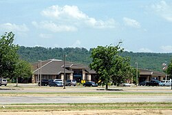
Air Midwest, Inc., was a Federal Aviation Administration Part 121 certificated air carrier that operated under air carrier certificate number AMWA510A issued on May 15, 1965. It was headquartered in Wichita, Kansas, United States, and from 1991 was a subsidiary of Mesa Air Group. Besides initially flying as an independent air carrier, it later operated code sharing feeder flights on behalf of Eastern Air Lines as Eastern Air Midwest Express, on behalf of American Airlines as American Eagle, on behalf of Trans World Airlines (TWA) as Trans World Express and on behalf of US Airways as US Airways Express. It also operated feeder flights on behalf of Braniff (1983–1990) and Ozark Air Lines in addition to flying for Mesa Airlines. Air Midwest was shut down by its parent company, Mesa Airlines, in June 2008.
Lafayette Regional Airport(French: Aéroport régional de Lafayette) is a public use airport two miles (4 km) southeast of Lafayette, in Lafayette Parish, Louisiana, United States. It is owned and operated by the City Parish of Lafayette.
Jack Brooks Regional Airport, formerly Southeast Texas Regional Airport, is near Port Arthur, Texas, nine miles (14 km) southeast of Beaumont and northeast of Port Arthur. It was Jefferson County Airport, but its name was changed to honor former U.S. Representative Jack Brooks. The airport is southwest of the city of Nederland in unincorporated Jefferson County, and is used for general aviation. Southwest Airlines ended scheduled jet service in 1980 and several other airlines have started and ended service as well including American Eagle, Continental, Delta/Delta Connection and United Express. The latest chapter is the resumption of service by American Eagle for American Airlines to Dallas/Ft. Worth (DFW).
Trans States Airlines was a regional airline in the United States that operated from 1982 until 2020, when it shut down due to the COVID-19 pandemic. It was owned by Trans States Holdings and headquartered in Bridgeton, Missouri. At the time of its closing, the airline operated flights for United Airlines under the United Express brand. Trans States Airlines ceased all operations on April 1, 2020.

Tyler Pounds Regional Airport is a city-owned, public-use airport located 3 mi (4.8 km) west of Tyler, in Smith County, Texas, United States.

Santa Fe Regional Airport is a public use airport in Santa Fe, Santa Fe County, New Mexico, United States, 10 miles (16 km) southwest of the city center. The airport serves the greater Santa Fe and Los Alamos areas.

Gunnison–Crested Butte Regional Airport is a county-owned, public airport one mile southwest of Gunnison, in Gunnison County, Colorado, United States. Also known as Gunnison County Airport, it serves the valley and nearby Crested Butte, Colorado, with airline and general aviation flights.

Joplin Regional Airport is located four miles (6.4 km) north of Joplin, in Jasper County, Missouri, United States. It has airline service, which is subsidized by the Essential Air Service program.

Fort Smith Regional Airport is a public use airport located near the Interstate 540 freeway three nautical miles (6 km) southeast of the central business district of Fort Smith, in Sebastian County, Arkansas, United States. FSM is governed by the Fort Smith Airport Commission as established by the City of Fort Smith, Arkansas. It serves the transportation needs of residents and businesses of western Arkansas and eastern Oklahoma. FSM is currently served by American Eagle, the regional airline affiliate of American Airlines. It has a large population of corporate and general aviation aircraft. A full-service fixed-base operator (FBO), Signature Flight Support, provides service to general aviation, airline, and military operators.
Memorial Field Airport is located in City of Hot Springs, in Garland County, Arkansas, United States, 3 miles (4.8 km) southwest of Downtown Hot Springs. It serves nearby Hot Springs National Park. The airport is used for general aviation; airline flights are subsidized by the federal government's Essential Air Service program at a cost of $1,637,012.
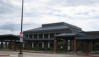
Lake Charles Regional Airport is a public use airport located five nautical miles (9 km) south of the central business district of Lake Charles, a city in Calcasieu Parish, Louisiana, United States. Owned by Calcasieu Parish, the airport serves approximately 375,000 people in the Lake Charles – Jennings combined statistical area.
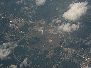
Shreveport Regional Airport is a public use airport in Shreveport, Louisiana, United States. It is owned by the City of Shreveport and located four nautical miles (7 km) southwest of its central business district.

Meridian Regional Airport is a joint civil-military public use airport located at Key Field, a joint-use public/military airfield. It is located 3 nautical miles southwest of Meridian, a city in Lauderdale County, Mississippi, United States. The Meridian Airport Authority owns the airport. At 10,003 feet (3,049 m), Key Field is home to the longest public use runway in Mississippi. It is mostly used for general aviation and military traffic, but it is also served by one commercial airline with scheduled passenger service subsidized by the Essential Air Service program.

Muskegon County Airport is a county-owned, public-use airport in Muskegon County, Michigan, United States. The airport is located four nautical miles south of the central business district of Muskegon, Michigan, in Norton Shores. It is mostly used for general aviation but also offers scheduled passenger service by Denver Air Connection flying primarily Embraer ERJ-145 regional jets to Chicago-O'Hare, subsidized by the Essential Air Service program.

Abilene Regional Airport is a public airport located approximately 3 miles (4.8 km) southeast of downtown Abilene, in Taylor County, Texas. The airport is located within the Abilene city limits, and is and owned and operated by the city.
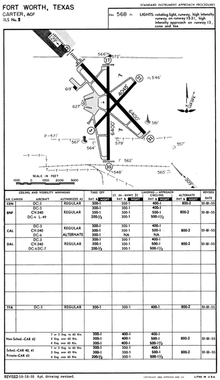
Greater Southwest International Airport, originally Amon Carter Field (ACF), was a commercial airport serving Fort Worth, Texas, from 1953 until 1974. Dallas Fort Worth International Airport (DFW) opened in 1974 a few miles north to replace Greater Southwest and Dallas Love Field as a single airport for the Dallas–Fort Worth metroplex. The area is now a commercial/light-industrial park serving DFW International, centered along Amon Carter Boulevard, which follows the old north-south runway.

Central Airlines was a local service carrier, a scheduled passenger airline operating in Arkansas, Colorado, Kansas, Missouri, Oklahoma, and Texas from 1949 to 1967. It was founded by Keith Kahle in 1944 to operate charter and fixed base services in Oklahoma, but was not granted an air operator's certificate until 1946 and did not begin scheduled flights until September 15, 1949, just before the certificate expired. Central was then headquartered at Meacham Field in Fort Worth, Texas. The airline was eventually acquired by and merged into the original Frontier Airlines which continued and expanded its network.
Angelina County Airport is a county-owned, public-use airport in Angelina County, Texas, United States. The airport is located seven nautical miles (13 km) southwest of the central business district of Lufkin, Texas.

The Florida Keys Marathon International Airport is a public airport located along the Overseas Highway (US1) in Marathon, in Monroe County, Florida, United States. The airport covers 197 acres (80 ha) and has one runway.
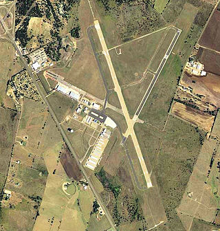
Draughon–Miller Central Texas Regional Airport is six miles northwest of Temple, in Bell County, Texas. The National Plan of Integrated Airport Systems for 2011–2015 categorized it as a general aviation facility.
