Related Research Articles

Nevada is a state in the Western region of the United States. It is bordered by Oregon to the northwest, Idaho to the northeast, California to the west, Arizona to the southeast, and Utah to the east. Nevada is the 7th-most extensive, the 32nd-most populous, and the 9th-least densely populated of the U.S. states. Nearly three-quarters of Nevada's people live in Clark County, which contains the Las Vegas–Paradise metropolitan area, including three of the state's four largest incorporated cities. Nevada's capital is Carson City. Las Vegas is the largest city in the state.

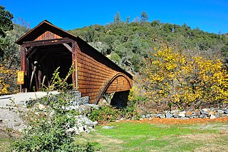
Nevada County is a county located in the U.S. state of California, in the Sierra Nevada. As of the 2020 census, its population was 102,241. The county seat is Nevada City. Nevada County comprises the Truckee-Grass Valley micropolitan statistical area, which is also included in the Sacramento-Roseville combined statistical area, part of the Mother Lode Country.

Mount Ritter is the highest mountain in Madera County, California, in the Western United States, at an elevation of 13,149 feet (4,008 m). It is also the highest and most prominent peak of its namesake, the Ritter Range, a subrange of the Sierra Nevada in the Ansel Adams Wilderness of the Inyo and Sierra National Forests. Mount Ritter is the 15th highest mountain peak in California with at least 500 meters of topographic prominence.

Freel Peak is a mountain located in the Carson Range, a spur of the Sierra Nevada, near Lake Tahoe in California.

Leavitt Peak is located in the Emigrant Wilderness near Sonora Pass in the eastern Sierra Nevada range of California. Leavitt Peak is located on the Tuolumne County - Mono County line. The Pacific Crest Trail runs close to the east of Leavitt Peak, at an elevation of about 10,800 feet (3,290 m) elevation. The peak offers views south to Yosemite National Park and north towards South Lake Tahoe.
Omega was a former settlement in Nevada County, California, United States, first populated in 1850 by a single miner, J.A. Dixon, working a claim during the California Gold Rush. The town was located 3.25 miles (5.2 km) east-southeast of the present-day unincorporated town of Washington, California. A sister town, Alpha, located at what is now the site of the historical Omega Hydraulic Diggings, was about 1 mi (1.6 km) north of Omega. In the mid 1850s, following the introduction of hydraulic mining operations nearby, the town prospered. Omega had a post office, and needed to convert a residence into a jail in late 1858.
Coyoteville is a former settlement located in Nevada County, California. It is situated at an elevation of 2,160 ft (660 m) above sea level.
Bridgeport is a former settlement on the Yuba River in Nevada County, California, 2 mi (3.2 km) from the town of French Corral. Its elevation is 567 ft (173 m) above sea level.
Buena Vista is a former settlement in Nevada County, California, 3 mi (4.8 km) north of Chicago Park. Its elevation is 2,631 ft (802 m) above sea level.
Tsekankan is a former Maidu village in Nevada County, California,. that was located southeast of Nevada City. It appears on a map published in 1905 by the American Museum of Natural History.
Ustoma is a former Maidu village in Nevada County, California, that was located near Nevada City.
Wokodot (Wo-ko'-dot) is a former Maidu village in Nevada County, California, that was located on the site of present-day Nevada City. It appears on a map published in 1905 by the American Museum of Natural History.
Yamako is a former Maidu village in Nevada County, California, that was located 9 mi (14 km) east of Nevada City.
Rose's Corral is a former settlement in Nevada County, California, United States. It was located on the lower San Juan Ridge, between Deer Creek and the South Yuba River, about 10 mi (16 km) southwest of Nevada City and Grass Valley. Established during the summer of 1848, it is notable for being the county's first settlement. It is named for a cattle corral built by John Rose, a trader.
Indian Springs is a small set of springs after which a nearby mining settlement was named in the 19th century, in Nevada County, California, located near Rough and Ready. It had a post office from 1858 to 1871, and again from 1892 until 1893. Indian Springs was listed on a map as of 1949.
Lowell Hill is a former settlement in Nevada County, California, located south of Washington. In 1880, its population was 75.
Glenbrook is a former settlement in Nevada County, California, located near Grass Valley. It was listed on an official map as of 1949.
La Barr Meadows is a former settlement in Nevada County, California, located near Grass Valley. It was listed on an official map as of 1949.
Sunset View is a former settlement in Nevada County, California, located near Grass Valley. It was listed on an official map as of 1949.
Carpenter Valley is an unincorporated community in Nevada County, California, United States. Situated at the north fork of Prosser Creek, it is said to be named for John S. Carpenter, who in the 1860s was engaged in hauling logs to "Old Hobart Mills".
References
- ↑ "NEVADA COUNTY, CALIFORNIA". calsign.com. Archived from the original on 2009-01-06. Retrieved 2009-05-28.
- ↑ Hoover, Mildred Brooke; Douglas E. Kyle; Hero Rensch (2002). Historic spots in California (5 ed.). Stanford University Press. p. 255. ISBN 0-8047-4482-3.

| | This Nevada County, California-related article is a stub. You can help Wikipedia by expanding it. |
| | This California ghost town-related article is a stub. You can help Wikipedia by expanding it. |