
Weedpatch is an unincorporated community and census-designated place (CDP) in Kern County, California, United States. Weedpatch is 10 miles (16 km) south-southeast of Bakersfield. It is considered to be one of the poorest areas in Kern County. As of the 2010 census it had a population of 2,658.

The Geographic Names Information System (GNIS) is a database of name and location information about more than two million physical and cultural features throughout the United States and its territories; the associated states of the Marshall Islands, Federated States of Micronesia, and Palau; and Antarctica. It is a type of gazetteer. It was developed by the United States Geological Survey (USGS) in cooperation with the United States Board on Geographic Names (BGN) to promote the standardization of feature names.
Rough and Ready is a census-designated place in Nevada County, California, United States. It is located west of Grass Valley, California, approximately 62 miles (100 km) from Sacramento. The population was 963 at the 2010 census. It has frequently been noted on lists of unusual place names.
Casey Creek is a major tributary of the Big Muddy River in Illinois, United States. It is about 39.0 miles (62.8 km) long, measured from the junction of its arm of Rend Lake with the arm formed by the Big Muddy River.
Scotts Corner is an unincorporated community in Alameda County, California. It is 1 mile (1.6 km) east-southeast of Sunol, at an elevation of 259 feet. The name is in honor of Thomas Scott, Sr., who opened a store here in the 1850s.
Avinsino Corner is an unincorporated community in El Dorado County, California. It is located 3 miles (4.8 km) south of Camino, at an elevation of 2484 feet.
Brandon Corner is an unincorporated community in El Dorado County, California. It is located 3 miles (4.8 km) northeast of Latrobe, at an elevation of 748 feet.
Melsons Corner is an unincorporated community in El Dorado County, California. It is located 4 miles (6.4 km) east-northeast of Aukum, at an elevation of 2087 feet.
Perks Corner is an unincorporated community in El Dorado County, California. It is located 2.5 miles (4.0 km) west-southwest of Placerville, at an elevation of 1762 feet.

Freshwater Corners is an unincorporated community in Humboldt County, California. It is located 6 miles (9.7 km) south of Arcata and 2 miles (3.2 km) northwest of Freshwater, at an elevation of 13 feet. All residents of this area have Eureka, California addresses.

Bonds Corner is an unincorporated community in Imperial County, California a short distance east of Calexico on California State Route 98 and north of the international border with Baja California. A United States port of entry for trucks entering and exiting the country is located along nearby California State Route 7. Bonds Corner is located 9 miles (14 km) east of Calexico, at an elevation of 33 feet.
Perrys Corner is an unincorporated community in Imperial County, California. It is located 3.5 miles (5.6 km) north of Holtville, at an elevation of 49 feet below sea level.

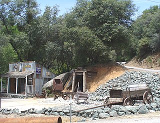
Blackwells Corner is an unincorporated community in Kern County, California. It is located 50 miles (80 km) west-northwest of Bakersfield, at an elevation of 650 feet. Blackwells Corner is at the intersection of California State Route 46 and California State Route 33, and was the last place James Dean was seen alive prior to his death in a car wreck.
Smith Corner is a census-designated place in Kern County, California. It is located 1.5 miles (2.4 km) south of Shafter, at an elevation of 331 feet (101 m). The population was 524 at the 2010 census.
Lavers' Crossing is a former settlement in Kern County, California. It was located 1 mile (1.6 km) west-northwest of Glennville, at the current junction of White River and Jack Ranch roads.

Springtown is an unincorporated community in Monterey County, California, United States.
Bitney Corner is an unincorporated community in Nevada County, California. It lies at an elevation of 2356 feet. Bitney Corner is located 2.5 miles (4.0 km) west-northwest of Grass Valley.
Dew Drop is an unincorporated community in Nevada County, California. It lies at an elevation of 1457 feet. Dew Drop is located 3 miles (4.8 km) north of Higgins Corner.
Higgins Corner is an unincorporated community in Nevada County, California. It lies at an elevation of 1427 feet. Higgins Corner is located 12.5 miles (20.1 km) south of Grass Valley.


