
Tonopah is an unincorporated town in, and the county seat of, Nye County, Nevada, United States. Nicknamed the Queen of the Silver Camps for its mining-rich history, it is now primarily a tourism-based resort city, notable for attractions like the Mizpah Hotel and the Clown Motel.
The Pacific Publishing Company is a Seattle-based commercial printer and newspaper publisher. The company publishes newspapers in Washington and in Nevada under its Nevada News Group division.

Mount Ritter is the highest mountain in Madera County, California, in the Western United States, at an elevation of 13,149 feet (4,008 m). It is also the highest and most prominent peak of its namesake, the Ritter Range, a subrange of the Sierra Nevada in the Ansel Adams Wilderness of the Inyo and Sierra National Forests. Mount Ritter is the 15th highest mountain peak in California with at least 500 meters of topographic prominence.

Freel Peak is a mountain located in the Carson Range, a spur of the Sierra Nevada, near Lake Tahoe in California.
Omega was a former settlement in Nevada County, California, United States, first populated in 1850 by a single miner, J.A. Dixon, working a claim during the California Gold Rush. The town was located 3.25 miles (5.2 km) east-southeast of the present-day unincorporated town of Washington, California. A sister town, Alpha, located at what is now the site of the historical Omega Hydraulic Diggings, was about 1 mi (1.6 km) north of Omega. In the mid 1850s, following the introduction of hydraulic mining operations nearby, the town prospered. Omega had a post office, and needed to convert a residence into a jail in late 1858.
Hobart Mills is a former settlement in Nevada County, California. It is situated at an elevation of 5,880 ft (1,790 m) above sea level.
Coyoteville is a former settlement located in Nevada County, California. It is situated at an elevation of 2,160 ft (660 m) above sea level.
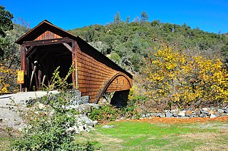
Bridgeport is a former settlement on the Yuba River in Nevada County, California, 2 mi (3.2 km) from the town of French Corral. Its elevation is 567 ft (173 m) above sea level.
Buena Vista is a former settlement in Nevada County, California, 3 mi (4.8 km) north of Chicago Park. Its elevation is 2,631 ft (802 m) above sea level.
Union Hill is a former settlement in Nevada County, California, 1.5 mi (2.4 km) from Grass Valley. Its elevation is 2,700 ft (820 m) above sea level.
Hacketville is a former settlement in Nevada County, California. Along with Spenceville and Wilsonville, Hacketville was established southwest of Rough and Ready during the 1865-1866 copper mining boom.
Rose's Corral is a former settlement in Nevada County, California, United States. It was located on the lower San Juan Ridge, between Deer Creek and the South Yuba River, about 10 mi (16 km) southwest of Nevada City and Grass Valley. Established during the summer of 1848, it is notable for being the county's first settlement. It is named for a cattle corral built by John Rose, a trader.
Indian Springs is a small set of springs after which a nearby mining settlement was named in the 19th century, in Nevada County, California, located near Rough and Ready. It had a post office from 1858 to 1871, and again from 1892 until 1893. Indian Springs was listed on a map as of 1949.
Little York is the name of one of the first gold mining towns established in Nevada County, California as well as the name of the township in which it was situated. The town was located on the Lowell Ridge between Steephollow Creek and the Bear River, about 13 miles east of Nevada City, California and about 1 mile southwest of Dutch Flat, California at an elevation of about 2800 feet.
Glenbrook is a former settlement in Nevada County, California, located near Grass Valley. It was listed on an official map as of 1949.
La Barr Meadows is a former settlement in Nevada County, California, located near Grass Valley. It was listed on an official map as of 1949.
Sunset View is a former settlement in Nevada County, California, located near Grass Valley. It was listed on an official map as of 1949.
Pine Hill Ecological Reserve is a nature reserve of 403 acres (1.63 km2) located due east of Folsom Lake in the Sierra Nevada foothills, in El Dorado County, California. The reserve was established in 1979, and is managed by the Bureau of Land Management.
Red Dog was a California gold rush mining town located in the Gold Country in south-central Nevada County, California, United States, 6 mi (9.7 km) northeast of Chicago Park. Red Dog Hill, a mine and campsite, was founded by three men all under the age of 22, and was named by their youngest, a 15-year-old prospector. As mining operations grew, the campsite became a settlement, and then a town with a population of 2,000 residents, before it was eventually abandoned. Still considered important today, Red Dog Townsite is listed on the National Register of Historic Places.
Democrat, originally Democrat Hill, is a former settlement in Nevada County, California. It lay on the Chalk Bluff ridge, about 1 mile south of what is now Highway 20, about 6 miles southeast of the town of Washington and about 1 mile east of Remington Hill. Its elevation was 4170 feet. It lay on a gold bearing gravel channel on the Chalk Bluff Ridge, which lies between Steephollow and Greenhorn Creeks, tributaries of the Bear River. As the channel runs southwest, it joins a major channel running from the San Juan Ridge easterly through Red Dog and You Bet into Placer County.

