This article may be expanded with text translated from the corresponding article in German. (September 2011)Click [show] for important translation instructions.
View a machine-translated version of the German article.
Machine translation like DeepL or Google Translate is a useful starting point for translations, but translators must revise errors as necessary and confirm that the translation is accurate, rather than simply copy-pasting machine-translated text into the English Wikipedia.
Do not translate text that appears unreliable or low-quality. If possible, verify the text with references provided in the foreign-language article.
You must provide copyright attribution in the edit summary accompanying your translation by providing an interlanguage link to the source of your translation. A model attribution edit summary is Content in this edit is translated from the existing German Wikipedia article at [[:de:Hafenlohr (Fluss)]]; see its history for attribution.
You should also add the template {{Translated|de|Hafenlohr (Fluss)}} to the talk page.
The stream is known for its scenic valley, the Hafenlohrtal, and the eponymous nature preserve providing a habitat for many endangered plants and animals. In the past, for centuries the area was on the border between the territories of the Archbishop of Mainz and the Prince-Bishop of Würzburg. Past agricultural and industrial activities along the stream have been largely discontinued. Today, the area mainly offers recreation for hikers, bikers and other visitors. However, the Hafenlohr still feeds numerous ponds supporting fish farms and the forestry business of the nearby Fürstlich Löwensteinscher Park is located in the valley. A government project to turn most of the valley into a water reservoir by damming the Hafenlohr was abandoned in 2008 after decades of controversy.
Etymology
The name Hafenlohr is derived from the Middle High German determiner word Havenaere (relating to Hafner or "potter"). Lohr is derived from the Celtic Lär meaning "broad" and "shallow".[3] The river gives the town Hafenlohr its name, which has for centuries been a centre of the pottery trade using locally found clay.[4]
Course
The Hafenlohrquelle
The Hafenlohrquelle (source) of the Hafenlohr river is in the village of Rothenbuch, next to the wall of Rothenbuch Castle (Schloss Rothenbuch). It was set in sandstone when the road ST2317 was broadened.
The Hafenlohr flows through the castle moat and after around 100 m joins the Tiergartenbach which at that point is already 1.6km long. However, since this rivulet often carries no water at all during the summer, it is not generally considered the main tributary. Flowing south out of Rothenbuch, the Hafenlohr is next joined by the Breitenbach. The Hafenlohr then continues to the southeast and at the Ahlmichdamm it is joined by the Steinbach. It then turns east-north-east into a steep-sided valley without any larger settlements whose floor is the "Nature Preserve Hafenlohrtal". Before it reaches Rothenbuch-Lichtenau the Hafenlohr is joined near the small Eichensee by the Mäusbach coming from NNW. It then continues through the Lichtenauer Grund, passes several small ponds and reaches the "Nature Preserve Mainzer Eck" where the valley starts to meander. The hill Klosterkuppel (552 m) blocks the Hafenlohr's by now easterly course and it turns into its final direction towards the south east at Rothenbuch-Erlenfurt.
The Hafenlohr then passes several forester's lodges, Alte and Neue Diana, Einsiedel, Lindenfurterhof and goes on into an unspoilt natural valley bordered on the south by the Fürstlich Löwensteinscher Park[de], a large, privately owned woodland. Further downriver are the Forsthaus Fürstenbrücke and Hubertus (formerly known as Bahnbrückenmühle). At that point lies the youth camping site Windheim of the Main-Spessart district and the Hafenlohr is joined by its largest tributary by far, the Wachenbach (also known as Wagenbach) coming from the south west. It then passes several small ponds fed by water from the Hafenlohr, crosses the town of Windheim as the valley widens and then flows past the solitary hill Achtelsberg (235 m), formerly located within a meander of the river Main. The Hafenlohr now flows through the Große Au, past several more small ponds and through the Kleine Au which is already bordered on the left and right by the outskirts of the town of Hafenlohr. Finally, it flows beneath the main street of Hafenlohr and at the town's eastern end discharges into the Main.
Watershed
The mouth of the Hafenlohr
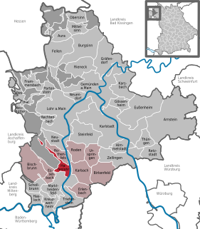
The Hafenlohr and its tributaries drain an area of around 147 square kilometres of mainly wooded hills and partially cleared valleys of the region known as Spessart. It is roughly bordered in the west by Weibersbrunn, Rothenbuch in the north, Bischbrunn and Esselbach in the south and Hafenlohr in the east. Geologically, the whole area is made of red sandstone.[5]
The Hafenlohrtal features two nature preserves. Most prominent is the "Oberes Hafenlohrtal", created in 1988.[6] It covers around 71 hectares and stretches along a roughly 4km long section of the valley from the Ahlmichdamm to Lichtenau. In this part of the valley, the Hafenlohr meanders through meadows of various degrees of wetness. These are kept clear of trees by regular mowing and by removing bushes.
The HafenlohrtalA Eurasian beaverA kingfisher
This environment offers a habitat to a large number of plant and animal species. These include the beaver, which was reintroduced to the area.[7]
Although the Spessart in general does not boast great diversity of species of trees, there are more than twenty varieties of trees in the valley.[5]
After 1945, the irrigated meadows lost their economic importance and were planted with sprucemonoculture, a tree inappropriate to the local environment, on a significant scale, especially downriver of Erlenfurt. In 2007 to 2009, around 10 hectares of spruce forest was removed by logging. The area is now kept clear of trees by goats or cattle. Among the animals used for the purpose are water buffalo. Where the terrain is too wet for grazing, wetland forests of mixed hardwood trees are being created.[10]
Today's appearance of the Hafenlohrtal is due to hundreds of years of human interaction with nature.[5] The water of the stream powered paper and saw mills, supplied glass foundries, meadows and fish ponds, helped create electricity and supplied drinking water for men and beasts.[5]
In the Hafenlohrtal the territories of two powerful ecclesial princes met: the Archbishop of Mainz and the Prince-Bishop of Würzburg. The former's sphere of influence extended via his holdings in Aschaffenburg into the area, whilst the latter had acquired the properties of the Benedictine abbey Kloster Neustadt am Main in the late 10th century.[11]
Until the end of the 19th century, firewood from the Spessart was rafted down the stream (which was dammed for the purpose in places) to Hafenlohr where it was loaded on ships.[5] From the 19th century through the mid-20th century, the meadows of the Hafenlohrtal were irrigated by a system of artificial streams, some of which remain today.[12]
Following the stream's course from origin to mouth:
Rothenbuch: The spring from which the Hafenlohr originates, is presumed to have been a meeting point for medieval hunters. Rothenbuch was first mentioned in written documents in 1318.[12] In 1342, construction of a hunting lodge for the Archbishop of Mainz began and the spring was used to fill the castle moat with water. Later trout ponds were added. Rothenbuch was the local seat of the Archbishop's forest administration, which was also in charge of supervising the glass foundries in the area and the use of wood by the local population.[12][13] The around 20 men working for the administration were also responsible for supplying game to the court at Aschaffenburg and organising hunts within the Spessart. In 1485, the Forstmeister of the Spessart moved his seat from Aschaffenburg to Rothenbuch.[13] From here the rafting of firewood down the Hafenlohr—through the territory of the rival Bishop of Würzburg—was organised.[13] Today's castle structure partially dates to 1567 and was built as a hunting lodge for the Archbishop of Mainz Daniel Brendel von Homburg.[12] It was expanded in the late 17th century.[13]
At Lichtenau the lands owned by Mainz and Würzburg met. To secure the border, in 1462 the Echter family, feudal retainers of the Archbishop of Mainz, established a stud farm at Lichtenau. However, the fief was soon integrated into the direct property of the Archbishopry and became a stud farm raising horses for the Archbishop's stables. From 1657 to 1790 it was the official Staatsgestüt for the Erzstift Mainz, property of the Archbishop.[11] However, after 1775 the closure of the stud was considered due to high costs. In 1813, it was acquired under Erbpacht by the Rexroth brothers who installed a hammer mill.[11] After the Rexroths moved to Lohr in 1850, activity here was reduced. The mill was finally closed in 1871.[11] In 1896, Julius Rexroth sold the property to the Eich brothers of next door Hoher Knuck. Initially used only for agriculture, they later opened a tavern and hotel which is still in operation.[11] In 1927, journalist and writer Kurt Tucholsky stopped here whilst on a walking tour of the region and commented very favourably on the experience in his writing.[12] Today, the border between the two administrative districts of Aschaffenburg and Main-Spessart still follows the old territorial borders and after running parallel to it for a while the Hafenlohr passes it at Erlenfurt (see below).[11]
Erlenfurt marks the boundary between two dialects: Rhine Franconian and Main-Franconian. It also borders the area known as Haderwald ("Forest of Strife"), subject of 200 years of strife between the Prince-Bishops of Mainz and Würzburg that ended in 1583.[12]
Einsiedel was founded in 1260 as a hermitage named "Ryffendal" by one Frater Radnoldus.[14] In 1264 it became a priory of the Benedictine abbey Neustadt am Main.[14] In 1483, it was transformed into a dependent farmstead and leased out. After Einsiedel became property of the family of Löwenstein-Wertheim-Rosenberg in the secularization of 1803, glass was manufactured here (1807–1889).[14] Although the foundry Karlshütte has since been torn down, dating back to the time of industrial production here (the glass foundry had up to 50 employees) is the neogothic church, constructed in 1866 by Princess Sophie Löwenstein-Wertheim-Rosenberg.[14] Since 1977, Einsiedel has been the centre of the local forestry business of the Löwenstein Estate.[12]
The Lindenfurter Hof was mentioned for the first time in 1264 and belonged to the Kloster Neustadt. Until 1790 it served as a stud farm for the Bishop of Würzburg. From 1850 to 1977 the administration of the Löwenstein forestry and game business was located here. Today it is leased out by the Löwenstein Estate.[12]
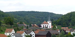
Hafenlohr was mentioned first in 1324 but its origins (and those of Windheim just to the north west) probably go back to around the year 1000.[15] It was a centre of the pottery industry. The area was property of the Kloster Neustadt since the late 8th century.[15] From the mid-12th century it belonged to the Counts of Rieneck until their male line died out in 1333 and the property reverted to the Hochstift of the Bishop of Würzburg.[15]
Economy
From 1978 to 2008, the Bavarian government considered building a dam in the valley of the Hafenlohr and use the stored water as a supply of drinking water. This would have created a 15km long lake in the valley, covering about 250 hectares, and resulted in the destruction of roughly 300 hectares of forest.[16] After decades of protests by local residents, environmentalists and other groups the plan was finally shelved in September 2008.[17]
Today, tourism plays a role in the local economy, with several establishments in the Hafenlohrtal providing gastronomical services including accommodation, such as the Schlosshotel Rothenbuch, Gasthaus im Hochspessart and Hoher Knuck. There are also active fish farms (trout) at the ponds of Erlenfurt and Lindenfurterhof. The Löwenstein Estate conducts forestry business in the area, although the Estate's administrative headquarters is in Amorbach.
Recreation
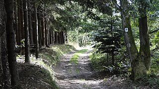
The area provides numerous signposted paths for biking and hiking.[5] The nature preserve Hafenlohrtal was originally off-limits to visitors but since 2004 has been opened up by a looping path of around 3km that includes a boardwalk leading into the valley and crossing the stream on a small wooden bridge.[7] The most prominent trail is the "European Culture Trail Hafenlohrtal", set up as part of the project "Pathways to Cultural Landscapes" supported by the European Union.[12]
Spessart is a Mittelgebirge, a range of low wooded mountains, in the States of Bavaria and Hesse in Germany. It is bordered by the Vogelsberg, Rhön and Odenwald. The highest elevation is the Geiersberg at 586 metres above sea level.
Schöllkrippen is a market community in the Aschaffenburg district in the Regierungsbezirk of Lower Franconia (Unterfranken) in Bavaria, Germany and seat of the Verwaltungsgemeinschaft of Schöllkrippen. It has a total population of around 4,300 (2020).
Klingenberg am Main is a town in the Miltenberg district in the Regierungsbezirk of Lower Franconia (Unterfranken) in Bavaria, Germany. It has a population of around 6,200 and is located on both banks of the river Main.
Lohr am Main is a town in the Main-Spessart district in the Regierungsbezirk of Lower Franconia (Unterfranken) in Bavaria, Germany and the seat of the Verwaltungsgemeinschaft of Lohr am Main. It has a population of around 15,000.
Rothenfels is a town in the Main-Spessart district in the Regierungsbezirk of Lower Franconia (Unterfranken) in Bavaria, Germany and a member of the Verwaltungsgemeinschaft of Marktheidenfeld. With a population of just around 1,000 it is said to be Bavaria’s smallest town.
Mespelbrunn is a community in the Aschaffenburg district in the Regierungsbezirk of Lower Franconia (Unterfranken) in Bavaria, Germany and a member of the Verwaltungsgemeinschaft of Mespelbrunn, whose seat is in Heimbuchenthal.
Rothenbuch is a community in the Aschaffenburg district in the Regierungsbezirk of Lower Franconia (Unterfranken) in Bavaria, Germany. It has a population of around 1,700.
Weibersbrunn is a community with a population of close to 2,000 in the Aschaffenburg district in the Regierungsbezirk of Lower Franconia (Unterfranken) in Bavaria, Germany.
Frammersbach is a market community in the Main-Spessart district in the Regierungsbezirk of Lower Franconia (Unterfranken) in Bavaria, Germany. In the early modern period, people from Frammersbach achieved international renown as drivers of wagons on the most important trans-European trade routes. Today, Frammersbach has a population of around 4,500.
Hafenlohr is a community in the Main-Spessart district in the Regierungsbezirk of Lower Franconia (Unterfranken) in Bavaria, Germany and a member of the Verwaltungsgemeinschaft of Marktheidenfeld.
Neustadt am Main is a community in the Main-Spessart district in the Regierungsbezirk of Lower Franconia (Unterfranken) in Bavaria, Germany and a member of the Verwaltungsgemeinschaft Lohr am Main.
Sulzbach am Main is a market municipality in the Miltenberg district in the Regierungsbezirk of Lower Franconia (Unterfranken) in Bavaria, Germany.
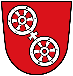
The Wheel of Mainz or Mainzer Rad, in German, was the coat of arms of the Archbishopric of Mainz and thus also of the Electorate of Mainz (Kurmainz), in Rhineland-Palatinate, Germany. It consists of a silver wheel with six spokes on a red background. The wheel can also be found in stonemasons' carvings and similar objects. Currently, the City of Mainz uses a double wheel connected by a silver cross.
Mespelbrunn Castle is a late-medieval/early-Renaissance moated castle on the territory of the town of Mespelbrunn, between Frankfurt and Würzburg, built in a tributary valley of the Elsava valley, within the Spessart forest. It is a popular tourist attraction and has become a famous Spessart landmark.
Biebergemünd is a municipality in the Main-Kinzig district, in Hesse, Germany. It has a population of over 8,000 and lies in the wooded hills of the Spessart.
Flörsbachtal is a municipality in the Main-Kinzig district, in Hesse, Germany. It has a population close to 2,400. Flösbachtal contains both the oldest parish and the youngest settlement established in the Spessart hills. Located within the municipal territory is the Hermannskoppe, the highest elevation in the Hessian part of the Spessart and the Wiesbüttmoor, a rare hanging bog.
Jossgrund is a municipality in the Main-Kinzig district, in Hesse, Germany. It has around 3,500 inhabitants distributed among several formerly independent villages, now Ortsteile. The administration seat is at Oberndorf.
The Main-Spessart Railway is a 110 kilometre-long railway line in the Bavarian province of Lower Franconia and the neighbouring state of Hesse in south central Germany. It runs from Würzburg via Gemünden (Main) and Aschaffenburg to Hanau. It is particularly important for long-distance and goods traffic because it links the Rhine-Main conurbation immediately northwest of Aschaffenburg with the Lower Franconian city of Würzburg and beyond it to the metropoles of Nuremberg and Munich. Its name derives from the fact that it initially runs parallel to the River Main and then cuts through the Spessart hills. It was opened on 22 June 1854 by the Frankfurt-Hanau Railway Company and is one of the oldest railways in Germany.
The Birkenhainer Straße is a long-distance hiking trail that follows an ancient trade route through the Mittelgebirge Spessart, in the states of Hesse and Bavaria, Germany. It is 71 km long and leads from Hanau to Gemünden am Main, cutting across the so-called Mainviereck, a large loop of the river Main. The trail follows an ancient trade route which in the Middle Ages was an important road for moving troops and for long-distance trade. The Birkenhainer Straße was a part of the link between Nuremberg and Antwerp. Its origins may lie back as far as the Neolithic period. The name likely derives from a prominent copse of birch trees that used to exist near the road at Geiselbach (Hesse).
Neustadt am Main Abbey was an abbey of the Benedictine Order in Neustadt am Main, Bavaria, Germany. It existed from the 8th century until the dissolution of abbeys in the course of secularization in 1803. During its heyday in the early Middle Ages, the abbey was a political power that vied for regional influence with the Prince-bishops of Würzburg, the Archbishops of Mainz and the Counts of Rieneck. Today its location is occupied by a monastery operated by the nuns of the "Dominican Order of Saint Catherine of Siena", also known as Kloster Neustadt. The former abbey church today serves as the Catholic parish church for Neustadt.
This page is based on this Wikipedia article Text is available under the CC BY-SA 4.0 license; additional terms may apply. Images, videos and audio are available under their respective licenses.