| Hampton Western Australia | |||||||||||||||
|---|---|---|---|---|---|---|---|---|---|---|---|---|---|---|---|
 | |||||||||||||||
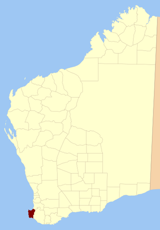
Hampton Land District is a land district (cadastral division) of Western Australia, located within the Eastern Land Division in the Goldfields region of the state.
| Hampton Western Australia | |||||||||||||||
|---|---|---|---|---|---|---|---|---|---|---|---|---|---|---|---|
| | |||||||||||||||
| |||||||||||||||
Hampton Land District is a land district (cadastral division) of Western Australia, located within the Eastern Land Division in the Goldfields region of the state.
The district is located in the central Goldfields region, and contains the following towns or former towns: [1]
† — former or ghost town.
The district was created on 4 October 1899, and was amended on 12 December 1900. It was described in the Government Gazette thus: [2]
Bounded by lines starting from the South-West corner of East Location 48, and extending North along part of its West boundary to the South-East corner of Location 51; thence West and South and West and North along the South and West boundaries of Location 51 and the East boundary of Location 53 to the latter's North-East corner; thence 324° 46' 36 miles 14 chains 81 links, and North 30 miles 47 chains 46 links along surveyed lines to survey mark R 3, thence East to a point situate North from the North-East corner of Location 32; thence South, through the North-East and South-East corners of said Location 32, to a point situate East from the starting point, and thence West to the starting point, partly along the South boundary of aforesaid Location 48.
Metes and bounds is a system or method of describing land, real property or real estate. The system has been used in England for many centuries and is still used there in the definition of general boundaries. The system is also used in the Canadian province of Ontario, and throughout Canada for the description of electoral districts. By custom, it was applied in the original Thirteen Colonies that became the United States and in many other land jurisdictions based on English common law, including Zimbabwe, South Africa, India and Bangladesh. While still in hand-me-down use, this system has been largely overtaken in the past few centuries by newer systems such as rectangular and lot and block.

Central Land Division was a land division of Western Australia defined under section 26 of the Land Act Amendment Act 1906, and existed from 1 February 1907 until 28 March 1917, when it became part of the Eastern Land Division under section 4 of the Land Act Amendment Act 1917. It was bounded by the Rabbit-proof fence in the west, and included Kalgoorlie. It comprised parts of the eastern Wheatbelt and the Goldfields-Esperance region.
Sussex Land District is a land district of Western Australia, located within the South-West Land Division on the state's west coast. It covers the south-western corner of the state and includes the townsites of Busselton, Margaret River and Augusta as well as Cape Naturaliste and Cape Leeuwin.

Weld Land District is one of the land districts of Western Australia, which is located within the Eastern Land Division in the north-eastern Goldfields region of the state.

Buningonia Land District is a land district of Western Australia, located within the Eastern Land Division on the Nullarbor Plain. It spans roughly 30°10'S - 32°00'S in latitude and 122°15'E - 124°00'E in longitude.
Malcolm Land District is a land district of Western Australia, located within the Eastern Land Division in the northern Goldfields region of the state.
Roe Land District is a land district of Western Australia, located within the South-West Land Division in the eastern Wheatbelt region of the state.
Nurina Land District is a land district of Western Australia, located within the Eucla Land Division on the Nullarbor Plain. It spans roughly 31°00'S - 32°20'S in latitude and 125°30'E - 127°30'E in longitude.
Esperance Land District is a land district of Western Australia, located within the Eucla Land Division on the state's south coast. It spans roughly 33°15'S - 34°00'S in latitude and 121°00'E - 122°20'E in longitude.
Nuyts Land District is a land district of Western Australia, located within the Eastern and Eucla land divisions on the Nullarbor Plain. It spans roughly 31°00'S - 32°50'S in latitude and 124°00'E - 125°30'E in longitude.
Oldfield Land District is a land district of Western Australia partly within the Eucla and South-West divisions on the state's south coast. It spans roughly 33°15'S - 34°00'S in latitude and 119°45'E - 121°10'E in longitude.
Wells Land District is a land district of Western Australia, located within the Eastern Land Division of the state. It spans roughly 24°00'S - 26°20'S in latitude and 121°40'E - 123°20'E in longitude. Its name honours Lawrence Allen Wells, an explorer of the area in 1896–1897.
Giles Land District is a land district of Western Australia, located within the Eastern and Eucla land divisions on the Nullarbor Plain. It spans roughly 29°00'S - 31°00'S in latitude and 123°30'E - 126°30'E in longitude.
Hann Land District is a land district of Western Australia, located within the Eastern Land Division of the state. It spans roughly 24°00'S - 25°40'S in latitude and 120°00'E - 121°40'E in longitude, east of the rabbit-proof fence. Part of the Canning Stock Route passes through the south-east of the district. It is named in honour of explorer Frank Hann.
Tugaila Land District is a land district of Western Australia, located within the Eastern Land Division in the Gibson Desert. It spans roughly 24°00'S - 26°50'S in latitude and 123°20'E - 125°50'E in longitude.
Milyuga Land District is a land district of Western Australia, located within the Eastern Land Division in the Gibson Desert. It spans roughly 24°00'S - 26°50'S in latitude and 125°50'E - 129°00'E in longitude, and includes the town of Warburton and the Giles Weather Station.
Yowalga Land District is a land district of Western Australia, located within the Eastern Land Division in the Great Victoria Desert, north of the Nullarbor Plain. It spans roughly 26°50'S - 29°00'S in latitude and 125°00'E - 129°00'E in longitude.
Yamarna Land District is a land district of Western Australia, located within the Eastern Land Division in the Great Victoria Desert, north of the Nullarbor Plain. It spans roughly 26°50'S - 29°00'S in latitude and 123°30'E - 125°00'E in longitude.
Balwina Land District is a land district of Western Australia, located within the Eastern Land Division in the Great Sandy Desert. It spans roughly 19°30'S - 21°00'S in latitude and 126°25'E - 129°00'E in longitude.
The District Council of Kondoparinga was a local government area in South Australia from 1853 until 1935, at which point the council lands and resources formed the heart of the new District Council of Meadows.
30°50′S121°40′E / 30.833°S 121.667°E
| | This article about a location in Western Australia is a stub. You can help Wikipedia by expanding it. |