The City of Stirling is a local government area in the northern suburbs of the Western Australian capital city of Perth about 10 kilometres (6 mi) north of Perth's central business district. The City covers an area of 105.2 square kilometres (40.6 sq mi) and had a population of over 210,000 as at the 2016 Census, making it the largest local government area by population in Western Australia.

The City of Belmont is a local government area in the inner eastern suburbs of the Western Australian capital city of Perth, located about 8 kilometres (5 mi) east of Perth's central business district on the south bank of the Swan River. The City covers an area of 39.8 square kilometres (15.4 sq mi), maintains 225 km of roads and had a population of almost 40,000 as at the 2016 Census. The City of Belmont is a member of the Eastern Metropolitan Regional Council

The City of Cockburn is a local government area in the southern suburbs of the Western Australian capital city of Perth about 8 kilometres (5 mi) south of Fremantle and about 24 kilometres (15 mi) south of Perth's central business district. The City covers an area of 167.5 square kilometres (64.7 sq mi) and had a population of over 104,000 as at the 2016 Census.

The Shire of Jondaryan was a local government area located in the Darling Downs region of Queensland, Australia, immediately west of the regional city of Toowoomba. The shire, administered from the town of Oakey, covered an area of 1,910.0 square kilometres (737.5 sq mi), and existed as a local government entity from 1890 until 2008, when it amalgamated with several other councils in the Toowoomba area to form the Toowoomba Region. Its growth in later years has been fuelled by the expansion of Toowoomba and suburbs such as Glenvale and Westbrook.

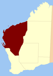
The Shire of Kent is a local government area in the Great Southern region of Western Australia, about 320 kilometres (200 mi) southeast of Perth, the state capital. The Shire covers an area of 5,634 square kilometres (2,175 sq mi) and its seat of government is the town of Nyabing. The area produces grains such as wheat, barley and legumes.

The Town of Port Hedland is a local government area in the Pilbara region of Western Australia for the twin towns of Port Hedland and South Hedland. It had a population of approximately 14,500 as at the 2016 Census of which only a few hundred live outside the settlement boundaries. The council maintains 171 km of sealed and 380 km of unsealed roads.

The Shire of Corrigin is a local government area in the Wheatbelt region of Western Australia, about 230 kilometres (143 mi) east of the state capital, Perth. Its seat of government is the town of Corrigin. The shire covers an area of 3,095 square kilometres (1,195 sq mi) and the economy, worth approximately $50 million per year to the state economy, is based on agriculture - predominantly cereal grains and sheep, with some supporting industries including a flour mill.

The Town of Bassendean is a local government area in the northeastern suburbs of the Western Australian capital city of Perth, 6 kilometres (4 mi) west of the industrial centre of Midland and about 12 kilometres (7 mi) northeast of Perth's central business district. The Town covers an area of 10.4 square kilometres (4.0 sq mi), maintains 97 km of roads and had a population of approximately 15,000 as at the 2016 Census. The Town of Bassendean is a member of the Eastern Metropolitan Regional Council.

The Shire of Mukinbudin is a local government area in the Wheatbelt region of Western Australia, about 80 kilometres (50 mi) north of Merredin and about 300 kilometres (186 mi) east of the state capital, Perth. The Shire covers an area of 3,437 square kilometres (1,327 sq mi), and its seat of government is the town of Mukinbudin.

The Shire of Dandaragan is a local government area located in the Wheatbelt region of Western Australia, about 200 kilometres (124 mi) north of the state capital, Perth. The Shire covers an area of 6,716 square kilometres (2,593 sq mi) and its seat of government is the town of Jurien Bay.

The Shire of Dalwallinu is a local government area in the Wheatbelt region of Western Australia, about 250 kilometres (155 mi) NNE of Perth, the state capital. The Shire covers an area of 7,236 square kilometres (2,794 sq mi) and its seat of government is the town of Dalwallinu.
The Shire of Broomehill-Tambellup is a local government area in the Great Southern region of Western Australia, 320 kilometres (200 mi) south-southeast of the state capital, Perth. The Shire covers an area of 2,609.1 square kilometres (1,007.4 sq mi), and its seat of government is the town of Tambellup. It came into existence in 2008 through the amalgamation of the former Shire of Broomehill and Shire of Tambellup.

Esperance Land District is a land district of Western Australia, located within the Eucla Land Division on the state's south coast. It spans roughly 33°15'S - 34°00'S in latitude and 121°00'E - 122°20'E in longitude.
Koondra Land District is a land district of Western Australia and a subdivision of the North-West Land Division, located in the Pilbara region of the state.
Balwina Land District is a land district of Western Australia, located within the Eastern Land Division in the Great Sandy Desert. It spans roughly 19°30'S - 21°00'S in latitude and 126°25'E - 129°00'E in longitude.