The geography of France consists of a terrain that is mostly flat plains or gently rolling hills in the north and west and mountainous in the south and the east.

Móng Cái is a city of Quảng Ninh Province in northern Vietnam. Located on China–Vietnam border, it sits on the southern bank of Beilun River across Dongxing city of China's Guangxi Autonomous Region. It has a population of about 103,000. It is known as one of the wealthiest cities in Vietnam with the average income in some areas exceeding US$20,000 per family. One of these areas is the Trần Phú ward.
Camden Park is a suburb of the city of Adelaide, South Australia.

Nagycserkesz is a village in Szabolcs-Szatmár-Bereg county, in the Northern Great Plain region of eastern Hungary.

Zasavica II, also known as Donja Zasavica, is a village in the Sremska Mitrovica municipality, in the Vojvodina province of Serbia. The village has a Serb ethnic majority and its population numbering 608 people. Although part of the Srem District, Zasavica II is situated in the region of Mačva south of the Sava river. With the adjacent village of Zasavica I, it still forms a single cadastral unit, although they are treated as separate villages for census purposes.
Dandli is a town in Kotli District, Azad Kashmir. It is located 13 kilometres from Kotli. There are many mineral resources in the town Koila, Gandhaik. A big hill Arri Gala is located near Dandli. The Dandli area contains the small villages of Gawan, Plung, Gojra Town, Nailan, Gunni.

Wonhyoro-dong is a dong, neighbourhood of Yongsan-gu in Seoul, South Korea.

Miastowice is a village in the administrative district of Gmina Kcynia, within Nakło County, Kuyavian-Pomeranian Voivodeship, in north-central Poland. It lies approximately 5 kilometres (3 mi) south-east of Kcynia, 20 km (12 mi) south of Nakło nad Notecią, and 36 km (22 mi) south-west of Bydgoszcz.

Wichrowice is a village in the administrative district of Gmina Choceń, within Włocławek County, Kuyavian-Pomeranian Voivodeship, in north-central Poland. It lies approximately 15 kilometres (9 mi) south-west of Włocławek and 61 km (38 mi) south-east of Toruń.

Chojane-Pawłowięta is a village in the administrative district of Gmina Kulesze Kościelne, within Wysokie Mazowieckie County, Podlaskie Voivodeship, in north-eastern Poland. It lies approximately 6 kilometres (4 mi) north of Wysokie Mazowieckie and 46 km (29 mi) west of the regional capital Białystok.

Cisk is a village in the administrative district of Gmina Goworowo, within Ostrołęka County, Masovian Voivodeship, in east-central Poland. It lies approximately 8 kilometres (5 mi) north of Goworowo, 12 km (7 mi) south of Ostrołęka, and 91 km (57 mi) north-east of Warsaw.

Wydorowo is a village in the administrative district of Gmina Śmigiel, within Kościan County, Greater Poland Voivodeship, in west-central Poland. It lies approximately 5 kilometres (3 mi) south of Śmigiel, 16 km (10 mi) south-west of Kościan, and 55 km (34 mi) south-west of the regional capital Poznań.

Kaczki Średnie is a village in the administrative district of Gmina Turek, within Turek County, Greater Poland Voivodeship, in west-central Poland. It lies approximately 6 kilometres (4 mi) south of Turek and 121 km (75 mi) south-east of the regional capital Poznań.

Muszkowo is a village in the administrative district of Gmina Krzeszyce, within Sulęcin County, Lubusz Voivodeship, in western Poland. It lies approximately 14 kilometres (9 mi) north-west of Sulęcin and 30 km (19 mi) south-west of Gorzów Wielkopolski.

Chorula is a village in the administrative district of Gmina Gogolin, within Krapkowice County, Opole Voivodeship, in south-western Poland. It lies approximately 7 kilometres (4 mi) north-west of Gogolin, 8 km (5 mi) north of Krapkowice, and 15 km (9 mi) south of the regional capital Opole.

Siódmak is a village in the administrative district of Gmina Szczytno, within Szczytno County, Warmian-Masurian Voivodeship, in northern Poland. It lies approximately 4 kilometres (2 mi) south of Szczytno and 42 km (26 mi) south-east of the regional capital Olsztyn.

Grodno is a coastal place on the island of Wolin, in the administrative district of Gmina Międzyzdroje, within Kamień County, West Pomeranian Voivodeship, in north-western Poland. It lies approximately 7 kilometres (4 mi) north-east of Międzyzdroje, 17 km (11 mi) west of Kamień Pomorski, and 62 km (39 mi) north of the regional capital Szczecin.
Gutenberg Glacier is a glacier 8 nautical miles (15 km) long in the northern Holyoake Range of the Churchill Mountains of Antarctica. It flows northwest between Mount Hubble and Mount Richter to enter Starshot Glacier. The glacier was named by the Advisory Committee on Antarctic Names after German-born seismologist Beno Gutenberg, director of the California Institute of Technology seismology laboratory in the 1930s, and collaborator with Charles F. Richter in developing the Richter Scale, 1935, used to measure the magnitude of earthquakes.
Skavlrimen Ridge is a largely snow-covered ridge, about 3 nautical miles (6 km) long and surmounted in the north part by Vyatskaya Peak, located 1.5 nautical miles (2.8 km) east of Dekefjellet Mountain in the Weyprecht Mountains, Queen Maud Land. Discovered and plotted from air photos by German Antarctic Expedition, 1938-39. Replotted from air photos and surveys by Norwegian Antarctic Expedition, 1956–60, and named Skavlrimen.

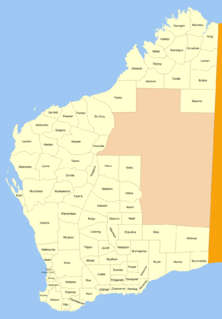
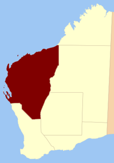
Yurabi Land District is one of the land districts of Western Australia, located within the Kimberley Division of the state. The name of the district is sometimes spelt Yooraby.


