
Arafura is an electoral division of the Legislative Assembly in Australia's Northern Territory. It was first created in 1983, and takes its name from the Arafura Sea, which adjoins the electorate. The electorate is predominantly rural, encompassing 156,087 square kilometres in western Arnhem Land and the Tiwi Islands, and including the towns of Oenpelli, Jabiru, Maningrida, Milikapiti and Nguiu. There were 5,477 people enrolled in the electorate as of August 2012.

Manitoba's Interlake is the name given to a region in the Canadian province of Manitoba. As the name indicates, it lies roughly between Lake Winnipeg and Lake Manitoba and comprises 14 rural municipalities, one city, six towns and one village, Dunnottar. The largest population centre in the region is Selkirk. The second largest is the town of Stonewall. The region is divided into three of Statistics Canada's census divisions of Canada: Manitoba Census Divisions No. 13, No. 14, and No. 18, which together had a population of 91,743 at the 2016 census. The total land area of the region is 15,855.37 km².

Mićunovo is a village in Serbia. It is situated in the Bačka Topola municipality, in the North Bačka District, Vojvodina province. The village has a Serb ethnic majority and its population numbering 516 people.

Austreskorve Glacier is a broad glacier in the Mühlig-Hofmann Mountains which drains north from a position just east of the head of Vestreskorve Glacier and passes along the east side of Breplogen Mountain. It was mapped and named from surveys and from air photos by the Sixth Norwegian Antarctic Expedition (1956–60).

Adams Glacier, also known as John Quincy Adams Glacier, is a broad channel glacier in Wilkes Land, Antarctica which is over 20 miles (32 km) long. It debouches into the head of Vincennes Bay, just east of Hatch Islands. It was first mapped in 1955 by G.D. Blodgett from aerial photographs taken by U.S. Navy Operation Highjump (1947), and it was named by the Advisory Committee on Antarctic Names (US-ACAN) for John Quincy Adams, sixth President of the United States. Adams was instrumental while later serving as U.S. representative from Massachusetts in gaining congressional authorization of the United States Exploring Expedition (1838–42) under Lieutenant Charles Wilkes, and perpetuating the compilation and publication of the large number of scientific reports based on the work of this expedition.

Zaspy is a village in the administrative district of Gmina Warta, within Sieradz County, Łódź Voivodeship, in central Poland. It lies approximately 15 kilometres (9 mi) north of Warta, 27 km (17 mi) north of Sieradz, and 56 km (35 mi) west of the regional capital Łódź.
Więcków is a village in the administrative district of Gmina Trojanów, within Garwolin County, Masovian Voivodeship, in east-central Poland. It lies approximately 30 kilometres (19 mi) south-east of Garwolin and 84 km (52 mi) south-east of Warsaw.
Kowanówko is a village in the administrative district of Gmina Oborniki, within Oborniki County, Greater Poland Voivodeship, in west-central Poland. It lies approximately 3 kilometres (2 mi) north-east of Oborniki and 31 km (19 mi) north of the regional capital Poznań.
Surbajny is a village in the administrative district of Gmina Zalewo, within Iława County, Warmian-Masurian Voivodeship, in northern Poland. It lies approximately 4 kilometres (2 mi) east of Zalewo, 28 km (17 mi) north of Iława, and 56 km (35 mi) west of the regional capital Olsztyn.
Stare Wierzchowo is a village in the administrative district of Gmina Szczecinek, within Szczecinek County, West Pomeranian Voivodeship, in north-western Poland. It lies approximately 13 kilometres (8 mi) north of Szczecinek and 146 km (91 mi) east of the regional capital Szczecin.
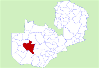
Kaoma District with headquarters at Kaoma, Zambia is located in the north-east corner of Western Province. As of the 2000 Zambian Census, the district had a population of 162,568 people. The population lives mainly around Kaoma town and the northern parts of the district along the Luena and Luampa Rivers. Its south-western portion is relatively uninhabited being very sandy with little water available in the dry season.

Numalgun Land District is a land district of Western Australia, located within the Kimberley Land Division in the Kimberley region of the state.
King Land District is a land district of Western Australia, located within the Kimberley Division of the state.
Kaluwiri Land District is a land district of Western Australia, located within the Eastern Land Division.
Jaurdi Land District is a land district of Western Australia, located within the Eastern Land Division.
Hampton Land District is a land district of Western Australia, located within the Eastern Land Division in the Goldfields region of the state.
Meda Land District is one of the land districts of Western Australia, located within the Kimberley Division of the state.
Oldfield Land District is a land district of Western Australia partly within the Eucla and South-West divisions on the state's south coast. It spans roughly 33°15'S - 34°00'S in latitude and 119°45'E - 121°10'E in longitude.
Doongan Land District is a land district of Western Australia, located within the Kimberley Land Division in the Kimberley region of the state.
Hann Land District is a land district of Western Australia, located within the Eastern Land Division of the state. It spans roughly 24°00'S - 25°40'S in latitude and 120°00'E - 121°40'E in longitude, east of the rabbit-proof fence. Part of the Canning Stock Route passes through the south-east of the district. It is named in honour of explorer Frank Hann.


