Wanman Land District

Last updated

Wanman
Western Australia
Western Australia land districts.png
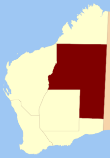
Location in Western Australia

Wanman Land District is a land district (cadastral division) of Western Australia, located within the Eastern Land Division. Little is known of this district, which was created after 1950 and was in use by 1988. The district is believed to be located in the Shire of East Pilbara and the Shire of Ngaanyatjarraku.

The lands administrative divisions of Western Australia refer to subdivisions of the state of Western Australia for cadastral purposes, most of which have been in place since the 19th century. The state is divided up for this purpose into five land divisions, which in turn are subdivided into land districts, which correspond to counties in other Australian states. These districts are then subdivided further into numbered locations, as well as gazetted townsites. Together, they form part of the lands administrative divisions of Australia.

Western Australia State in Australia

Western Australia is a state occupying the entire western third of Australia. It is bounded by the Indian Ocean to the north and west, and the Southern Ocean to the south, the Northern Territory to the north-east, and South Australia to the south-east. Western Australia is Australia's largest state, with a total land area of 2,529,875 square kilometres, and the second-largest country subdivision in the world, surpassed only by Russia's Sakha Republic. The state has about 2.6 million inhabitants – around 11 percent of the national total – of whom the vast majority live in the south-west corner, 79 per cent of the population living in the Perth area, leaving the remainder of the state sparsely populated.

Eastern Land Division

Eastern Division is one of five land divisions of Western Australia, part of the cadastral divisions of Western Australia. Most of the land is desert, part of the Great Sandy Desert, Gibson Desert and Great Victoria Desert. It is located in the eastern parts of the Goldfields-Esperance region and the Pilbara region.

Related Research Articles

City of Cockburn Local government area in Western Australia

The City of Cockburn is a local government area in the southern suburbs of the Western Australian capital city of Perth about 8 kilometres (5 mi) south of Fremantle and about 24 kilometres (15 mi) south of Perth's central business district. The City covers an area of 167.5 square kilometres (64.7 sq mi) and had a population of over 104,000 as at the 2016 Census.

Aligarh district District of Uttar Pradesh in India

Aligarh district is a district in the state of Uttar Pradesh, India. This district is a part of Aligarh Division.

Numalgun Land District Cadastral in Western Australia

Numalgun Land District is a land district of Western Australia, located within the Kimberley Land Division in the Kimberley region of the state.

King Land District Cadastral in Western Australia

King Land District is a land district of Western Australia, located within the Kimberley Division of the state.

Yilgarn Land District Cadastral in Western Australia

Yilgarn Land District is a land district of Western Australia, located within the Eastern Land Division.

Malcolm Land District Cadastral in Western Australia

Malcolm Land District is a land district of Western Australia, located within the Eastern Land Division in the northern Goldfields region of the state.

Kaluwiri Land District Cadastral in Western Australia

Kaluwiri Land District is a land district of Western Australia, located within the Eastern Land Division.

Jaurdi Land District Cadastral in Western Australia

Jaurdi Land District is a land district of Western Australia, located within the Eastern Land Division.

Canning Land District Cadastral in Western Australia

Canning Land District is a land district of Western Australia, located within the South West Division in the eastern and south-eastern suburbs of metropolitan Perth.

Cockburn Sound Land District Cadastral in Western Australia

Cockburn Sound Land District is a land district of Western Australia, located within the South West Division.

Kent Land District, Western Australia Cadastral in Western Australia

Kent Land District is a land district of Western Australia, located within the South West Division.

Plantagenet Land District Cadastral in Western Australia

Plantagenet Land District is a land district of Western Australia, located within the South West Division.

Williams Land District Cadastral in Western Australia

Williams Land District is a land district of Western Australia, located within the South West Division.

Nookawarra Land District Cadastral in Western Australia

Nookawarra Land District is a land district of Western Australia, located within the North-West Land Division.

Kyarra Land District Cadastral in Western Australia

Kyarra Land District is a land district of Western Australia, located within the North-West Land Division.

Gascoyne Land District Cadastral in Western Australia

Gascoyne Land District is a land district of Western Australia, located within the North-West Land Division.

Meda Land District Cadastral in Western Australia

Meda Land District is one of the land districts of Western Australia, located within the Kimberley Division of the state.

Dundas Land District Cadastral in Western Australia

Dundas Land District is a land district of Western Australia within the Eucla Land Division. It spans roughly 31°40'S - 32°40'S in latitude and 121°00'E - 122°15'E in longitude.

Koondra Land District Cadastral in Western Australia

Koondra Land District is a land district of Western Australia and a subdivision of the North-West Land Division, located in the Pilbara region of the state.

Hann Land District Cadastral in Western Australia

Hann Land District is a land district of Western Australia, located within the Eastern Land Division of the state. It spans roughly 24°00'S - 25°40'S in latitude and 120°00'E - 121°40'E in longitude, east of the rabbit-proof fence. Part of the Canning Stock Route passes through the south-east of the district. It is named in honour of explorer Frank Hann.

References

    Coordinates: 22°10′S123°50′E / 22.167°S 123.833°E / -22.167; 123.833

    Geographic coordinate system Coordinate system

    A geographic coordinate system is a coordinate system that enables every location on Earth to be specified by a set of numbers, letters or symbols. The coordinates are often chosen such that one of the numbers represents a vertical position and two or three of the numbers represent a horizontal position; alternatively, a geographic position may be expressed in a combined three-dimensional Cartesian vector. A common choice of coordinates is latitude, longitude and elevation. To specify a location on a plane requires a map projection.