Nelson Western Australia | |||||||||||||||
---|---|---|---|---|---|---|---|---|---|---|---|---|---|---|---|
Location in Western Australia | |||||||||||||||
|
Nelson Land District is a land district (cadastral division) of Western Australia, located within the South West Division on the state's south coast. It covers part of the state's Lower South West region and includes the townsites of Bridgetown, Manjimup, Pemberton, Northcliffe and Nannup as well as Point D'Entrecasteaux and, at its far southeastern corner, Walpole (the Frankland River is its boundary at this point). [1]
The lands administrative divisions of Western Australia refer to subdivisions of the state of Western Australia for cadastral purposes, most of which have been in place since the 19th century. The state is divided up for this purpose into five land divisions, which in turn are subdivided into land districts, which correspond to counties in other Australian states. These districts are then subdivided further into numbered locations, as well as gazetted townsites. Together, they form part of the lands administrative divisions of Australia.
Western Australia is a state occupying the entire western third of Australia. It is bounded by the Indian Ocean to the north and west, and the Southern Ocean to the south, the Northern Territory to the north-east, and South Australia to the south-east. Western Australia is Australia's largest state, with a total land area of 2,529,875 square kilometres, and the second-largest country subdivision in the world, surpassed only by Russia's Sakha Republic. The state has about 2.6 million inhabitants – around 11 percent of the national total – of whom the vast majority live in the south-west corner, 79 per cent of the population living in the Perth area, leaving the remainder of the state sparsely populated.
The South West region is one of the nine regions of Western Australia. It is so named because it is located in the south-west corner of Western Australia. The South West region has an area of 23,970 km², and a population of about 170,000 people, which is predicted to rise to 217,000 people by 2023.
The system of land districts came together in an ad hoc fashion, and the Nelson district started to be subdivided in 1858 well before any thought was given to formally defining its boundaries. [2]
The Nelson district contains the following current or former townsites: [3]
Under the Land Act 1898, the Agricultural Lands Purchase Act 1896, and preceding regulations, it was open to the Governor to declare agricultural areas on crown land or repurchased estates on private land, to which special provisions applied for both alienation and improvement. Many of these estates came into being shortly after World War I for the purposes of soldier resettlement.
In property law, alienation is the voluntary act of an owner of some property disposing of the property, while alienable is the capacity for a piece of property or a property right to be sold or otherwise transferred from one party to another. Most property is alienable, but some may be subject to restraints on alienation. In England under the feudal system, land was generally transferred by subinfeudation and alienation required licence from the overlord. Some objects are incapable of being regarded as property and are inalienable, such as people and body parts. Aboriginal title is one example of inalienability in common law jurisdictions. A similar concept is non-transferability, such as tickets. Rights commonly described as a licence or permit are generally only personal and are not assignable. However, they are alienable in the sense that they can generally be surrendered.
World War I, also known as the First World War or the Great War, was a global war originating in Europe that lasted from 28 July 1914 to 11 November 1918. Contemporaneously described as "the war to end all wars", it led to the mobilisation of more than 70 million military personnel, including 60 million Europeans, making it one of the largest wars in history. It is also one of the deadliest conflicts in history, with an estimated nine million combatants and seven million civilian deaths as a direct result of the war, while resulting genocides and the resulting 1918 influenza pandemic caused another 50 to 100 million deaths worldwide.
Soldier settlement refers to the settlement of land throughout parts of Australia by returning discharged soldiers under schemes administered by the state governments after World Wars I and II.
Name | Coordinates | Gazetted | Notes |
---|---|---|---|
Brooklands Estate | 33°47′46″S115°56′49″E / 33.796°S 115.947°E | 1919 | West of Balingup |
Cammilleri Estate | 33°48′58″S115°47′02″E / 33.816°S 115.784°E | 1920 | |
Cascades Estate | 33°52′55″S116°07′05″E / 33.882°S 116.118°E | 1919 | |
Cundinup Estate | 33°49′26″S115°48′07″E / 33.824°S 115.802°E | 1922 | |
Glenlea Estate | 34°00′04″S116°12′40″E / 34.001°S 116.211°E | 1919 | near Glenlynn |
Glenmore Estate | 33°48′54″S115°58′05″E / 33.815°S 115.968°E | 1919 | near Balingup |
Norlup Park Estate | 1920 | near Greenbushes | |
Perup AA | 34°15′40″S116°21′40″E / 34.261°S 116.361°E | 1898 | cancelled in 1904 |
Ravenscliffe Estate | 1919 | near Kirup | |
Tanjanerup AA | 33°58′55″S115°47′06″E / 33.982°S 115.785°E | 1897 | |
Tweed AA | 33°58′41″S116°24′22″E / 33.978°S 116.406°E | 1892 | |
Wilgarrup AA | 34°08′46″S116°14′46″E / 34.146°S 116.246°E | 1898 |
Western Australia is divided into regions according to a number of systems.
Perenjori is a townsite in the northern agricultural region, 348 kilometres (216 mi) north of Perth and 39 kilometres (24 mi) south-east of Morawa. It is located on the Wongan Hills to Mullewa railway line which was opened in 1915. Perenjori was approved as the name of a siding in April 1913, and later that year the government decided to establish a townsite there. Perenjori townsite was gazetted in 1916.
Serpentine is a town located 55 kilometres (34 mi) south-southeast of Perth, the capital of Western Australia, and 7 km south of Mundijong.
Beverley is a town in the Wheatbelt region of Western Australia, 133 kilometres (83 mi) south-east of the state capital, Perth, between York and Brookton on the Great Southern Highway. It is on the Great Southern railway line.
Boddington is a town and shire in the Peel region of Western Australia, located 120 kilometres (75 mi) south-east of Perth. The town sits on the road from Pinjarra to Williams on the Hotham River.
The Shire of West Arthur is a local government area in the Wheatbelt region of Western Australia, generally to the west of Albany Highway about 200 kilometres (124 mi) south-east of Perth, the state capital. The Shire covers an area of 2,834 square kilometres (1,094 sq mi) and its seat of government is the town of Darkan. Industries within the Shire, worth approximately $45 million per year to the State's economy, are dominated by wool and sheep, and also include timber, grain, forestry, beef, pigs, cattle hide tanning, engineering and earthmoving.
The Shire of Beverley is a local government area in the Wheatbelt region of Western Australia about 130 kilometres (80 mi) southeast of Perth, the state capital. The Shire covers an area of 2,372 square kilometres (916 sq mi), starting 20 kilometres (12 mi) outside Armadale in the Darling Scarp and extending eastwards beyond the scarp into agricultural lands which support broad acre activities such as livestock and cropping. Its seat of government is the town of Beverley, which accommodates just over half of the Shire's population.
The Shire of Manjimup is a local government area in the South West region of Western Australia, about 320 kilometres (200 mi) south of the state capital, Perth. The Shire covers an area of 7,027 square kilometres (2,713 sq mi), and its seat of government is the town of Manjimup.
The Shire of Dalwallinu is a local government area in the Wheatbelt region of Western Australia, about 250 kilometres (155 mi) NNE of Perth, the state capital. The Shire covers an area of 7,236 square kilometres (2,794 sq mi) and its seat of government is the town of Dalwallinu.
Sussex Land District is a land district of Western Australia, located within the South-West Land Division on the state's west coast. It covers the south-western corner of the state and includes the townsites of Busselton, Margaret River and Augusta as well as Cape Naturaliste and Cape Leeuwin.
Wellington Land District is a land district of Western Australia, located within the South-West Land Division on the state's west coast. It spans roughly 32°56'S - 33°40'S in latitude and 115°25'E - 116°50'E in longitude.
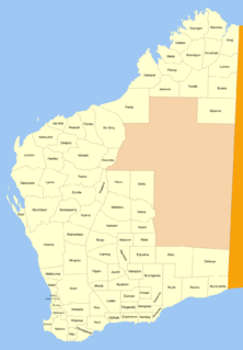
Murray Land District is a land district of Western Australia, located within the South-West Land Division on the state's west coast. It spans roughly 32°25'S - 32°56'S in latitude and 115°25'E - 116°30'E in longitude, and is located on the Indian Ocean coast, taking in the Shires of Murray and Waroona, the eastern part of the Serpentine-Jarrahdale and the western suburbs of Mandurah.
Neridup Land District is a land district of Western Australia, located within the Eucla Land Division on the state's south coast. It spans roughly 33°15'S - 34°00'S in latitude and 122°20'E - 123°30'E in longitude.
Fitzgerald Land District is a land district of Western Australia, located within the Eucla Land Division inland from Esperance. It spans roughly 32°35'S - 33°15'S in latitude and 121°00'E - 122°15'E in longitude.
Esperance Land District is a land district of Western Australia, located within the Eucla Land Division on the state's south coast. It spans roughly 33°15'S - 34°00'S in latitude and 121°00'E - 122°20'E in longitude.
Dundas Land District is a land district of Western Australia within the Eucla Land Division. It spans roughly 31°40'S - 32°40'S in latitude and 121°00'E - 122°15'E in longitude.
Oldfield Land District is a land district of Western Australia partly within the Eucla and South-West divisions on the state's south coast. It spans roughly 33°15'S - 34°00'S in latitude and 119°45'E - 121°10'E in longitude.
Coondle is a small acre farming estate in the Shire of Toodyay in Western Australia. It started as an estate developed under the provisions of the Agricultural Lands Purchase Act (1896) near what was then known as Newcastle.
West Toodyay was the original location of the town of Toodyay, Western Australia. It is situated in the Toodyay valley, 85 kilometres (53 mi) north east of Perth. The Toodyay valley, discovered by Ensign Robert Dale in 1831, was opened up for settlement in 1836. The original site for the town of Toodyay was determined in 1836 and its boundaries were finalized 1838. The first survey of the town was carried out in 1849. After several serious floods, the decision was made to move the town of Toodyay to higher ground. In 1860, the new town of Newcastle was established 3 miles (4.8 km) further upstream. Newcastle was renamed in 1910 to Toodyay, and the original site became known as West Toodyay.
Coordinates: 34°09′56″S116°10′06″E / 34.16556°S 116.16833°E
A geographic coordinate system is a coordinate system that enables every location on Earth to be specified by a set of numbers, letters or symbols. The coordinates are often chosen such that one of the numbers represents a vertical position and two or three of the numbers represent a horizontal position; alternatively, a geographic position may be expressed in a combined three-dimensional Cartesian vector. A common choice of coordinates is latitude, longitude and elevation. To specify a location on a plane requires a map projection.
This article about a location in Western Australia is a stub. You can help Wikipedia by expanding it. |