Harmon, Illinois

Last updated

Harmon
Harmon post office 61042.jpg
Village post office
Lee County Illinois Incorporated and Unincorporated areas Harmon Highlighted.svg
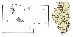
Location of Harmon in Lee County, Illinois.
Illinois in United States (US48).svg
Location of Illinois in the United States
Coordinates: 41°43′14″N89°33′19″W / 41.72056°N 89.55528°W / 41.72056; -89.55528
CountryUnited States
StateIllinois
County Lee
Area
[1]
  Total0.26 sq mi (0.69 km2)
  Land0.26 sq mi (0.69 km2)
  Water0.00 sq mi (0.00 km2)
Population
 (2020)
  Total111
  Density420.45/sq mi (162.04/km2)
Time zone UTC-6 (CST)
  Summer (DST) UTC-5 (CDT)
ZIP Code(s)
61042
Area codes 815 & 779
FIPS code 17-32967
Wikimedia CommonsHarmon, Illinois

Harmon is a village in Lee County, Illinois, United States. The population was 120 at the 2010 census, down from 149 in 2000.

Contents

Geography

Harmon is located at 41°43′14″N89°33′19″W / 41.72056°N 89.55528°W / 41.72056; -89.55528 (41.720660, -89.555298). [2]

According to the 2010 census, Harmon has a total area of 0.15 square miles (0.39 km2), all land. [3]

Demographics

Historical population
CensusPop.Note
1880 238
1890 132−44.5%
1910 162
1920 20224.7%
1930 2093.5%
1940 201−3.8%
1950 2083.5%
1960 2142.9%
1970 205−4.2%
1980 193−5.9%
1990 186−3.6%
2000 149−19.9%
2010 120−19.5%
2020 111−7.5%
U.S. Decennial Census [4]

As of the census [5] of 2000, there were 149 people, 58 households, and 44 families residing in the village. The population density was 1,049.7 inhabitants per square mile (405.3/km2). There were 62 housing units at an average density of 436.8 per square mile (168.6/km2). The racial makeup of the village was 99.33% White, and 0.67% from two or more races. Hispanic or Latino of any race were 4.03% of the population.

There were 58 households, out of which 41.4% had children under the age of 18 living with them, 67.2% were married couples living together, 5.2% had a female householder with no husband present, and 24.1% were non-families. 19.0% of all households were made up of individuals, and 8.6% had someone living alone who was 65 years of age or older. The average household size was 2.57 and the average family size was 2.98.

In the village, the population was spread out, with 24.2% under the age of 18, 10.7% from 18 to 24, 27.5% from 25 to 44, 22.8% from 45 to 64, and 14.8% who were 65 years of age or older. The median age was 38 years. For every 100 females, there were 125.8 males. For every 100 females age 18 and over, there were 126.0 males.

The median income for a household in the village was $58,750, and the median income for a family was $63,750. Males had a median income of $33,864 versus $19,375 for females. The per capita income for the village was $14,697. There were 2.6% of families and 3.2% of the population living below the poverty line, including no under eighteens and 30.0% of those over 64.

Notable people

Related Research Articles

<span class="mw-page-title-main">Dover, Illinois</span> Village in Illinois, United States

Dover is a village in Bureau County, Illinois, United States. The population was 135 at the 2020 census. It is part of the Ottawa Micropolitan Statistical Area.

<span class="mw-page-title-main">La Moille, Illinois</span> Village in Illinois, United States

La Moille is a village in Bureau County, Illinois, United States. The population was 679 at the 2020 census. It is part of the Ottawa Micropolitan Statistical Area.

<span class="mw-page-title-main">Malden, Illinois</span> Village in Illinois, United States

Malden is a village in Bureau County, Illinois, United States. The population was 318 at the 2010 census. It is part of the Ottawa Micropolitan Statistical Area.

<span class="mw-page-title-main">Manlius, Illinois</span> Village in Illinois, United States

Manlius is a village in Bureau County, Illinois, United States. The population was 359 at the 2010 census. It is part of the Ottawa Micropolitan Statistical Area.

<span class="mw-page-title-main">Elkville, Illinois</span> Village in Illinois, United States

Elkville is a village in Jackson County, Illinois, United States. The population was 928 at the 2010 census, down from 1,001 at the 2000 census. As of 2018 the estimated population was 871.

<span class="mw-page-title-main">Vergennes, Illinois</span> Village in Illinois, United States

Vergennes is a village in Jackson County, Illinois, United States. The population was 298 at the 2010 census, down from 491 at the 2000 census.

<span class="mw-page-title-main">Cedar Point, Illinois</span> Village in Illinois, United States

Cedar Point is a village in LaSalle County, Illinois, United States. The population was 266 at the 2020 census, down from 277 at the 2010 census. It is part of the Ottawa Micropolitan Statistical Area. North of town was the Cedar Point Mine, which operated from 1906 to 1924.

<span class="mw-page-title-main">Ashton, Illinois</span> Village in Illinois, United States

Ashton is a village in Lee County, Illinois, United States. The population was 972 at the 2010 census, down from 1,142 in 2000.

<span class="mw-page-title-main">West Brooklyn, Illinois</span> Village in Illinois, United States

West Brooklyn is a village in Lee County, Illinois, United States. The population was 142 at the 2010 census, down from 174 in 2000. There is one Church located in West Brooklyn...St. Mary of the Assumption Catholic Parish.

<span class="mw-page-title-main">Eagarville, Illinois</span> Village in Illinois, United States

Eagarville is a village in Macoupin County, Illinois, United States. The population was 114 at the 2020 census.

<span class="mw-page-title-main">Mount Clare, Illinois</span> Village in Illinois, United States

Mount Clare is a village in Macoupin County, Illinois, United States. Its population was 311 at the 2020 census.

<span class="mw-page-title-main">White City, Illinois</span> Village in Illinois, United States

White City is a village in Macoupin County, Illinois, United States. The population was 212 as of the 2020 census.

<span class="mw-page-title-main">Mapleton, Illinois</span> Village in Illinois, United States

Mapleton is a small village in Peoria County, Illinois, United States. The population was 227 at the 2000 census. Mapleton is part of the Peoria, Illinois Metropolitan Statistical Area. There are four different plants in Mapleton, all located along U.S. Route 24: an Evonik chemical plant, a Lonza Group plant, a Caterpillar Inc. foundry, and an Ingredion facility; together, the large industrial complex forms one of Mapleton's most significant employers and a good source of skilled employees and good jobs.

<span class="mw-page-title-main">Mark, Illinois</span> Place in Illinois, United States

Mark is a village in Putnam County, Illinois, United States. The population was 555 at the 2010 census, up from 491 in 2000. It is part of the Ottawa Micropolitan Statistical Area. It maintains close ties to neighboring Granville, Illinois.

<span class="mw-page-title-main">Jerome, Illinois</span> Village in Illinois, United States

Jerome is a village in Sangamon County, Illinois, United States. The population was 1,656 at the 2010 census. It is part of the Springfield, Illinois Metropolitan Statistical Area.

<span class="mw-page-title-main">Bradford, Illinois</span> Village in Illinois, United States

Bradford is a village in Stark County, Illinois, United States. The population was 768 at the 2010 census. Bradford is part of the Peoria, Illinois Metropolitan Statistical Area.

<span class="mw-page-title-main">Venedy, Illinois</span> Village in Illinois, United States

Venedy is a village in Washington County, Illinois, United States. The population was 138 at the 2010 census.

<span class="mw-page-title-main">Deer Grove, Illinois</span> Village in Illinois, United States

Deer Grove is a village in Whiteside County, Illinois, United States. The population was given as 45 in the 2010 census, down from 48 in 2000.

<span class="mw-page-title-main">Tampico, Illinois</span> Village in Illinois, United States

Tampico is a village located in Tampico Township, Whiteside County, Illinois, United States next to Rock Falls and Sterling, Illinois. As of the 2010 census the village had a total population of 790, up from 772 at the 2000 census. It is known as the birthplace of Ronald Reagan, the 40th President of the United States.

<span class="mw-page-title-main">Panorama Park, Iowa</span> City in Iowa, United States

Panorama Park is a city in Scott County, Iowa, United States. The population was 139 at the time of the 2020 census. It is surrounded by Bettendorf, and is part of the Quad Cities metro area.

References

  1. "2020 U.S. Gazetteer Files". United States Census Bureau. Retrieved March 15, 2022.
  2. "US Gazetteer files: 2010, 2000, and 1990". United States Census Bureau. February 12, 2011. Retrieved April 23, 2011.
  3. "G001 - Geographic Identifiers - 2010 Census Summary File 1". United States Census Bureau. Archived from the original on February 13, 2020. Retrieved August 3, 2015.
  4. "Census of Population and Housing". Census.gov. Retrieved June 4, 2015.
  5. "U.S. Census website". United States Census Bureau . Retrieved January 31, 2008.
  6. 'Illinois Blue Book 1955-1956,' Biographical Sketch of Hubert D. Considine, p. 270-271
  7. 'American Legislative Leaders in the Midwest, 1911-1994,' Nancy Weatherly Sharp and James Roger Sharp: Greenwood Publishing Group: 1997, Biographical Sketch of James P. Devine, p. 101