Lee | |
---|---|
![]() Location of Lee in DeKalb & Lee Counties, Illinois. | |
![]() Location of Illinois in the United States | |
Coordinates: 41°47′39″N88°56′27″W / 41.79417°N 88.94083°W | |
Country | United States |
State | Illinois |
County | DeKalb, Lee |
Area | |
• Total | 0.20 sq mi (0.51 km2) |
• Land | 0.20 sq mi (0.51 km2) |
• Water | 0.00 sq mi (0.00 km2) |
Population (2020) | |
• Total | 313 |
• Density | 1,588.83/sq mi (614.35/km2) |
Time zone | UTC-6 (CST) |
• Summer (DST) | UTC-5 (CDT) |
ZIP Code(s) | 60530 |
Area codes | 815 & 779 |
FIPS code | 17-42587 |
Wikimedia Commons | Lee, Illinois |
Website | https://www.villageoflee.com/ |
Lee is a village in DeKalb County and Lee County, Illinois, United States. The population was 313 at the 2020 census. [2]
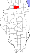
Lee is located on the border of DeKalb and Lee counties at 41°47′39″N88°56′27″W / 41.79417°N 88.94083°W (41.794240, -88.940951). [3] Viking Vie, the main street of the village, follows the county line. It is 15 miles (24 km) southeast of Rochelle and 17 miles (27 km) southwest of DeKalb.
According to the 2021 census gazetteer files, Lee has a total area of 0.20 square miles (0.52 km2), all land. [4]
The Lee area is unique for a small village, in that the surrounding area is a part of four different watersheds. Northwest of the village is a part of the Rock River valley. Northeast of the village is a part of the Kishwaukee River valley. Southwest of the village is a part of the Green River valley. Southeast of the village is a part of the Fox River valley.
Lee is noted for its strong ties to Norwegian American culture. In fact, all of the streets in the village have Norwegian names. In 1974, in honor of the town's centennial, a contest was held to rename the streets and Mary Ellen Prestegaard's entry was chosen. She ran a shop in the village called the Hardanger Hus that sold Norwegian gifts. Many of the original citizens of the community came from the Hardanger region of Norway, and there are still many community members that can trace their ancestry back to that region.
Census | Pop. | Note | %± |
---|---|---|---|
1880 | 218 | — | |
1890 | 264 | 21.1% | |
1900 | 287 | 8.7% | |
1910 | 303 | 5.6% | |
1920 | 289 | −4.6% | |
1930 | 269 | −6.9% | |
1940 | 257 | −4.5% | |
1950 | 251 | −2.3% | |
1960 | 228 | −9.2% | |
1970 | 252 | 10.5% | |
1980 | 304 | 20.6% | |
1990 | 319 | 4.9% | |
2000 | 313 | −1.9% | |
2010 | 337 | 7.7% | |
2020 | 313 | −7.1% | |
U.S. Decennial Census [5] |
As of the 2020 census [2] there were 313 people, 138 households, and 107 families residing in the village. The population density was 1,580.81 inhabitants per square mile (610.35/km2). There were 142 housing units at an average density of 717.17 per square mile (276.90/km2). The racial makeup of the village was 92.01% White, 1.28% African American, 0.32% Native American, 0.32% Asian, 1.28% from other races, and 4.79% from two or more races. Hispanic or Latino of any race were 6.39% of the population.
There were 138 households, out of which 48.6% had children under the age of 18 living with them, 40.58% were married couples living together, 25.36% had a female householder with no husband present, and 22.46% were non-families. 21.74% of all households were made up of individuals, and 5.80% had someone living alone who was 65 years of age or older. The average household size was 2.91 and the average family size was 2.75.
The village's age distribution consisted of 26.1% under the age of 18, 7.6% from 18 to 24, 30.9% from 25 to 44, 27.6% from 45 to 64, and 7.9% who were 65 years of age or older. The median age was 36.5 years. For every 100 females, there were 92.9 males. For every 100 females age 18 and over, there were 87.3 males.
The median income for a household in the village was $82,500, and the median income for a family was $75,625. Males had a median income of $52,188 versus $34,750 for females. The per capita income for the village was $34,351. About 2.8% of families and 8.7% of the population were below the poverty line, including 7.2% of those under age 18 and 3.3% of those age 65 or over.
Hinckley is a village in Squaw Grove Township, DeKalb County, Illinois, United States. The population was 2,006 at the 2020 census, a slight decline from 2,070 at the 2010 census.
Kirkland is a village in DeKalb County, Illinois, United States. The population was 1,650 at the 2020 census, down from 1,744 at the 2010 census.
Malta is a village in DeKalb County, Illinois, United States. The population was 1,143 at the 2020 census.
Shabbona is a village in DeKalb County, Illinois, United States. The population was 863 at the 2020 census, down from 925 at the 2010 census.
Waterman is a village in DeKalb County, Illinois, United States. The population was 1,433 at the 2020 census.
Cleveland is a village in Henry County, Illinois, United States. The population was 163 at the 2020 census.
Loda is a village in Loda Township, Iroquois County, Illinois, United States. As of the 2020 census its population was 356.
Simpson is a village in Johnson County, Illinois, United States. The population was 60 at the 2010 census.
Naplate is a village in LaSalle County, Illinois, United States. The population was 412 at the 2020 census. It is part of the Ottawa Micropolitan Statistical Area.
Sublette is a village in Lee County, Illinois, United States. The population was 449 at the 2010 census.
Stonefort is a village in Saline and Williamson Counties, Illinois, United States. The population was 297 at the 2010 census.
Pittsburg is a village in Williamson County, Illinois. The population was 572 at the 2010 census.
Walton Hills is a village in Cuyahoga County, Ohio, United States. The population was 2,033 at the 2020 census. A suburb of Cleveland, it is a part of the Cleveland metropolitan area.
Horsepasture is a census-designated place (CDP) in Henry County, Virginia, United States. The population was 2,227 at the 2010 census. It is part of the Martinsville Micropolitan Statistical Area.
Camden-on-Gauley is a town in Webster County, West Virginia, United States, along the Gauley River. The population was 126 at the 2020 census.
Van Buren is a census-designated place (CDP) comprising the main village within the town of Van Buren in Aroostook County, Maine, United States. The population of the CDP was 1,937 at the 2010 census, out of a population of 2,171 for the entire town.
Lowell is a village in Dodge County, Wisconsin, United States, along the Beaver Dam River. The population was 309 at the 2020 census. The village is located within the Town of Lowell.
Paw Paw Township is one of nineteen townships in DeKalb County, Illinois, USA. As of the 2020 census, its population was 345 and it contained 130 housing units.
Shabbona Township is one of nineteen townships in DeKalb County, Illinois, USA. As of the 2020 census, its population was 1,344 and it contained 600 housing units. The township contains the Chief Shabbona Forest Preserve and Shabbona Lake State Park.
Cortland is an incorporated town in DeKalb County, Illinois, United States. The population was 4,398 at the 2020 Census. It was previously 4,270 at the 2010 census, up from 2,066 in 2000. Because of its status as an incorporated town, Cortland has adopted the slogan, "The Third Largest Town in Illinois". Only the towns of Cicero and Normal are larger, in terms of population. Most municipalities in Illinois are defined as "cities" or "villages."