Harrisonburg Methodist Church | |
 | |
  | |
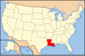
| Location | 105 Pine Street, Harrisonburg, Louisiana |
|---|---|
| Coordinates | 31°46′15″N91°49′16″W / 31.77092°N 91.82109°W |
| Area | Less than one acre |
| Built | 1853-54 |
| NRHP reference No. | 15000345 [1] |
| Added to NRHP | June 15, 2015 |
The Harrisonburg Methodist Church in Harrisonburg in Catahoula Parish, Louisiana was listed on the National Register of Historic Places in 2015. [1]
Built in 1853–54, the church is located at 105 Pine Street, a major road through Harrisonburg, just off the east end of a bridge crossing the Ouachita River. After a flood in 1927, the church was modified in 1929 and further expanded in 1957. [2]
It is a one-story Classical Revival-style church with a covered portico and a "witch's hat" cupola upon which a crucifix rises. [2]