Hay River, Wisconsin

Last updated

Hay River, Wisconsin
WIMap-doton-Hay River.png
Location of Hay River, Wisconsin
Coordinates: 45°4′49″N91°56′25″W / 45.08028°N 91.94028°W / 45.08028; -91.94028
Country Flag of the United States.svg  United States
State Flag of Wisconsin.svg  Wisconsin
County Dunn
Area
  Total36.1 sq mi (93.4 km2)
  Land36.1 sq mi (93.4 km2)
  Water0.0 sq mi (0.0 km2)
Elevation
[1]
942 ft (287 m)
Population
 (2000)
  Total546
  Density15.1/sq mi (5.8/km2)
Time zone UTC-6 (Central (CST))
  Summer (DST) UTC-5 (CDT)
Area code(s) 715 & 534
FIPS code 55-33400 [2]
GNIS feature ID1583369 [1]

Hay River is a town in Dunn County, Wisconsin, United States, along the Hay River. The population was 546 at the 2000 census. The unincorporated community of Baxter is located in the town.

Contents

Geography

According to the United States Census Bureau, the town has a total area of 36.1 square miles (93.4 km2), all of it land.

Demographics

Historical population
CensusPop.Note
1990 510
2000 5467.1%
2010 5582.2%
2020 (est.)5885.4%

As of the census [2] of 2000, there were 546 people, 194 households, and 149 families residing in the town. The population density was 15.1 people per square mile (5.8/km2). There were 204 housing units at an average density of 5.7 per square mile (2.2/km2). The racial makeup of the town was 98.17% White, 0.18% Asian, 0.73% from other races, and 0.92% from two or more races. Hispanic or Latino of any race were 0.73% of the population.[ citation needed ]

There were 194 households, out of which 37.6% had children under the age of 18 living with them, 62.9% were married couples living together, 9.8% had a female householder with no husband present, and 22.7% were non-families. 19.6% of all households were made up of individuals, and 6.2% had someone living alone who was 65 years of age or older. The average household size was 2.81 and the average family size was 3.19.[ citation needed ]

In the town, the population was spread out, with 29.7% under the age of 18, 7.0% from 18 to 24, 27.5% from 25 to 44, 24.9% from 45 to 64, and 11.0% who were 65 years of age or older. The median age was 36 years. For every 100 females, there were 97.8 males. For every 100 females age 18 and over, there were 107.6 males.[ citation needed ]

The median income for a household in the town was $41,458, and the median income for a family was $48,750. Males had a median income of $30,795 versus $20,179 for females. The per capita income for the town was $19,272. About 1.2% of families and 6.2% of the population were below the poverty line, including 4.3% of those under age 18 and 5.9% of those age 65 or over.[ citation needed ]

Related Research Articles

<span class="mw-page-title-main">Fillmore, Indiana</span> Town in Indiana, United States

Fillmore is a town in Marion Township, Putnam County, in the U.S. state of Indiana. The population was 532 at the 2020 census.

<span class="mw-page-title-main">Chapman, Maine</span> Town in the state of Maine, United States

Chapman is a town in Aroostook County, Maine, United States. The population was 491 at the 2020 census.

<span class="mw-page-title-main">Eagle Lake, Maine</span> Town in the state of Maine, United States

Eagle Lake is a town in Aroostook County, Maine, United States. The population was 772 at the 2020 census. The town was named by a body of troops heading from Bangor to the Aroostook War for the many eagles that they saw around the lake. A total of 49.0% of the population speaks French, reflecting a trend in Northeastern Maine.

<span class="mw-page-title-main">Wallagrass, Maine</span> Town in the state of Maine, United States

Wallagrass is a town in Aroostook County, Maine, United States. The population was 519 at the 2020 census.

<span class="mw-page-title-main">Weld, Maine</span> Town in the state of Maine, United States

Weld is a town in Franklin County, Maine, United States. The population was 376 at the 2020 census. Set beside Webb Lake and almost surrounded by mountains, Weld is noted for its scenery. It is home to Mount Blue State Park, Camp Kawanhee for Boys, and Camp Lawroweld.

<span class="mw-page-title-main">Hanover, Maine</span> Town in the state of Maine, United States

Hanover is a town in Oxford County, Maine, United States. The population was 286 at the 2020 census. The town is a popular vacation and recreation area.

Woodstock is a town in Oxford County, Maine, United States. Woodstock is included in the Lewiston-Auburn, Maine metropolitan New England city and town area. The population was 1,352 at the 2020 census. The village of Bryant Pond, on State Route 26 in the northern part of Woodstock, is the town's urban center and largest settlement.

Chester is a town in Penobscot County, Maine, United States. The population was 549 at the 2020 census.

Lee is a town in Penobscot County, Maine, United States. It was incorporated in 1832. The town was originally called Mattekeunk, but changed it to Lee to give it an English name. Stephen Lee suggested the town be named Lee after Revolutionary general Henry "High Horse" Lee. To further convince the townsfolk, he brought a barrel of rum to the meeting. The population was 916 at the 2020 census. Lee has been home to Lee Academy since 1845.

<span class="mw-page-title-main">Dent, Minnesota</span> City in Minnesota, United States

Dent is a city in Otter Tail County, Minnesota, United States. The population was 173 at the 2020 census.

<span class="mw-page-title-main">Pike Township, St. Louis County, Minnesota</span> Township in Minnesota, United States

Pike Township is a township in Saint Louis County, Minnesota, United States. The population was 417 at the 2010 census.

<span class="mw-page-title-main">Scandia, Minnesota</span> City in Minnesota, United States

Scandia is a city in Washington County, Minnesota, United States. The population was 3,984 at the 2020 census. Scandia is 25 miles northeast of Saint Paul, Minnesota.

<span class="mw-page-title-main">Morse, Wisconsin</span> Town in Wisconsin, United States

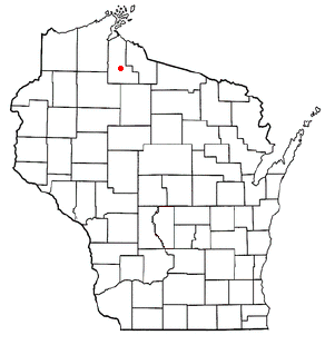
Morse is a town in Ashland County in the U.S. state of Wisconsin. The population was 493 at the 2010 census. The unincorporated communities of Ballou, Cayuga, Foster Junction, and Penokee are located in the town.
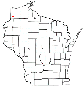
<span class="mw-page-title-main">Shields, Marquette County, Wisconsin</span> Town in Wisconsin, United States

Shields is a town in Marquette County, Wisconsin, United States. The population was 456 at the 2000 census. The unincorporated community of Germania is located in the town.

<span class="mw-page-title-main">Lanark, Wisconsin</span> Town in Wisconsin, United States

Lanark is a town in Portage County, Wisconsin, United States. As of the 2000 census, the town had a population of 1,449. The unincorporated community of Badger is in the town.

<span class="mw-page-title-main">Madge, Wisconsin</span> Town in Wisconsin, United States

Madge is a town in Washburn County, Wisconsin, United States. The population was 454 at the 2000 census.

Philadelphia is a village in Jefferson County, New York, United States. The population was 1,252 at the 2010 census, down from 1,519 in 2000.

<span class="mw-page-title-main">Hustisford (town), Wisconsin</span> Town in Wisconsin, United States

Hustisford is a town in Dodge County, Wisconsin, United States. The population was 1,379 at the 2000 census. Most of the town residents live in the village of Hustisford, within the town.

Woodman is a town in Grant County in the U.S. state of Wisconsin. The population was 195 at the 2000 census. The Village of Woodman is located within the town.

Winter is a town in Sawyer County, Wisconsin, United States. The population was 969 at the 2000 census. The Village of Winter is located within the town, but not a part of it. The unincorporated community of Hay Stack Corner is also located in the town. The town claims to be the largest town in Wisconsin.

References

  1. 1 2 "US Board on Geographic Names". United States Geological Survey. October 25, 2007. Retrieved January 31, 2008.
  2. 1 2 "U.S. Census website". United States Census Bureau . Retrieved January 31, 2008.