Haydon Hall

Last updated

Haydon Hall
Haydon Hall.jpg
Haydon Hall
Greater London UK location map 2.svg
Red pog.svg
Location within Greater London
General information
Architectural styleClassic
Location Eastcote
Town or city Greater London
CountryEngland
Coordinates 51°35′18″N0°24′22″W / 51.588333°N 0.406111°W / 51.588333; -0.406111
Completed1630
Rebuilt 1720
Demolished1967
ClientLady Alice, Dowager Countess of Derby
Technical details
SizeGrounds:14.7 acres (5.9 ha)

Haydon Hall was one of the three main houses of Eastcote, within what is now the London Borough of Hillingdon. The house was built in 1630 as a home for Lady Alice, Dowager Countess of Derby who had been living in Harefield. The house remained in the ownership of Lady Alice's descendants for several years, on the side of her eldest daughter. For a time the house was renamed "Eastcote Park" though was returned to the original name.

Contents

Under the ownership of Lawrence James Baker from 1864, the house was expanded with two wings, and several cottages for workers were built within the grounds. Baker also had Eastcote Lodge built within the estate, which his son and daughter-in-law moved into after their marriage.

Despite being purchased by the Ruislip-Northwood Urban District Council (RNUDC) and Middlesex County Council to serve as the RNUDC's new civic centre, the house fell into a state of disrepair during the Second World War and was eventually demolished in 1967. The area where the house stood still retains the Haydon Hall name, and includes a cricket club and public meeting rooms.

History

Ownership

Lady Alice, Dowager Countess of Derby was already living at Harefield Place, although she became concerned that Lord Castlehaven, the second husband of her eldest daughter, Lady Anne Stanley, would attempt to claim her estate in the event of her death. She had Haydon Hall built in 1630, although Lord Castlehaven was tried and executed the following year. After Lady Alice died in 1636, her eldest daughter reverted to her first married name, Lady Chandos, and became owner of the house. [1]

The house remained in the possession of Lady Chandos' descendants for several generations until 1675, when it was bought by George Sitwell. He had moved to Eastcote in 1668 from Eckington to marry Elizabeth Hawtrey, whose family owned the nearby Eastcote House. Sitwell was an ironmaster, although his ironworks failed and he was lent money by his father-in-law, Ralph Hawtrey, with Haydon Hall as security. As a result of the failure, he was declared bankrupt in 1693, and his sister-in-law Mary's husband, Thomas Franklin, purchased it from him in 1698 having been his creditor. [1] Franklin had the house rebuilt in the Classic style in 1720 and it was renamed "Deanes". [2]

Haydon Hall and grounds in 1945 Haydon Hall - 1945.png
Haydon Hall and grounds in 1945

Under the later ownership of the Scropes family from Cockerington, the house was renamed "Eastcote Park" from 1770 until 1789 when it returned to the original Haydon Hall name. The house passed to George Woodroffe in 1799, who held the position of Chief Protonotary of the Court of Common Pleas. Woodroffe was also on the bench in Uxbridge and remained owner of Haydon Hall until 1822. [3]

The Methodist preacher Dr Adam Clarke lived in the house between 1824 and 1832. Dr Clarke founded a place of worship nearby on Joel Street in 1826 which was regularly very well attended. It was expanded in March 1827 to include a Sunday school, continuing after Dr Clarke's death in 1832 until his daughter-in-law's husband, John Harnett, forced the Methodists to leave the cottage. A new place of worship was soon established in Field End Road in 1848. [3]

Lawrence James Baker of the London Stock Exchange bought the house and grounds in 1864 and had two additional wings added. Baker had several new cottages built for workers within the grounds, designed by Harold Peto of Eastcote House and Ernest George. Peto's sister, Helen Agnes Peto, married Baker's son, Lawrence Ingham Baker. The newly married couple moved into Eastcote Lodge, built within the grounds and designed by Peto and George. [4]

Baker leased the rights to shoot in Copse Wood, Park Wood and Manor Farm from their owner, King's College, Cambridge. He bought the land in 1873, eventually owning 387 acres (157 ha), and had gamekeeper's cottages built in Fore Street and Mad Bess Woods. [4]

Final years

After Lawrence James Baker moved to Ottershaw Park in Chertsey in the 1880s, he let out Haydon Hall to Captain Bennett-Edwards from 1886. Captain Bennett-Edwards and his wife, a novelist, opened the grounds for flower shows, and established a cricket ground for the Eastcote Cricket Club. The house was later bought by Mrs Bennett-Edwards. After her death in 1936, the Ruislip-Northwood Urban District Council and Middlesex County Council bought the house and grounds, intending to make it the new civic centre. The outbreak of the Second World War delayed the conversion work, and following a long period of deterioration, the house was eventually demolished in 1967. [5] The grounds were retained for the public and continue to be used by Eastcote Cricket Club. [6]

The Friends of Eastcote House Gardens issued in 2016 Haydon Hall's Forgotten History by Andy Weller.

Related Research Articles

<span class="mw-page-title-main">Ickenham</span> Human settlement in England

Ickenham is an area in Greater London, forming the northern part of Uxbridge and within the London Borough of Hillingdon.

<span class="mw-page-title-main">Northwood, London</span> Area in the London Borough of Hillingdon and Harrow

Northwood is an area in the London Borough of Hillingdon, North West London, located 14+12 miles northwest of Charing Cross. Northwood was part of the ancient parish of Ruislip, Middlesex. The area was situated on the historic Middlesex boundary with Hertfordshire, and since being incorporated into Greater London in 1965, has been on the Greater London boundary with that county.

<span class="mw-page-title-main">Ruislip</span> Area of west London, England

Ruislip is a suburb in the London Borough of Hillingdon in West London. Prior to 1965 it was in Middlesex. Ruislip lies 13.8 miles (22.2 km) west-north-west of Charing Cross, London.

<span class="mw-page-title-main">London Borough of Hillingdon</span> London borough in United Kingdom

The London Borough of Hillingdon is a London borough in Greater London, England. It forms part of outer London and West London, being the westernmost London borough. It was formed in 1965 from the districts of Hayes and Harlington, Ruislip-Northwood, Uxbridge, and Yiewsley and West Drayton. The borough includes most of Heathrow Airport and Brunel University, and is the second largest of the 32 London boroughs by area.

<span class="mw-page-title-main">South Ruislip</span> Human settlement in England

South Ruislip is an area of west London in the London Borough of Hillingdon.

<span class="mw-page-title-main">Eastcote</span> Area of west London, England

Eastcote is a suburban area in the London Borough of Hillingdon, in west London.
<span class="mw-page-title-main">Ruislip-Northwood Urban District</span> Former urban district in Middlesex, UK

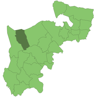
Ruislip-Northwood was an urban district in west Middlesex, England, from 1904 to 1965. From its inception Ruislip-Northwood fell within the Metropolitan Police District and from 1933 it was part of the London Passenger Transport Area.

<span class="mw-page-title-main">Ruislip Manor</span> Human settlement in England

Ruislip Manor is an area of Ruislip in the London Borough of Hillingdon in West London. It is located approximately 13 miles (20.9 km) west north west of Charing Cross.

<span class="mw-page-title-main">Ruislip Lido</span> Reservoir and artificial beach in London

Ruislip Lido is a reservoir and artificial beach in Ruislip, within the London Borough of Hillingdon, England, situated between Ruislip Common, Ruislip Woods, and Poor's Field.

<span class="mw-page-title-main">Mount Vernon Hospital</span> Hospital in London, England

Mount Vernon Hospital is a hospital located in Northwood in the London Borough of Hillingdon. It is one of two hospitals run by The Hillingdon Hospitals NHS Foundation Trust, the other being Hillingdon Hospital.

<span class="mw-page-title-main">Alice Spencer, Countess of Derby</span> English noblewoman

Alice Spencer, Countess of Derby was an English noblewoman from the Spencer family and noted patron of the arts. Poet Edmund Spenser represented her as "Amaryllis" in his eclogue Colin Clouts Come Home Againe (1595) and dedicated his poem The Teares of the Muses (1591) to her.

<span class="mw-page-title-main">Ruislip Woods</span> Woodland in Ruislip, London

Ruislip Woods is a Site of Special Scientific Interest and national nature reserve covering 726 acres (294 ha) in Ruislip in the London Borough of Hillingdon. The woods became London's first national nature reserve in May 1997. Ruislip Local Nature Reserve at TQ 090 899 is part of the national nature reserve.

<span class="mw-page-title-main">RAF Eastcote</span> Former Royal Air Force site in London

RAF Eastcote, also known over time as RAF Lime Grove, HMS Pembroke V and Outstation Eastcote, was a UK Ministry of Defence site in Eastcote, Middlesex.

<span class="mw-page-title-main">Manor Farm, Ruislip</span> Historic site in Greater London, England

Manor Farm is a 22-acre (8.9 ha) historic site in Ruislip, Greater London. It incorporates a medieval farm complex, with a main old barn dating from the 13th century and a farm house from the 16th. Nearby are the remains of a motte-and-bailey castle believed to date from shortly after the Norman conquest of England. Original groundwork on the site has been dated to the 9th century.

<span class="mw-page-title-main">Highgrove House, Eastcote</span> Country house in Eastcote, London

Highgrove House, also known as High Grove House or High Grove, is a Grade II listed mansion in the suburban area of Eastcote, within the London Borough of Hillingdon. Originally built in 1750 by the Reverend John Lidgould, the house was rebuilt in 1881 by Sir Hugh Hume-Campbell following a catastrophic fire. Along with Haydon Hall and Eastcote House, Highgrove was one of the three main houses of Eastcote and eventually became a residential hostel for homeless families, run by the local council from the 1960s until 2007. An area of the estate was sold to the local council in 1935 by the then-owner Eleanor Warrender to become what is now Warrender Park. In 1975, the house was granted Grade II listed status on account of its special architectural character.

<span class="mw-page-title-main">St Giles' Church, Ickenham</span> Church in Ickenham, United Kingdom

St. Giles' Church is the parish church in Ickenham, within the London Borough of Hillingdon in England.

<span class="mw-page-title-main">St Martin's Church, Ruislip</span> Church in United Kingdom

St Martin's Church is a church in the west London town of Ruislip, within the London Borough of Hillingdon. It has been designated since January 1950 by English Heritage as a Grade I listed building. The present chancel and nave date back to the 13th century. The church stands at the northern end of Ruislip High Street, near the Manor Farm site.

<span class="mw-page-title-main">Eastcote House Gardens</span>

Eastcote House Gardens is an area of public parkland in Eastcote, within the London Borough of Hillingdon. The site covers 3.63 hectares and incorporates the walled garden, dovecote and coach house of Eastcote House. The house was demolished in 1964 by the then Ruislip-Northwood Urban District Council (RNUDC), one of the predecessors of the London Borough of Hillingdon which was formed the following year. At the public's request, the garden and outbuildings were retained and are now maintained by a group of volunteers, the Friends of Eastcote House Gardens, in partnership with the local authority.

References

Citations
  1. 1 2 Bowlt 1994, p.31
  2. Ruislip, Northwood and Eastcote Local History Society 1984, p.19
  3. 1 2 Bowlt 1994, p.33
  4. 1 2 Bowlt 1994, p.34
  5. Bowlt 1994, p.35
  6. Ruislip, Northwood and Eastcote Local History Society 1984, p.20
Bibliography

51°35′18″N0°24′22″W / 51.58833°N 0.40611°W / 51.58833; -0.40611