Head of the Harbor, New York

Last updated

Head of the Harbor, New York
Incorporated Village of Head of the Harbor
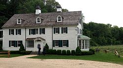
East Farm farmhouse, Head of the Harbor.jpg
c.1690 farmhouse on the East Farm Estate, currently used as a winery tasting room
Head-harbor-ny-map.gif
U.S. Census map of Head of the Harbor
Location map Long Island.png
Red pog.svg
Location within the state of New York
USA New York location map.svg
Red pog.svg
Head of the Harbor, New York (New York)
Coordinates: 40°53′54″N73°9′44″W / 40.89833°N 73.16222°W / 40.89833; -73.16222
Country Flag of the United States.svg  United States
State Flag of New York.svg  New York
County Suffolk
Town Smithtown
Incorporated 1928
Government
[1]
   Mayor Michael Utevsky
Area
[2]
  Total3.04 sq mi (7.86 km2)
  Land2.81 sq mi (7.27 km2)
  Water0.23 sq mi (0.59 km2)
Elevation
121 ft (37 m)
Population
 (2020)
  Total1,520
  Density541.70/sq mi (209.19/km2)
Time zone UTC-5 (Eastern (EST))
  Summer (DST) UTC-4 (EDT)
FIPS code 36-32963
GNIS feature ID0952475
Website www.villagehohny.org

Head of the Harbor is a village in Suffolk County, on the North Shore of Long Island, New York, United States. The population was 1,472 at the time of the 2010 census. [3]

Contents

The Village of Head of the Harbor is located entirely within the Town of Smithtown. Despite this, the Northern part of the village is part of the Three Village Central School District in the Town of Brookhaven. On the border with Stony Brook Village, Head of the Harbor hosts the Avalon Nature Preserve; a privately owned memorial park of 216 acres [4] consisting of trails and landmarks. Due to proximity, common, shared landmark, and heavy forestation, the North is seen as an extension of Stony Brook itself. It's this part of the village where Robert Mercer lives [5] , owing to Renaissance Technologies' headquarters in Three Village.

History

Head of the Harbor incorporated as a village in 1928. [1]

Geography

According to the United States Census Bureau, the village has a total area of 3.0 square miles (7.8 km2), of which 2.8 square miles (7.3 km2) is land and 0.2 square miles (0.52 km2), or 7.52%, is water.

To the north of the village lies Stony Brook Harbor. [6] [7]

Demographics

Historical population
CensusPop.Note
1930 244
1940 2554.5%
1950 33431.0%
1960 52456.9%
1970 94380.0%
1980 1,0238.5%
1990 1,35432.4%
2000 1,4476.9%
2010 1,4721.7%
2020 1,5203.3%
U.S. Decennial Census [8]

At the 2000 census, there were 1,447 people, 484 households, and 413 families in the village. The population density was 513.6 inhabitants per square mile (198.3/km2). There were 501 housing units at an average density of 177.8 per square mile (68.6/km2). The racial makup of the village was 95.02% White, 1.24% African American, 3.25% Asian, and 0.48% from two or more races. Hispanic or Latino of any race were 1.38% of the population. [9]

Of the 484 households 38.4% had children under the age of 18 living with them, 77.9% were married couples living together, 4.3% had a female householder with no spouse present, and 14.5% were non-families. 11.4% of households were one person and 3.5% were one person aged 65 or older. The average household size was 2.99 and the average family size was 3.23. [9]

The age distribution was 27.0% under the age of 18, 5.2% from 18 to 24, 25.0% from 25 to 44, 31.2% from 45 to 64, and 11.6% 65 or older. The median age was 41 years. For every 100 females, there were 102.4 males. For every 100 women age 18 and over, there were 101.9 men. [9]

The median household income was $117,450 and the median family income was $129,157. Males had a median income of $97,095 versus $50,481 for females. The per capita income for the village was $52,999. About 1.2% of families and 1.5% of the population were below the poverty line, including none of those under age 18 and 2.9% of those age 65 or over. [9]

Government

As of April 2024, the Mayor of Head of the Harbor is Michael Utevsky, the Deputy Mayor is Lisa Davidson, and the Village Trustees are Jeffrey D. Fischer, Judith C. Ogden, and Daniel White. [10]

Notable person

Related Research Articles

<span class="mw-page-title-main">Viola, Illinois</span> Village in Illinois, United States

Viola is a village in Mercer County, Illinois, United States. The population was 869 at the 2020 census, a decline of 9 percent from 955 in 2010.

Delaware Township is a civil township of Sanilac County in the U.S. state of Michigan. The population was 784 at the 2020 census.

Stony Brook Township is a township in Grant County, Minnesota, United States. The population was 164 at the 2000 census.

<span class="mw-page-title-main">Lyndeborough, New Hampshire</span> Town in New Hampshire, United States

Lyndeborough is a town in Hillsborough County, New Hampshire, United States. The population was 1,702 at the 2020 census.

Hounsfield is a town in Jefferson County, New York, United States. The population was 3,466 at the 2010 census. The name of the town is from Ezra Hounsfield, a land agent and land owner.

<span class="mw-page-title-main">Laurel Hollow, New York</span> Village in New York, United States

Laurel Hollow is a village in the Town of Oyster Bay in Nassau County, on the North Shore of Long Island, in New York, United States. The population was 1,952 at the 2010 census. According to Bloomberg BusinessWeek, Laurel Hollow was the eighth wealthiest town in America.

Dansville is a town in Steuben County, New York, United States, not to be confused with the nearby village of Dansville in Livingston County. The population was 1,842 at the 2010 census. The town was named after Daniel Faulkner.

<span class="mw-page-title-main">Asharoken, New York</span> Village in New York, United States

Asharoken is a village in the Town of Huntington in Suffolk County, on the North Shore of Long Island in New York. The population was 654 at the 2010 census.

<span class="mw-page-title-main">Belle Terre, New York</span> Village in New York, United States

Belle Terre is a village in the Town of Brookhaven in Suffolk County, on the North Shore of Long Island, in New York, United States. The population was 792 at the 2010 census.

<span class="mw-page-title-main">Centereach, New York</span> Hamlet and census-designated place in New York, United States

Centereach is a hamlet and census-designated place in Suffolk County, New York, United States. The population was 31,578 at the 2010 census.

<span class="mw-page-title-main">Dering Harbor, New York</span> Village in New York, United States

Dering Harbor is a village in the Town of Shelter Island, in Suffolk County, New York, United States. As of the 2020 census, the village population was 50, making it the least populous village in the State of New York.

<span class="mw-page-title-main">Lake Grove, New York</span> Village in Suffolk County, New York

Lake Grove is a village in the Town of Brookhaven in Suffolk County, New York, United States. The population was 11,163 at the 2010 census.

<span class="mw-page-title-main">Nissequogue, New York</span> Village in New York, United States

Nissequogue is a village in Suffolk County, on the North Shore of Long Island, in New York, United States. The village population was 1,564 at the 2020 census.

<span class="mw-page-title-main">Poquott, New York</span> Village in New York, United States

Poquott is a village in Suffolk County, New York, United States. The population was 953 at the 2010 census. The village is located in the Town of Brookhaven, on the North Shore of Long Island, and is officially known as the Incorporated Village of Poquott.

<span class="mw-page-title-main">Setauket, New York</span> Census-designated place in New York, United States

Setauket is a hamlet and census-designated place (CDP) in the Town of Brookhaven, Suffolk County, New York, United States, on the North Shore of Long Island. As of the 2010 United States census, the CDP population, which at the time included East Setauket as well, was 15,477.

<span class="mw-page-title-main">Shelter Island Heights, New York</span> Hamlet and census-designated place in New York, United States

Shelter Island Heights is a hamlet and census-designated place (CDP) located in the Town of Shelter Island, in Suffolk County, New York, United States. It is located on the north side of Shelter Island, surrounding the village of Dering Harbor. The population was 1,601 at the time of the 2020 census.

<span class="mw-page-title-main">St. James, New York</span> Hamlet and census-designated place in New York, United States

St. James is a hamlet and census-designated place (CDP) in Suffolk County, New York, United States. The population of the CDP was 13,487 at the 2020 census. St. James is part of the Town of Smithtown and is located on the North Shore of Long Island. The ZIP code is 11780.

<span class="mw-page-title-main">Stony Brook, New York</span> Hamlet and census-designated place in New York, United States

Stony Brook is a hamlet and census-designated place (CDP) in the Town of Brookhaven in Suffolk County, New York, United States, on the North Shore of Long Island. Begun in the colonial era as an agricultural enclave, the hamlet experienced growth first as a resort town and then to its current state as one of Long Island's major tourist towns and centers of education. Despite being referred to as a village by residents and tourists alike, Stony Brook has never been legally incorporated by the state. The population was 13,740 at the 2010 census.

<span class="mw-page-title-main">Southampton, New York</span> Town in New York, United States

Southampton, officially the Town of Southampton, is a town in southeastern Suffolk County, New York, partly on the South Fork of Long Island. As of the 2020 U.S. census, the town had a population of 69,036. Southampton is included in the stretch of shoreline prominently known as the Hamptons.

<span class="mw-page-title-main">Huntington (CDP), New York</span> Place in New York, United States

Huntington is a hamlet and census-designated place (CDP) located within the Town of Huntington in Suffolk County, on the North Shore of Long Island, in New York, United States. The population was 18,406 at the 2010 census. The hamlet serves as the Town Seat of the Town of Huntington.

References

  1. 1 2 "Village of Head of the Harbor". Suffolk County Village Officials Association. Archived from the original on May 26, 2003. Retrieved August 23, 2010.
  2. "ArcGIS REST Services Directory". United States Census Bureau. Retrieved September 20, 2022.
  3. "Geographic Identifiers: 2010 Demographic Profile Data (G001): Head of the Harbor village, New York". U.S. Census Bureau, American Factfinder. Archived from the original on February 12, 2020. Retrieved December 20, 2012.
  4. "Our Roots | Avalon Nature Preserve". avalonnaturepreserve.org. Retrieved April 10, 2024.
  5. "Robert Mercer's House in Head of the Harbor, NY (Google Maps) (#3)". Virtual Globetrotting. July 15, 2016. Retrieved April 10, 2024.
  6. "Home – Head of the Harbor". villagehohny.org. Retrieved July 1, 2022.
  7. "Long Island Index: Interactive Map". www.longislandindexmaps.org. Retrieved July 1, 2022.
  8. "Census of Population and Housing". Census.gov. Retrieved June 4, 2015.
  9. 1 2 3 4 "U.S. Census website". United States Census Bureau . Retrieved January 31, 2008.
  10. "Board of Trustees – Head of the Harbor". villagehohny.org. Retrieved July 1, 2022.