Historic and Architectural Resources of Route 66 Through Illinois

Last updated

Route 66 Through Illinois Multiple Property Submission
Map of US 66.svg
Location Illinois, US
NRHP reference No. 64500208
Added to NRHPMay 5, 2006

U.S. Route 66 was a highway established on November 11, 1926, connecting Chicago, Illinois to the Southwest. Several buildings from the Route 66 era still stand and are part of the Historic and Architectural Resources of Route 66 Through Illinois Multiple Property Submission on the National Register of Historic Places.

Resource NameImageAddressCityAdded
Ambler's Texaco Gas Station Ambler's Texaco Gas Station4.JPG Illinois Route 17 and Old U.S. 66
41°5′39″N88°26′26″W / 41.09417°N 88.44056°W / 41.09417; -88.44056 (Ambler's Texaco Gas Station)
Dwight November 29, 2001
Ariston Café AristonCafe LitchfieldIL.jpg 314 Old Route 66
39°10′38″N89°40′5″W / 39.17722°N 89.66806°W / 39.17722; -89.66806 (Ariston Cafe)
Litchfield May 5, 2006
Alternate Route 66, Wilmington to Joliet Historic Route 66 & Route 53 in Joliet IL south of Theodore Street.jpg Illinois Route 53 between Wilmington and Joliet
41°24′16″N88°6′27″W / 41.40444°N 88.10750°W / 41.40444; -88.10750 (Alternate Route 66, Wilmington to Joilet)
Joliet and WilmingtonMay 5, 2006
Belvidere Café, Motel, and Gas Station Belvidere Cafe, Motel, and Gas Station.JPG 817 Old Route 66
39°10′16″N89°40′3″W / 39.17111°N 89.66750°W / 39.17111; -89.66750 (Belevidere Cafe, Motel and Gas Station)
LitchfieldFebruary 21, 2007
Chain of Rocks Bridge ChainOfRocksBridge StLouisMO.jpg West Chain of Rocks Rd.
38°45′41″N90°10′26″W / 38.76139°N 90.17389°W / 38.76139; -90.17389 (Chain of Rocks Bridge)
Madison December 1, 2006
Dell Rhea's Chicken Basket Dell Rhea Chicken Basket sign.jpg 645 Joliet Road
41°44′51″N87°56′22″W / 41.74750°N 87.93944°W / 41.74750; -87.93944 (Dell Rhea's Chicken Basket)
Willowbrook May 5, 2006
Lou Mitchell's Restaurant Lou Mitchells in Chicago.jpg 565 W. Jackson Blvd.
41°52′38″N87°38′30″W / 41.87722°N 87.64167°W / 41.87722; -87.64167 (Lou Mitchell's Restaurant)
Chicago May 5, 2006
Route 66 by Carpenter ParkOld Route 66 between Cabin Smoke Trail and north bank of the Sangamon River
39°52′21″N89°36′51″W / 39.87250°N 89.61417°W / 39.87250; -89.61417 (Route 66 by Carpenter Park)
Springfield and Sherman May 9, 2002
Route 66, Cayuga to Chenoa Cayuga IL Route 66, Cayuga to Chenoa5.jpg Route 66, between just N. of Township Rd 2200 N. and just S. of Township Rd 3000 N.
40°45′12″N88°43′7″W / 40.75333°N 88.71861°W / 40.75333; -88.71861 (Route 66, Cayuga to Chenoa)
Pontiac July 23, 2003
Route 66, Girard to Nilwood Union Pacific trestle over old rt 66.JPG Route 66, between Illinois Route 4 (IL 4) south of Girard and IL 4 in Nilwood
39°24′45″N89°47′16″W / 39.41250°N 89.78778°W / 39.41250; -89.78778 (Route 66, Girard to Nilwood)
NilwoodMay 23, 2002
Route 66, Litchfield to Mount Olive Route 66, Litchfield to Mount Olive.JPG Route 66, N of Illinois Route 16 in Litchfield to Mount Olive
39°7′48″N89°41′34″W / 39.13000°N 89.69278°W / 39.13000; -89.69278 (Route 66, Litchfield to Mount Olive)
LitchfieldNovember 29, 2001
Route 66 South of Lake Springfield Olde Rt. 66/Olde Carriage Way
39°40′30.9″N89°37′28.92″W / 39.675250°N 89.6247000°W / 39.675250; -89.6247000 (Route 66 South of Lake Springfield)
SpringfieldMay 12, 2009
Sprague's Super Service Sprague's Super Service in Normal, Illinois on Route 66..jpg 305 E. Pine St.
40°31′3″N88°58′51″W / 40.51750°N 88.98083°W / 40.51750; -88.98083 (Sprague's Super Service)
Normal April 25, 2008
Standard Oil Gasoline Station Standard Oil Gasoline Station5.JPG 400 S. West St.
41°0′7″N88°31′44″W / 41.00194°N 88.52889°W / 41.00194; -88.52889 (Standard Oil Gasoline Station)
Odell November 9, 1997
Soulsby Service Station SoulsbyServiceStation MtOliveIL.jpg 102 S. Route 66 St.
39°4′23″N89°44′8″W / 39.07306°N 89.73556°W / 39.07306; -89.73556 (Soulsby Service Station)
Mount OliveMay 6, 2004

Related Research Articles

<span class="mw-page-title-main">National Register of Historic Places listings in Oklahoma</span>

This is a list of properties and historic districts in Oklahoma that are designated on the National Register of Historic Places. Listings are distributed across all of Oklahoma's 77 counties.

<span class="mw-page-title-main">National Register of Historic Places listings in Illinois</span>

This is a list of properties and districts in Illinois that are on the National Register of Historic Places. There are over 1,900 in total. Of these, 85 are National Historic Landmarks. There are listings in all of the state's 102 counties.
     This National Park Service list is complete through NPS recent listings posted April 12, 2024.

<span class="mw-page-title-main">National Register of Historic Places listings in Sangamon County, Illinois</span>

This is a list of the National Register of Historic Places listings in Sangamon County, Illinois.

<span class="mw-page-title-main">National Register of Historic Places listings in Adams County, Illinois</span>

This is a list of the National Register of Historic Places listings in Adams County, Illinois.

<span class="mw-page-title-main">National Register of Historic Places listings in Champaign County, Illinois</span>

This is intended to be a complete list of the properties and districts on the National Register of Historic Places in Champaign County, Illinois, United States. Latitude and longitude coordinates are provided for many National Register properties and districts; these locations may be seen together in a map.

<span class="mw-page-title-main">National Register of Historic Places listings in Rock Island County, Illinois</span>

This is a list of the National Register of Historic Places listings in Rock Island County, Illinois.

<span class="mw-page-title-main">National Register of Historic Places listings in Bureau County, Illinois</span>

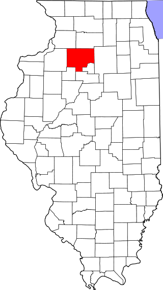
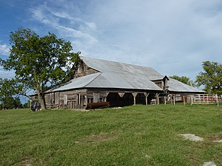
This is a list of the National Register of Historic Places listings in Bureau County, Illinois.

<span class="mw-page-title-main">National Register of Historic Places listings in Henry County, Illinois</span>

This is a list of the National Register of Historic Places listings in Henry County, Illinois.

<span class="mw-page-title-main">National Register of Historic Places listings in Logan County, Illinois</span>

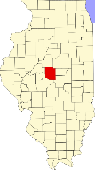
This is a list of the National Register of Historic Places listings in Logan County, Illinois.

<span class="mw-page-title-main">National Register of Historic Places listings in Hancock County, Illinois</span>

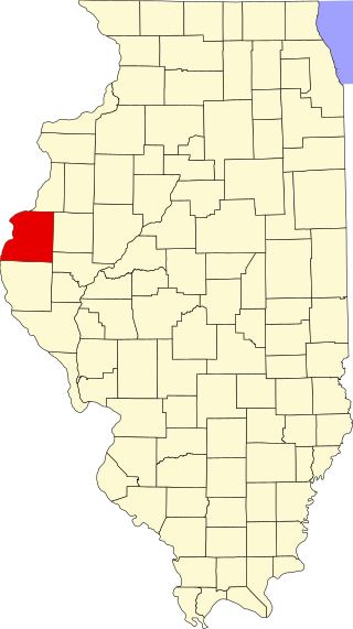
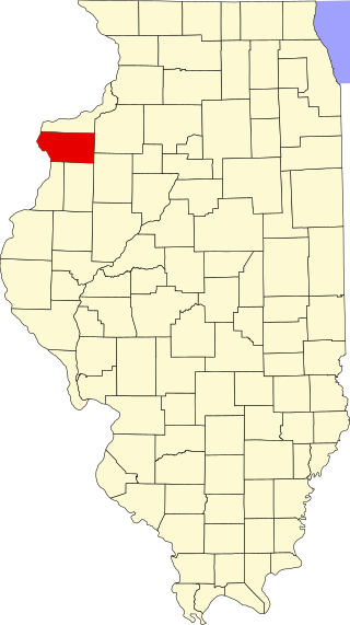
This is a list of the National Register of Historic Places listings in Hancock County, Illinois.

<span class="mw-page-title-main">National Register of Historic Places listings in Pike County, Ohio</span>

This is a list of the National Register of Historic Places listings in Pike County, Ohio.

<span class="mw-page-title-main">National Register of Historic Places listings in Mercer County, Illinois</span>

This is a list of the National Register of Historic Places listings in Mercer County, Illinois.

For the rest of Cook County, see National Register of Historic Places listings in Cook County, Illinois.

<span class="mw-page-title-main">National Register of Historic Places listings in Clark County, Illinois</span>

This is a list of the National Register of Historic Places listings in Clark County, Illinois.

<span class="mw-page-title-main">National Register of Historic Places listings in Alexander County, Illinois</span>

This is a list of the National Register of Historic Places listings in Alexander County, Illinois.

The New Mexico State Register of Cultural Properties is a register of historic and prehistoric properties located in the state of New Mexico. It is maintained by the New Mexico Historic Preservation Division of the New Mexico Department of Cultural Affairs. The Cultural Properties Review Committee meets at least six times a year. The committee lists properties in the State Register and forwards nominations to the National Register.

There are 291 properties and historic districts on the National Register of Historic Places in Worcester, Massachusetts. Of these, 81 are west of I-190 and the north-south section of I-290 and south of Massachusetts Route 122, and are listed below. One listing, the Blackstone Canal Historic District, overlaps into other parts of the city. Another listing has been removed.

<span class="mw-page-title-main">National Cycle Route 658</span> Cycling route in York, England

National Cycle Network (NCN) Route 658 is a Sustrans Regional Route. It is two miles (3.2 km) long, and provides a connection between Route 65 and Route 66 through York city centre. The full length of the route is part of the Way of the Roses. It is fully signed and open.