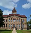
National Register of Historic Places listings in Greene County, Illinois

Last updated
Location of Greene County in Illinois Map of Illinois highlighting Greene County.svg
Location of Greene County in Illinois

This is a list of the National Register of Historic Places listings in Greene County, Illinois.

Contents

This is intended to be a complete list of the properties and districts on the National Register of Historic Places in Greene County, Illinois, United States. Latitude and longitude coordinates are provided for many National Register properties and districts; these locations may be seen together in a map. [1]

There are 12 properties and districts listed on the National Register in the county.

This National Park Service list is complete through NPS recent listings posted January 7, 2022. [2]
Map all coordinates using: OpenStreetMap  
Download coordinates as: KML

Current listings

[3] Name on the RegisterImageDate listed [4] Location City or townDescription
1 Black Homestead Farm
Black Homestead Farm Black Homestead Farm.jpg
Black Homestead Farm
May 24, 2005
(#05000110)
RR 3
39°17′37″N90°26′45″W / 39.293493°N 90.445852°W / 39.293493; -90.445852 (Black Homestead Farm)
Carrollton
2 Carrollton Courthouse Square Historic District
Carrollton Courthouse Square Historic District Image Greene County Courthouse.jpg
Carrollton Courthouse Square Historic District
August 1, 1985
(#85001667)
Roughly bounded by S. Main, W. 5th, N. Main and W. 6th Sts.
39°18′06″N90°24′35″W / 39.301667°N 90.409722°W / 39.301667; -90.409722 (Carrollton Courthouse Square Historic District)
Carrollton
3 James John Eldred House
James John Eldred House James John Eldred House.jpg
James John Eldred House
June 25, 1999
(#99000732)
Bluffdale Township Rd., E of IL 100
39°18′29″N90°32′55″W / 39.307924°N 90.548530°W / 39.307924; -90.548530 (James John Eldred House)
Eldred
4 Greene County Almshouse
Greene County Almshouse Greene County Almshouse.jpg
Greene County Almshouse
May 17, 1991
(#91000568)
Twp. Rd. TR156A NE of Carrollton
39°19′47″N90°21′53″W / 39.329722°N 90.364722°W / 39.329722; -90.364722 (Greene County Almshouse)
Carrollton
5 Hodges House
Hodges House Hodges House in Carrollton.jpg
Hodges House
November 3, 1980
(#80001364)
532 N. Main St.
39°18′08″N90°24′32″W / 39.302361°N 90.408889°W / 39.302361; -90.408889 (Hodges House)
Carrollton
6 Hotel Roodhouse
Hotel Roodhouse Site of the Hotel Roodhouse.jpg
Hotel Roodhouse
November 7, 1995
(#95001238)
303 Morse St.
39°28′56″N90°22′22″W / 39.482287°N 90.372797°W / 39.482287; -90.372797 (Hotel Roodhouse)
Roodhouse
7 Koster Site
Koster Site COLLEGE STUDENTS WORK WITH ARCHAEOLOGISTS AT "KOSTER DIG" AN ANCIENT INDIAN BURIAL SITE - NARA - 552495.jpg
Koster Site
June 19, 1972
(#72000460)
200 yards (180 m) east of the Eldred-Hillview road, 5.5 miles (8.9 km) south of Eldred [5]
39°12′33″N90°32′57″W / 39.209167°N 90.549167°W / 39.209167; -90.549167 (Koster Site)
Eldred
8 Mound House Site September 1, 1978
(#78001148)
Eastern bank of the Illinois River, ½ mile west of the end of 600E [6]
39°29′36″N90°35′01″W / 39.49333°N 90.58361°W / 39.49333; -90.58361 (Mound House Site)
Hillview
9 Henry T. Rainey Farm
Henry T. Rainey Farm Henry T. Rainey Farm.jpg
Henry T. Rainey Farm
May 12, 1987
(#87000682)
RR 1, N side of IL 108
39°18′12″N90°23′14″W / 39.303397°N 90.387312°W / 39.303397; -90.387312 (Henry T. Rainey Farm)
Carrollton
10 Virginia Tillery Round Barn
Virginia Tillery Round Barn Virginia Tillery Round Barn.jpg
Virginia Tillery Round Barn
August 26, 1982
(#82002536)
W of White Hall on CR 738
39°26′26″N90°26′37″W / 39.440556°N 90.443611°W / 39.440556; -90.443611 (Virginia Tillery Round Barn)
White Hall
11 White Hall Foundry
White Hall Foundry Image The Foundry.jpeg
White Hall Foundry
May 28, 1980
(#80001365)
102 S. Jacksonville St.
39°26′05″N90°24′30″W / 39.434722°N 90.408333°W / 39.434722; -90.408333 (White Hall Foundry)
White Hall
12 White Hall Historic District
White Hall Historic District Image 117 Main Street, White Hall.jpeg
White Hall Historic District
May 20, 1987
(#86003145)
Roughly bounded by Bridgeport, Jacksonville, Ayers, and Main Sts.; also 120 S. Jacksonville St.
39°26′12″N90°24′11″W / 39.436667°N 90.403056°W / 39.436667; -90.403056 (White Hall Historic District)
White Hall 120 Jacksonville represents a boundary increase of February 11, 1993

See also

Related Research Articles

National Register of Historic Places listings in Adams County, Illinois

This is a list of the National Register of Historic Places listings in Adams County, Illinois.

National Register of Historic Places listings in Whiteside County, Illinois

This is a list of the National Register of Historic Places listings in Whiteside County, Illinois.

National Register of Historic Places listings in Fulton County, Illinois

This is a list of the National Register of Historic Places listings in Fulton County, Illinois.

National Register of Historic Places listings in Madison County, Illinois

This is a list of the National Register of Historic Places listings in Madison County, Illinois.

National Register of Historic Places listings in LaSalle County, Illinois

This is a list of the National Register of Historic Places listings in LaSalle County, Illinois.

National Register of Historic Places listings in Peoria County, Illinois Wikipedia list article

This is a list of the National Register of Historic Places listings in Peoria County, Illinois.

National Register of Historic Places listings in Jersey County, Illinois

This is a list of the National Register of Historic Places listings in Jersey County, Illinois.

National Register of Historic Places listings in Pike County, Illinois

This is a list of the National Register of Historic Places listings in Pike County, Illinois.

National Register of Historic Places listings in Randolph County, Illinois

This is a list of the National Register of Historic Places listings in Randolph County, Illinois.

National Register of Historic Places listings in St. Clair County, Illinois

This is a list of the National Register of Historic Places listings in St. Clair County, Illinois.

National Register of Historic Places listings in Jackson County, Illinois

This is a list of the National Register of Historic Places listings in Jackson County, Illinois.

National Register of Historic Places listings in Kankakee County, Illinois

This is a list of the National Register of Historic Places listings in Kankakee County, Illinois.

National Register of Historic Places listings in Kendall County, Illinois

This is a list of the National Register of Historic Places listings in Kendall County, Illinois.

National Register of Historic Places listings in White County, Illinois

This is a list of the National Register of Historic Places listings in White County, Illinois.

National Register of Historic Places listings in Monroe County, Illinois

This is a list of the National Register of Historic Places listings in Monroe County, Illinois.

National Register of Historic Places listings in Alexander County, Illinois

This is a list of the National Register of Historic Places listings in Alexander County, Illinois.

National Register of Historic Places listings in Gallatin County, Illinois

This is a list of the National Register of Historic Places listings in Gallatin County, Illinois.

National Register of Historic Places listings in Edgar County, Illinois

This is a list of the National Register of Historic Places listings in Edgar County, Illinois.

National Register of Historic Places listings in Crawford County, Illinois

This is a list of the National Register of Historic Places listings in Crawford County, Illinois.

National Register of Historic Places listings in Calhoun County, Illinois

This is a list of the National Register of Historic Places listings in Calhoun County, Illinois.

References

  1. The latitude and longitude information provided in this table was derived originally from the National Register Information System, which has been found to be fairly accurate for about 99% of listings. Some locations in this table may have been corrected to current GPS standards.
  2. National Park Service, United States Department of the Interior, "National Register of Historic Places: Weekly List Actions", retrieved January 7, 2022.
  3. Numbers represent an alphabetical ordering by significant words. Various colorings, defined here, differentiate National Historic Landmarks and historic districts from other NRHP buildings, structures, sites or objects.
  4. The eight-digit number below each date is the number assigned to each location in the National Register Information System database, which can be viewed by clicking the number.
  5. Struever, Stuart. National Register of Historic Places Inventory - Nomination Form: The Koster Site. National Park Service, 1971-11-04.
  6. Maruszak, Kathleen. National Register of Historic Places Inventory/Nomination: Mound House Site. National Park Service, 1977-07, 4.