National Register of Historic Places listings in White County, Illinois

Last updated

Location of White County in Illinois Map of Illinois highlighting White County.svg
Location of White County in Illinois

This is a list of the National Register of Historic Places listings in White County, Illinois.

Contents

This is intended to be a complete list of the properties and districts on the National Register of Historic Places in White County, Illinois, United States. Latitude and longitude coordinates are provided for many National Register properties and districts; these locations may be seen together in a map. [1]

There are 11 properties and districts listed on the National Register in the county.


    This National Park Service list is complete through NPS recent listings posted September 15, 2023. [2]

Map all coordinates using: OpenStreetMap

Current listings

[3] Name on the Register [4] ImageDate listed [5] Location City or townDescription
1 Bieker-Wilson Village Site
Bieker-Wilson Village Site Bieker-Wilson Village Site.jpg
Bieker-Wilson Village Site
November 21, 1978
(#78001197)
Sandy Slough, southeast of the junction of County Road 300N and 1650E [6]
37°55′02″N88°04′34″W / 37.91722°N 88.07611°W / 37.91722; -88.07611 (Bieker-Wilson Village Site)
New Haven
2 Carmi Chapter House
Carmi Chapter House Carmi Chapter House.jpg
Carmi Chapter House
November 28, 1980
(#80001416)
604 W. Main St.
38°05′07″N88°10′06″W / 38.085278°N 88.168333°W / 38.085278; -88.168333 (Carmi Chapter House)
Carmi
3 William W. Gray House
William W. Gray House William W. Gray House.jpg
William W. Gray House
February 13, 1992
(#92000049)
119 N. Court St.
38°15′31″N87°59′46″W / 38.258611°N 87.996111°W / 38.258611; -87.996111 (William W. Gray House)
Grayville Designed by architect George Franklin Barber
4 L. Haas Store
L. Haas Store L. Haas Store.jpg
L. Haas Store
February 4, 1994
(#94000026)
219 E. Main St.
38°05′26″N88°09′34″W / 38.090556°N 88.159444°W / 38.090556; -88.159444 (L. Haas Store)
Carmi
5 Harmony Way Bridge
Harmony Way Bridge Harmony Way Bridge, southern side detailed from east.jpg
Harmony Way Bridge
October 3, 2007
(#07001030)
Indiana State Road 66/Illinois Route 14
38°07′52″N87°56′32″W / 38.131111°N 87.942222°W / 38.131111; -87.942222 (Harmony Way Bridge)
Crossville Extends into Posey County, Indiana
6 Hubele Mounds and Village Site
Hubele Mounds and Village Site Hubele Mounds and Village Site.jpg
Hubele Mounds and Village Site
August 25, 1978
(#78001196)
East of the junction of County Roads 950N and 1900E [7]
38°01′00″N88°01′56″W / 38.01666°N 88.03222°W / 38.01666; -88.03222 (Hubele Mounds and Village Site)
Maunie
7 Old Morrison Mill
Old Morrison Mill Old Morrison Mill - Burnt Prairie Illinois.jpg
Old Morrison Mill
July 11, 1984
(#84001169)
Off Liberty Rd.
38°15′08″N88°15′29″W / 38.252222°N 88.258056°W / 38.252222; -88.258056 (Old Morrison Mill)
Burnt Prairie
8 Ratcliff Inn
Ratcliff Inn Ratcliff Inn at Carmi.jpg
Ratcliff Inn
June 4, 1973
(#73000719)
214 E. Main St.
38°05′25″N88°09′33″W / 38.090278°N 88.159167°W / 38.090278; -88.159167 (Ratcliff Inn)
Carmi
9 Robinson-Stewart House
Robinson-Stewart House Robinson-Stewart House.jpg
Robinson-Stewart House
August 17, 1973
(#73000720)
110 S. Main Cross St.
38°05′25″N88°09′31″W / 38.090278°N 88.158500°W / 38.090278; -88.158500 (Robinson-Stewart House)
Carmi
10 James Robert Williams House
James Robert Williams House James Robert Williams House.jpg
James Robert Williams House
January 29, 1987
(#86003716)
310 E. Main St.
38°05′27″N88°09′29″W / 38.090833°N 88.158056°W / 38.090833; -88.158056 (James Robert Williams House)
Carmi Designed by George Franklin Barber
11 Wilson Mounds and Village Site
Wilson Mounds and Village Site Wilson Mounds at Rising Sun.jpg
Wilson Mounds and Village Site
November 16, 1977
(#77000491)
Within and surrounding the Marshall Ferry Cemetery at Rising Sun [8]
37°59′57″N88°01′55″W / 37.99916°N 88.03194°W / 37.99916; -88.03194 (Wilson Mounds and Village Site)
Maunie

See also

Related Research Articles

<span class="mw-page-title-main">National Register of Historic Places listings in Illinois</span>

This is a list of properties and districts in Illinois that are on the National Register of Historic Places. There are over 1,900 in total. Of these, 85 are National Historic Landmarks. There are listings in all of the state's 102 counties.
     This National Park Service list is complete through NPS recent listings posted September 15, 2023.

<span class="mw-page-title-main">Emma Township, White County, Illinois</span> Township in Illinois, United States

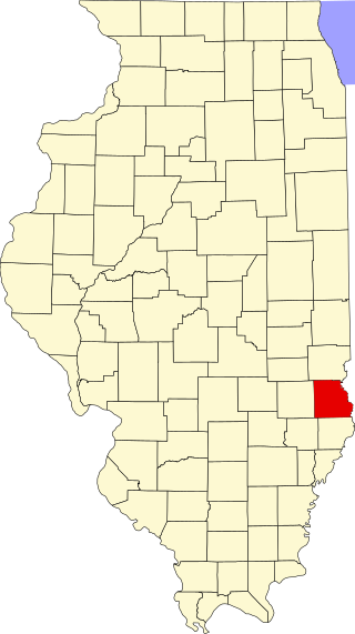
Emma Township is located in White County, Illinois. As of the 2010 census, its population was 387 and it contained 235 housing units.

<span class="mw-page-title-main">National Register of Historic Places listings in Will County, Illinois</span>

This is a list of the National Register of Historic Places listings in Will County, Illinois.

<span class="mw-page-title-main">National Register of Historic Places listings in Whiteside County, Illinois</span>

This is a list of the National Register of Historic Places listings in Whiteside County, Illinois.

<span class="mw-page-title-main">National Register of Historic Places listings in Fulton County, Illinois</span>

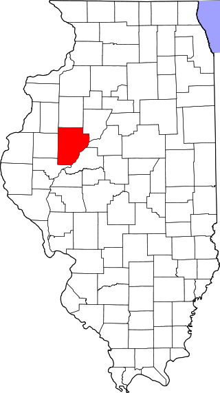
This is a list of the National Register of Historic Places listings in Fulton County, Illinois.

<span class="mw-page-title-main">National Register of Historic Places listings in Madison County, Illinois</span>

This is a list of the National Register of Historic Places listings in Madison County, Illinois.

<span class="mw-page-title-main">National Register of Historic Places listings in LaSalle County, Illinois</span>

This is a list of the National Register of Historic Places listings in LaSalle County, Illinois.

<span class="mw-page-title-main">National Register of Historic Places listings in Jersey County, Illinois</span>

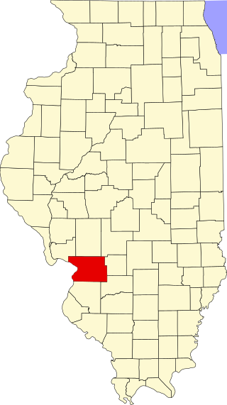
This is a list of the National Register of Historic Places listings in Jersey County, Illinois.

<span class="mw-page-title-main">National Register of Historic Places listings in Pike County, Illinois</span>

This is a list of the National Register of Historic Places listings in Pike County, Illinois.

<span class="mw-page-title-main">National Register of Historic Places listings in Randolph County, Illinois</span>

This is a list of the National Register of Historic Places listings in Randolph County, Illinois.

<span class="mw-page-title-main">National Register of Historic Places listings in St. Clair County, Illinois</span>

This is a list of the National Register of Historic Places listings in St. Clair County, Illinois.

<span class="mw-page-title-main">National Register of Historic Places listings in Greene County, Illinois</span>

This is a list of the National Register of Historic Places listings in Greene County, Illinois.

<span class="mw-page-title-main">National Register of Historic Places listings in Jackson County, Illinois</span>

This is a list of the National Register of Historic Places listings in Jackson County, Illinois.

<span class="mw-page-title-main">National Register of Historic Places listings in Logan County, Ohio</span>

This is a list of the National Register of Historic Places listings in Logan County, Ohio.

<span class="mw-page-title-main">National Register of Historic Places listings in Alexander County, Illinois</span>

This is a list of the National Register of Historic Places listings in Alexander County, Illinois.

<span class="mw-page-title-main">National Register of Historic Places listings in Crawford County, Illinois</span>

This is a list of the National Register of Historic Places listings in Crawford County, Illinois.

<span class="mw-page-title-main">National Register of Historic Places listings in Calhoun County, Illinois</span>

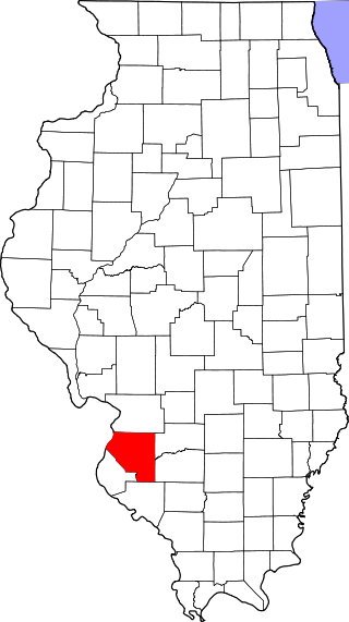
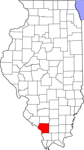
This is a list of the National Register of Historic Places listings in Calhoun County, Illinois.

<span class="mw-page-title-main">National Register of Historic Places listings in Union County, Illinois</span>

This is a list of the National Register of Historic Places listings in Union County, Illinois.

<span class="mw-page-title-main">Wilson Mounds and Village Site</span> Archaeological site in Illinois, United States

The Wilson Mounds and Village Site is a prehistoric archaeological site located in and around the Marshall Ferry Cemetery in Rising Sun, White County, Illinois. The site includes twelve Hopewell burial mounds and a village site.

References

  1. The latitude and longitude information provided in this table was derived originally from the National Register Information System, which has been found to be fairly accurate for about 99% of listings. Some locations in this table may have been corrected to current GPS standards.
  2. National Park Service, United States Department of the Interior, "National Register of Historic Places: Weekly List Actions", retrieved September 15, 2023.
  3. Numbers represent an alphabetical ordering by significant words. Various colorings, defined here, differentiate National Historic Landmarks and historic districts from other NRHP buildings, structures, sites or objects.
  4. "National Register Information System". National Register of Historic Places . National Park Service. March 13, 2009.
  5. The eight-digit number below each date is the number assigned to each location in the National Register Information System database, which can be viewed by clicking the number.
  6. Maruszak, Kathleen. National Register of Historic Places Inventory/Nomination: Bieker-Wilson Village Site. National Park Service, 1977-06, 3.
  7. Bodner, Connie. National Register of Historic Places Inventory/Nomination: Hubele Mounds and Village Site. National Park Service, 1976-07, 5.
  8. Bodner, Connie. National Register of Historic Places Inventory/Nomination: Wilson Mounds and Village Site. National Park Service, 1976-07, 6.