This is a list of properties and districts in Illinois that are on the National Register of Historic Places. There are over 1,900 in total. Of these, 85 are National Historic Landmarks. There are listings in all of the state's 102 counties.
This National Park Service list is complete through NPS recent listings posted September 15, 2023.
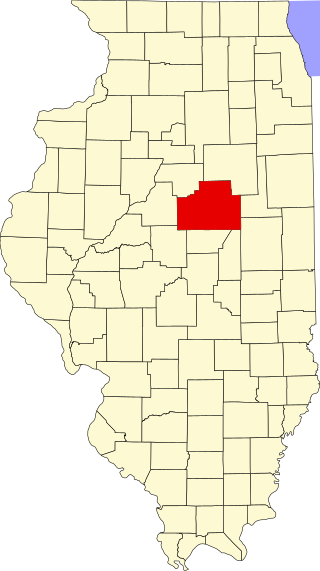
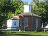
This is a list of the National Register of Historic Places listings in McLean County, Illinois.

This is a list of the National Register of Historic Places listings in Big Horn County, Wyoming.

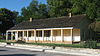
This is a list of the National Register of Historic Places listings in Whiteside County, Illinois.
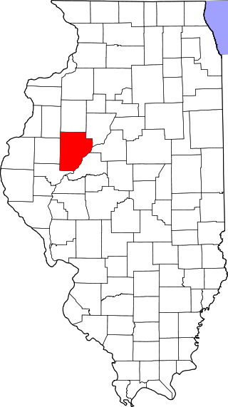
This is a list of the National Register of Historic Places listings in Fulton County, Illinois.
This is a list of the National Register of Historic Places listings in Madison County, Illinois.

This is a list of the National Register of Historic Places listings in LaSalle County, Illinois.

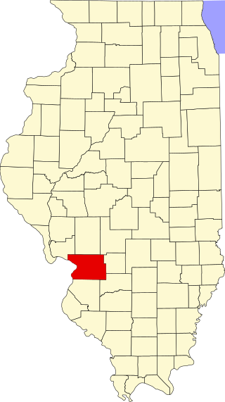
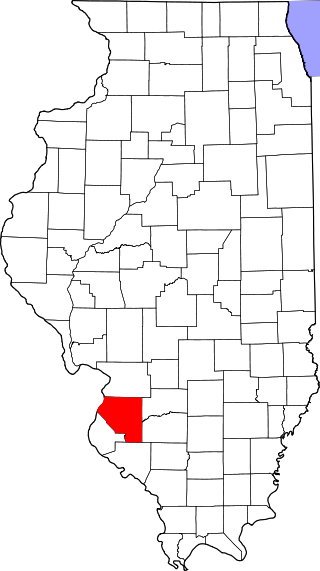
This is a list of the National Register of Historic Places listings in Jersey County, Illinois.

This is a list of the National Register of Historic Places listings in Pike County, Illinois.
This is a list of the National Register of Historic Places listings in St. Clair County, Illinois.

This is a list of the National Register of Historic Places listings in Kankakee County, Illinois.
This is a list of the National Register of Historic Places listings in White County, Illinois.
This is a list of the National Register of Historic Places listings in Crawford County, Illinois.

This is a list of the National Register of Historic Places listings in Calhoun County, Illinois.

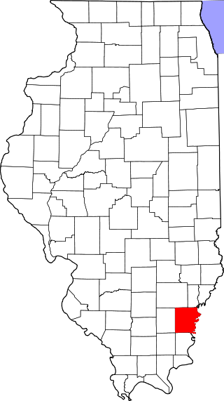
This is a list of the National Register of Historic Places listings in Union County, Illinois.

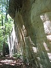
The Piney Creek Site is a prehistoric rock art site located on the north side of Piney Creek in Piney Creek Ravine State Natural Area in Randolph County, Illinois. The site consists of a sandstone outcropping with over 150 petroglyph and pictograph designs, the most at a single known site in Illinois. The designs are divided into four distinct groups; three of these are on the center and ends of the rock shelter's wall, while the fourth is on a joint block of sandstone within the shelter. Most of the designs were created during the Late Woodland and Mississippian periods, which spanned from 450 to 1550 A.D.; a number of the figures were added after 1550. A 1 metre tall spear-holding anthropomorph in the western group is the largest individual petroglyph in Illinois. In addition to anthropomorphs, other common designs at the site include zoomorphs, quadrupeds which probably represent deer, and symbols; the quadrupeds and anthropomorphs are frequently depicted in motion. The rock shelter was likely used as a religious site by prehistoric inhabitants, and several of the designs appear to have mystical or spiritual significance; for instance, the winged anthropomorphs likely represent shamans.

The Piney Creek South Site is a prehistoric rock art site located on the south side of Piney Creek in Piney Creek Ravine State Natural Area in Randolph County, Illinois. The site consists of two groups of petroglyphs drawn on a sandstone rockshelter. The petroglyphs most likely date from the Late Woodland period, which lasted from 450 to 900 A.D. The larger petroglyph group contains ten designs: four anthropomorphs, a quadruped resembling a deer, three crosses, and two pits. The four designs in the smaller group include two anthropomorphs, a group of pits extending from an anthropomorph's head, and a pecked area. Several of the anthropomorphs appear to have wings, two are carrying shields or rattles, one appears to have a beak, and one may have a crude penis. The site likely had spiritual significance, and the anthropomorphs may represent shamans, who were frequently depicted with wings in Native American art.
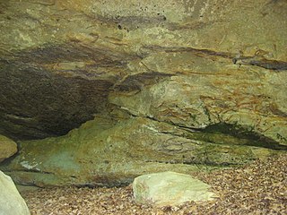
The Piney Creek West Site is a prehistoric rock art site located north of Piney Creek in Piney Creek Ravine State Natural Area in Randolph County, Illinois. The site consists of four petroglyphs painted on the inside of a rock shelter and a pictograph painted on the outside. The interior petroglyphs include an abstract shape, two curved lines, and a serpentine line with a pit at one end; two of the petroglyphs are filled in with ochre pigment, representing the only intact example of this painting technique in Illinois. The pictograph, which has deteriorated badly, depicts a human left hand; nearby flecks of paint from an unrecognizably faded figure likely indicate the site of the right hand. The paintings were likely added during the Late Woodland period, which lasted from 450 to 900 A.D. The serpentine figure inside the shelter suggests that the site had spiritual significance, as it resembles other prehistoric rock art depicting shamanic trance states.

The Tegtmeyer Site is a prehistoric rock art site located north of Piney Creek in Piney Creek Ravine State Natural Area in Randolph County, Illinois. The site consists of two petroglyphs painted on a sandstone rock shelter. One petroglyph depicts a winged anthropomorph in flight, while the other depicts a winged zoomorph which may also be flying. Based on their similarity to other sites from the period, the petroglyphs at the site most likely date from the Mississippian period. The petroglyphs resemble some of the figures painted at the nearby Piney Creek Site; given that the Tegtmeyer Site was unsuitable for inhabitation, it was most likely used for additional paintings which could not fit at the Piney Creek Site.