National Register of Historic Places listings in Madison County, Illinois

Last updated

Location of Madison County in Illinois Map of Illinois highlighting Madison County.svg
Location of Madison County in Illinois

This is a list of the National Register of Historic Places listings in Madison County, Illinois.

Contents

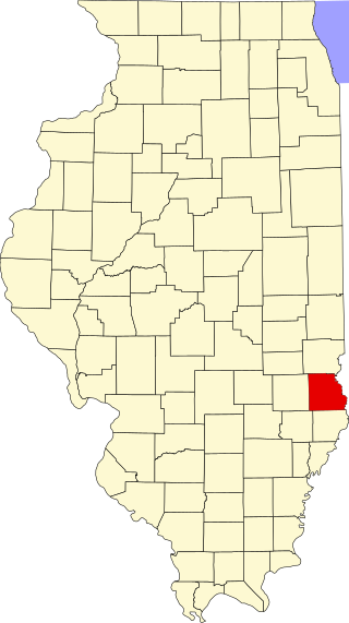
This is intended to be a complete list of the properties and districts on the National Register of Historic Places in Madison County, Illinois, United States. Latitude and longitude coordinates are provided for many National Register properties and districts; these locations may be seen together in a map. [1]

There are 43 properties and districts listed on the National Register in the county, including 2 National Historic Landmarks. Another two properties were once listed but have been removed.


    This National Park Service list is complete through NPS recent listings posted April 12, 2024. [2]

Current listings

[3] Name on the RegisterImageDate listed [4] Location City or townDescription
1 Alton Chapter House
Alton Chapter House Alton Chapter House.jpg
Alton Chapter House
November 28, 1980
(#80001388)
509 Beacon St.
38°53′35″N90°11′24″W / 38.893194°N 90.190000°W / 38.893194; -90.190000 (Alton Chapter House)
Alton
2 Alton Gas & Electric Power House
Alton Gas & Electric Power House Abbott Machine Co. building.jpg
Alton Gas & Electric Power House
August 28, 2019
(#100004309)
700 W. Broadway
38°53′39″N90°11′47″W / 38.8942°N 90.1963°W / 38.8942; -90.1963 (Alton Gas & Electric Power House)
Alton
3 Alton Military Prison Site
Alton Military Prison Site Alton Military Prison remains.jpg
Alton Military Prison Site
December 31, 1974
(#74000766)
Inside the block bounded by Broadway and William, 4th, and Mill Sts. [5]
38°53′29″N90°11′22″W / 38.891389°N 90.189444°W / 38.891389; -90.189444 (Alton Military Prison Site)
Alton
4 Alton National Cemetery
Alton National Cemetery Alton National Cemetery.jpg
Alton National Cemetery
May 5, 2011
(#11000245)
600 Pearl St.
38°53′26″N90°09′48″W / 38.890556°N 90.163333°W / 38.890556; -90.163333 (Alton National Cemetery)
Alton
5 Berleman House
Berleman House Berleman House front.jpg
Berleman House
March 27, 1980
(#80001391)
115 S. Main St.
38°48′39″N89°57′21″W / 38.810750°N 89.955833°W / 38.810750; -89.955833 (Berleman House)
Edwardsville
6 Bethalto Village Hall
Bethalto Village Hall Bethalto Village Hall.jpg
Bethalto Village Hall
December 2, 1987
(#87002049)
124 Main St.
38°54′36″N90°02′31″W / 38.910000°N 90.041806°W / 38.910000; -90.041806 (Bethalto Village Hall)
Bethalto
7 Brooks Catsup Bottle Water Tower
Brooks Catsup Bottle Water Tower Catsup bottle 5 27 2006 171.jpg
Brooks Catsup Bottle Water Tower
August 13, 2002
(#02000847)
800 South Morrison Ave.
38°39′46″N89°58′56″W / 38.662878°N 89.982267°W / 38.662878; -89.982267 (Brooks Catsup Bottle Water Tower)
Collinsville
8 Cahokia Mounds
Cahokia Mounds Atop-monks-mound.JPG
Cahokia Mounds
October 15, 1966
(#66000899)
7850 Collinsville Rd., Cahokia Mounds State Park
38°39′36″N90°03′44″W / 38.660000°N 90.062222°W / 38.660000; -90.062222 (Cahokia Mounds)
Collinsville World Heritage Site. Extends into St. Clair County
9 John Carney House
John Carney House John Carney House.jpg
John Carney House
July 28, 1983
(#83000327)
306 E. Market St.
38°43′44″N89°52′44″W / 38.728889°N 89.878889°W / 38.728889; -89.878889 (John Carney House)
Troy
10 Chain of Rocks Bridge
Chain of Rocks Bridge ChainOfRocksBridge StLouisMO.jpg
Chain of Rocks Bridge
December 1, 2006
(#06001091)
West Chain of Rocks Rd.
38°45′41″N90°10′26″W / 38.761389°N 90.173889°W / 38.761389; -90.173889 (Chain of Rocks Bridge)
Madison
11 Christian Hill Historic District
Christian Hill Historic District Fourth northwest of William, Christian Hill.jpg
Christian Hill Historic District
May 22, 1978
(#78001165)
Roughly bounded by Broadway, Belle, 7th, Cliff, Bluff, and State Sts.
38°53′42″N90°11′32″W / 38.895000°N 90.192222°W / 38.895000; -90.192222 (Christian Hill Historic District)
Alton
12 Daniel Dove Collins House
Daniel Dove Collins House Daniel Dove Collins House.jpg
Daniel Dove Collins House
November 21, 2002
(#02001385)
621 W. Main St.
38°40′04″N89°59′37″W / 38.667778°N 89.993611°W / 38.667778; -89.993611 (Daniel Dove Collins House)
Collinsville
13 Collinsville City Hall and Fire Station
Collinsville City Hall and Fire Station Collinsville City Hall and Fire Station.jpg
Collinsville City Hall and Fire Station
August 20, 2004
(#04000865)
125 S. Center St.
38°40′09″N89°59′10″W / 38.669167°N 89.986111°W / 38.669167; -89.986111 (Collinsville City Hall and Fire Station)
Collinsville
14 Collinsville Masonic Temple Lodge No. 712 A.F. & A.M.
Collinsville Masonic Temple Lodge No. 712 A.F. & A.M. Collinsville Masonic Temple.jpg
Collinsville Masonic Temple Lodge No. 712 A.F. & A.M.
May 22, 2005
(#05000430)
213 W. Clay St.
38°40′14″N89°59′19″W / 38.670556°N 89.988611°W / 38.670556; -89.988611 (Collinsville Masonic Temple Lodge No. 712 A.F. & A.M.)
Collinsville
15 Collinsville Township High School August 21, 2023
(#100009253)
1203 Vandalia St.
38°40′58″N89°58′40″W / 38.6827°N 89.9777°W / 38.6827; -89.9777 (Collinsville Township High School)
Collinsville
16 Edwardsville Chapter House
Edwardsville Chapter House Edwardsville Chapter House.jpg
Edwardsville Chapter House
November 28, 1980
(#80001392)
515 W. High St.
38°48′51″N89°57′43″W / 38.814028°N 89.961806°W / 38.814028; -89.961806 (Edwardsville Chapter House)
Edwardsville
17 Emmert-Zippel House
Emmert-Zippel House Emmert-Zippel House.jpg
Emmert-Zippel House
May 2, 1996
(#96000511)
3279 Maryville Rd., 2 miles (3.2 km) north of Illinois Route 162
38°43′20″N90°06′14″W / 38.722222°N 90.103889°W / 38.722222; -90.103889 (Emmert-Zippel House)
Granite City
18 Glen Carbon Grade School
Glen Carbon Grade School Glen Carbon Grade School Front.JPG
Glen Carbon Grade School
August 25, 2014
(#14000507)
124 School St.
38°44′55″N89°58′43″W / 38.748590°N 89.978648°W / 38.748590; -89.978648 (Glen Carbon Grade School)
Glen Carbon
19 Glen Carbon Village Hall and Firehouse April 19, 2018
(#100002326)
180 Summit Ave.
38°44′56″N89°58′46″W / 38.748800°N 89.979549°W / 38.748800; -89.979549 (Glen Carbon Village Hall and Firehouse)
Glen Carbon
20 Benjamin Godfrey Memorial Chapel
Benjamin Godfrey Memorial Chapel Godfrey Memorial Chapel HABS.jpg
Benjamin Godfrey Memorial Chapel
May 10, 1979
(#79000856)
Godfrey Rd.
38°57′01″N90°11′29″W / 38.950397°N 90.191519°W / 38.950397; -90.191519 (Benjamin Godfrey Memorial Chapel)
Godfrey
21 Granite City YMCA
Granite City YMCA Granite City YMCA (34307718933).jpg
Granite City YMCA
September 5, 2017
(#100001564)
2001 Edison Ave.
38°42′06″N90°08′56″W / 38.70179°N 90.148912°W / 38.70179; -90.148912 (Granite City YMCA)
Granite City
22 Guertler House
Guertler House Guertler House front.jpg
Guertler House
July 30, 1974
(#74000767)
101 Blair St.
38°54′03″N90°10′58″W / 38.900833°N 90.182778°W / 38.900833; -90.182778 (Guertler House)
Alton
23 Haskell Playhouse
Haskell Playhouse Haskell Playhouse.jpg
Haskell Playhouse
July 30, 1974
(#74000768)
Henry St. in Haskell Park
38°53′55″N90°10′33″W / 38.898611°N 90.175972°W / 38.898611; -90.175972 (Haskell Playhouse)
Alton
24 Horseshoe Lake Mound and Village Site
Horseshoe Lake Mound and Village Site Horseshoe Lake Village.jpg
Horseshoe Lake Mound and Village Site
November 26, 1980
(#80001396)
Southwest of the junction of Illinois Route 111 and Horseshoe Lake Rd. [6]
38°42′15″N90°04′07″W / 38.704167°N 90.068611°W / 38.704167; -90.068611 (Horseshoe Lake Mound and Village Site)
Granite City
25 Hotel Stratford
Hotel Stratford Hotel Stratford in Alton.jpg
Hotel Stratford
January 27, 2000
(#99001709)
229 Market St.
38°53′27″N90°11′06″W / 38.890833°N 90.185000°W / 38.890833; -90.185000 (Hotel Stratford)
Alton
26 William W. Jarvis House
William W. Jarvis House William W. Jarvis House.jpg
William W. Jarvis House
February 3, 1988
(#87002514)
317 E. Center St.
38°43′36″N89°52′36″W / 38.726667°N 89.876667°W / 38.726667; -89.876667 (William W. Jarvis House)
Troy
27 Kuhn Station Site
Kuhn Station Site Kuhn Station Site.jpg
Kuhn Station Site
November 25, 1980
(#80001393)
Rosewood Hills Dr. [7]
38°47′11″N89°51′38″W / 38.786389°N 89.860556°W / 38.786389; -89.860556 (Kuhn Station Site)
Edwardsville
28 LeClaire Historic District
LeClaire Historic District Cottages on Holyoke, Edwardsville.jpg
LeClaire Historic District
August 8, 1979
(#79000855)
Roughly bounded by the railroad tracks, Wolf St., and Hadley and Madison
38°48′00″N89°57′00″W / 38.800000°N 89.950000°W / 38.800000; -89.950000 (LeClaire Historic District)
Edwardsville
29 Marine Chapter House
Marine Chapter House Marine Chapter House.jpg
Marine Chapter House
November 28, 1980
(#80001397)
Silver St.
38°47′20″N89°46′36″W / 38.788889°N 89.776667°W / 38.788889; -89.776667 (Marine Chapter House)
Marine
30 Middletown Historic District
Middletown Historic District Beall summer.jpg
Middletown Historic District
July 11, 1978
(#78001166)
Roughly bounded by Broadway, Market, Alton, Franklin, Common, Liberty, Humboldt, and Plum Sts.; also 3rd St. between Market and Piasa St.; also roughly bounded by Front, State, Fourth, Market, Broadway, Third, Alby, Langdon, and Ridge Sts.
38°53′41″N90°10′28″W / 38.894722°N 90.174444°W / 38.894722; -90.174444 (Middletown Historic District)
Alton Second and third sets of boundaries represents boundary increases of September 16, 1982 and January 4, 2022
31 Miners Institute Building
Miners Institute Building Miners' Institute, Collinsville.jpg
Miners Institute Building
August 29, 1985
(#85001913)
204 W. Main
38°40′10″N89°59′15″W / 38.669444°N 89.9875°W / 38.669444; -89.9875 (Miners Institute Building)
Collinsville
32 Mitchell Archeological Site
Mitchell Archeological Site Mitchell Archaeological Site.jpg
Mitchell Archeological Site
February 7, 1978
(#78001168)
Western end of University Dr. [8]
38°45′32″N90°05′10″W / 38.758889°N 90.086111°W / 38.758889; -90.086111 (Mitchell Archeological Site)
Mitchell A boundary increase was approved April 15, 2024.
33 Mount Lookout
Mount Lookout McPike Mansion.jpg
Mount Lookout
June 17, 1980
(#80001389)
2018 Alby Street
38°54′21″N90°11′01″W / 38.905833°N 90.183611°W / 38.905833; -90.183611 (Mount Lookout)
Alton
34 Narodni Sin
Narodni Sin Narodni Sin.JPG
Narodni Sin
November 21, 2002
(#02001353)
209-211 E. Vandalia
38°48′49″N89°57′13″W / 38.813611°N 89.953611°W / 38.813611; -89.953611 (Narodni Sin)
Edwardsville
35 Post House
Post House Post House in Alton.jpg
Post House
May 28, 1980
(#80001390)
1516 State St.
38°54′22″N90°11′43″W / 38.906111°N 90.195278°W / 38.906111; -90.195278 (Post House)
Alton
36 Salem Baptist Church
Salem Baptist Church Salem Baptist Church north of Alton.jpg
Salem Baptist Church
December 31, 2013
(#13001004)
2001 Seiler Rd.
38°58′01″N90°07′21″W / 38.967083°N 90.122500°W / 38.967083; -90.122500 (Salem Baptist Church)
Alton
37 St. Louis Street Historic District
St. Louis Street Historic District E.M.West (627) and Ralph Griffin (705) Houses.jpg
St. Louis Street Historic District
May 9, 1983
(#83000328)
603-1306 St. Louis St.
38°48′39″N89°58′07″W / 38.810833°N 89.968611°W / 38.810833; -89.968611 (St. Louis Street Historic District)
Edwardsville
38 State Bank Building
State Bank Building State Bank, Collinsville.jpg
State Bank Building
April 23, 2010
(#09000233)
102 W. Main St.
38°48′25″N89°57′09″W / 38.806944°N 89.9525°W / 38.806944; -89.9525 (State Bank Building)
Collinsville
39 Benjamin Stephenson House
Benjamin Stephenson House Benjamin Stephenson House (front).JPG
Benjamin Stephenson House
May 31, 1980
(#80001395)
409 S. Buchanan St.
38°48′25″N89°57′09″W / 38.806944°N 89.9525°W / 38.806944; -89.9525 (Benjamin Stephenson House)
Edwardsville
40 Lyman Trumbull House
Lyman Trumbull House Lyman Trumbull House.jpg
Lyman Trumbull House
May 15, 1975
(#75000667)
1105 Henry St.
38°53′51″N90°10′34″W / 38.897500°N 90.176111°W / 38.897500; -90.176111 (Lyman Trumbull House)
Alton
41 Upper Alton Historic District
Upper Alton Historic District Evergreen north of College, Alton.jpg
Upper Alton Historic District
May 2, 1978
(#78001167)
Seminary St., College, Leverett, and Evergreen Aves.
38°54′17″N90°08′34″W / 38.904722°N 90.142778°W / 38.904722; -90.142778 (Upper Alton Historic District)
Alton
42 John Weir House
John Weir House John Weir House in Edwardsville.jpg
John Weir House
May 9, 1983
(#83000329)
715 N. Main St.
38°48′59″N89°57′42″W / 38.816389°N 89.961667°W / 38.816389; -89.961667 (John Weir House)
Edwardsville
43 Yakel House and Union Brewery
Yakel House and Union Brewery Yakel House and Union Brewery complex.jpg
Yakel House and Union Brewery
May 11, 1982
(#82002585)
1421-1431 Pearl St.
38°53′35″N90°09′51″W / 38.893056°N 90.164167°W / 38.893056; -90.164167 (Yakel House and Union Brewery)
Alton

Former listing

[3] Name on the RegisterImageDate listedDate removedLocation City or townDescription
1 Madison County Sheriff's House and Jail
Madison County Sheriff's House and Jail Edwardsville central bus station.jpg
Madison County Sheriff's House and Jail
May 31, 1980
(#80001394)
January 2, 2020210 N. Main St.
38°48′48″N89°57′27″W / 38.813333°N 89.9575°W / 38.813333; -89.9575 (Madison County Sheriff's House and Jail)
Edwardsville
2 Rutherford House March 19, 1982
(#82002584)
December 8, 19951006 Pearl St.
Alton Demolished in June, 1995.

See also

Related Research Articles

<span class="mw-page-title-main">National Register of Historic Places listings in New Haven County, Connecticut</span>

This is a list of the National Register of Historic Places listings in New Haven County, Connecticut. It is intended to be a complete list of the properties and districts on the National Register of Historic Places in New Haven County, Connecticut, United States. The locations of National Register properties and districts for which the latitude and longitude coordinates are included below, may be seen in an online map.

<span class="mw-page-title-main">National Register of Historic Places listings in Adams County, Illinois</span>

This is a list of the National Register of Historic Places listings in Adams County, Illinois.

<span class="mw-page-title-main">National Register of Historic Places listings in Whiteside County, Illinois</span>

This is a list of the National Register of Historic Places listings in Whiteside County, Illinois.

<span class="mw-page-title-main">National Register of Historic Places listings in Fulton County, Illinois</span>

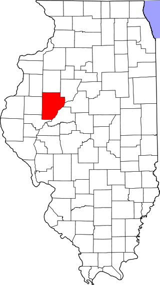
This is a list of the National Register of Historic Places listings in Fulton County, Illinois.

<span class="mw-page-title-main">National Register of Historic Places listings in LaSalle County, Illinois</span>

This is a list of the National Register of Historic Places listings in LaSalle County, Illinois.

<span class="mw-page-title-main">National Register of Historic Places listings in Peoria County, Illinois</span>

This is a list of the National Register of Historic Places listings in Peoria County, Illinois.

<span class="mw-page-title-main">National Register of Historic Places listings in Jersey County, Illinois</span>

This is a list of the National Register of Historic Places listings in Jersey County, Illinois.

<span class="mw-page-title-main">National Register of Historic Places listings in Pike County, Illinois</span>

This is a list of the National Register of Historic Places listings in Pike County, Illinois.

<span class="mw-page-title-main">National Register of Historic Places listings in Randolph County, Illinois</span>

This is a list of the National Register of Historic Places listings in Randolph County, Illinois.

<span class="mw-page-title-main">National Register of Historic Places listings in St. Clair County, Illinois</span>

This is a list of the National Register of Historic Places listings in St. Clair County, Illinois.

<span class="mw-page-title-main">National Register of Historic Places listings in Greene County, Illinois</span>

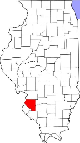
This is a list of the National Register of Historic Places listings in Greene County, Illinois.

<span class="mw-page-title-main">National Register of Historic Places listings in Jackson County, Illinois</span>

This is a list of the National Register of Historic Places listings in Jackson County, Illinois.

<span class="mw-page-title-main">National Register of Historic Places listings in Kankakee County, Illinois</span>

This is a list of the National Register of Historic Places listings in Kankakee County, Illinois.

<span class="mw-page-title-main">National Register of Historic Places listings in Kendall County, Illinois</span>

This is a list of the National Register of Historic Places listings in Kendall County, Illinois.

<span class="mw-page-title-main">National Register of Historic Places listings in White County, Illinois</span>

This is a list of the National Register of Historic Places listings in White County, Illinois.

<span class="mw-page-title-main">National Register of Historic Places listings in Monroe County, Illinois</span>

This is a list of the National Register of Historic Places listings in Monroe County, Illinois.

<span class="mw-page-title-main">National Register of Historic Places listings in Alexander County, Illinois</span>

This is a list of the National Register of Historic Places listings in Alexander County, Illinois.

<span class="mw-page-title-main">National Register of Historic Places listings in Gallatin County, Illinois</span>

This is a list of the National Register of Historic Places listings in Gallatin County, Illinois.

<span class="mw-page-title-main">National Register of Historic Places listings in Crawford County, Illinois</span>

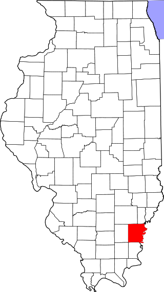
This is a list of the National Register of Historic Places listings in Crawford County, Illinois.

<span class="mw-page-title-main">National Register of Historic Places listings in Calhoun County, Illinois</span>

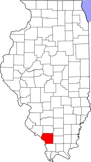
This is a list of the National Register of Historic Places listings in Calhoun County, Illinois.

References

  1. The latitude and longitude information provided in this table was derived originally from the National Register Information System, which has been found to be fairly accurate for about 99% of listings. Some locations in this table may have been corrected to current GPS standards.
  2. National Park Service, United States Department of the Interior, "National Register of Historic Places: Weekly List Actions", retrieved April 12, 2024.
  3. 1 2 Numbers represent an alphabetical ordering by significant words. Various colorings, defined here, differentiate National Historic Landmarks and historic districts from other NRHP buildings, structures, sites or objects.
  4. The eight-digit number below each date is the number assigned to each location in the National Register Information System database, which can be viewed by clicking the number.
  5. Means, Ruth, and P.H. Poehner. National Register of Historic Places Inventory/Nomination: Alton Military Prison Site. National Park Service, 1973-11-30, 10.
  6. Wagner, Mark. National Register of Historic Places Inventory/Nomination: Horseshoe Lake Mound and Village Site. National Park Service, 1980-08-18, 6.
  7. van Hartesveldt, Eric N. National Register of Historic Places Inventory/Nomination: Kuhn Station Site. National Park Service, 1980-07-25, 6.
  8. Bodner, Connie. National Register of Historic Places Inventory/Nomination: Mitchell Archeological Site. National Park Service, 1976-08, 5.