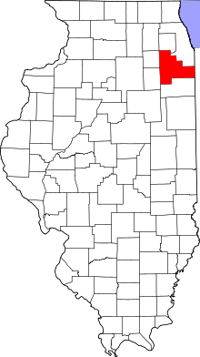
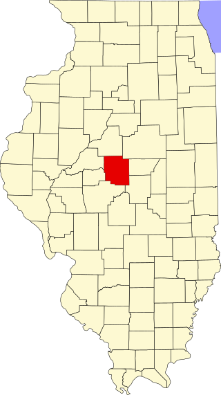
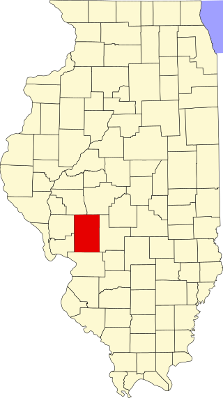
This is intended to be a complete list of the properties and districts on the National Register of Historic Places in Will County, Illinois, United States. Latitude and longitude coordinates are provided for many National Register properties and districts; these locations may be seen together in a map.[1]
There are 40 properties and districts listed on the National Register in the county, including 1 National Historic Landmark. Another property was once listed but has been removed.
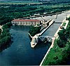
This is the section of former U.S. Route 66 that traveled from Wilmington to Joliet. The road mostly traverses agricultural land, but does pass the former Joliet Army Ammunition Plant. Most of this 15.9-mile (25.6km) stretch has been re-designated Illinois Route 53. One bridge, one overpass, and Four concrete box culverts along the road are also included in the listing.
The mounds are an archeological site located along the north side of the Des Plaines River. Surveys and excavations from 1938 to 1964 revealed Mississippian pottery and bodies dating from 1200-1500 AD.
The church was built in 1885 to serve the Episcopalian religious congregation. Designed by F. S. Allen, the congregation met in the church until 2004. It was destroyed in a 2006 fire.[6]
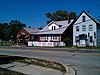
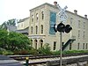
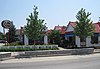
The Illinois Central Railroad opened in 1856 with a station in eastern Will County. The surrounding area became known as Peotone and featured a lively commercial district along the tracks. This district later expanded in response to growing use of automobiles.
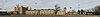
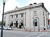
Eagle Hotel opened in the late 1830s to accommodate farmers traveling to Wilmington to use the local grist mill. The Chicago and Alton Railroad and U.S. Route 66 were later constructed near the hotel, providing further commerce. The interior was badly damaged in a 1990 fire.
This is a list of the National Register of Historic Places listings in DuPage County, Illinois.
This is a list of the National Register of Historic Places listings in Winnebago County, Illinois.
This is a list of the National Register of Historic Places listings in Marion County, Illinois.
This is a list of the National Register of Historic Places listings in Adams County, Illinois.
This is intended to be a complete list of the properties and districts on the National Register of Historic Places in Champaign County, Illinois, United States. Latitude and longitude coordinates are provided for many National Register properties and districts; these locations may be seen together in a map.
This is a list of the National Register of Historic Places listings in Kane County, Illinois.
This is a list of the National Register of Historic Places listings in LaSalle County, Illinois.
This is a list of the National Register of Historic Places listings in Henry County, Illinois.
This is a list of the National Register of Historic Places listings in Kankakee County, Illinois.
This is a list of the National Register of Historic Places listings in Logan County, Illinois.
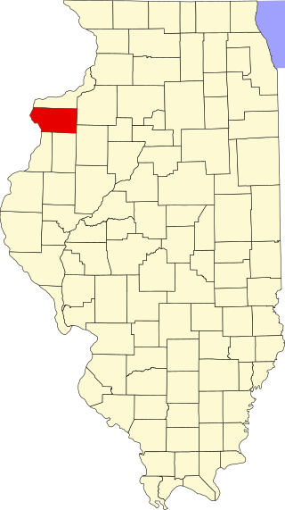
This is a list of the National Register of Historic Places listings in Warren County, Illinois.
This is a list of the National Register of Historic Places listings in Mercer County, Illinois.
This is a list of the National Register of Historic Places listings in Clark County, Illinois.
This is a list of the National Register of Historic Places listings in Alexander County, Illinois.
This is a list of the National Register of Historic Places listings in Morgan County, Illinois.
This is a list of the National Register of Historic Places listings in Woodford County, Illinois.
This is a list of the National Register of Historic Places listings in Macoupin County, Illinois.
This is a list of the National Register of Historic Places listings in McDonough County, Illinois.
This is a list of the National Register of Historic Places listings in Knox County, Illinois.
This is a list of the National Register of Historic Places listings in Grundy County, Illinois.
↑ The latitude and longitude information provided in this table was derived originally from the National Register Information System, which has been found to be fairly accurate for about 99% of listings. Some locations in this table may have been corrected to current GPS standards.
1 2 Numbers represent an alphabetical ordering by significant words. Various colorings, defined here, differentiate National Historic Landmarks and historic districts from other NRHP buildings, structures, sites or objects.
↑ The eight-digit number below each date is the number assigned to each location in the National Register Information System database, which can be viewed by clicking the number.
↑ Maruszak, Kathleen, and Debi A. Jones. National Register of Historic Places Inventory/Nomination: Briscoe Mounds. National Park Service, 1978-07, 9.
This page is based on this Wikipedia article Text is available under the CC BY-SA 4.0 license; additional terms may apply. Images, videos and audio are available under their respective licenses.