National Register of Historic Places listings in DuPage County, Illinois

Last updated

Location of DuPage County in Illinois Map of Illinois highlighting DuPage County.svg
Location of DuPage County in Illinois

This is a list of the National Register of Historic Places listings in DuPage County, Illinois.

Contents

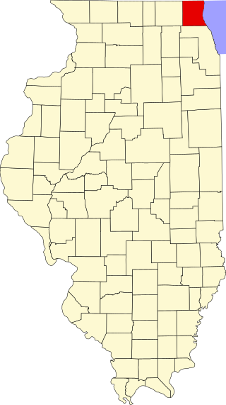
This is intended to be a complete list of the properties and districts on the National Register of Historic Places in DuPage County, Illinois, United States. Latitude and longitude coordinates are provided for many National Register properties and districts; these locations may be seen together in a map. [1]

There are 48 properties and districts listed on the National Register in the county. Another three properties were once listed but have been removed.


    This National Park Service list is complete through NPS recent listings posted December 1, 2023. [2]

Map all coordinates using: OpenStreetMap

Current listings

[3] Name on the Register [4] ImageDate listed [5] Location City or townDescription
1 Adams Memorial Library
Adams Memorial Library AdamsMemorial.JPG
Adams Memorial Library
June 4, 1981
(#81000675)
102 East Wesley St.
41°51′57″N88°06′23″W / 41.865972°N 88.106389°W / 41.865972; -88.106389 (Adams Memorial Library)
Wheaton 
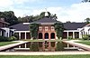
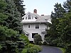
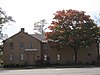
The library was designed by Charles Sumner Frost in 1891. It was the only library in the area until 1965. Later that year it was converted to the DuPage County Historical Museum.
2 Ardmore Avenue Train Station
Ardmore Avenue Train Station ArdmoreStation.JPG
Ardmore Avenue Train Station
November 21, 1980
(#80004525)
10 W. Park Ave.
41°53′00″N87°58′46″W / 41.883333°N 87.979583°W / 41.883333; -87.979583 (Ardmore Avenue Train Station)
Villa Park One of the few Chicago Aurora and Elgin Railroad stations still standing.
3 George Baker House
George Baker House GeorgeBakerHouse.JPG
George Baker House
March 1, 2010
(#10000038)
1 S. 500 Taylor Rd.
41°51′02″N88°03′20″W / 41.850417°N 88.055694°W / 41.850417; -88.055694 (George Baker House)
Milton Township The house of an early settler to DuPage County.
4 Orland P. Bassett House
Orland P. Bassett House Orland P. Bassett House.JPG
Orland P. Bassett House
December 7, 2004
(#04001299)
329 E. Sixth St.
41°47′55″N87°55′18″W / 41.798611°N 87.921667°W / 41.798611; -87.921667 (Orland P. Bassett House)
Hinsdale 
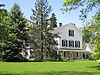
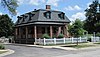
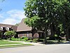
Home of Orland P. Bassett, who is credited as the first person to distribute the American Beauty rose. His company became the largest employer in Hinsdale.
5 Big Woods School
Big Woods School The Big Woods School.jpg
Big Woods School
April 21, 2016
(#16000197)
3033 N. Eola Rd.
41°48′56″N88°13′55″W / 41.815525°N 88.231881°W / 41.815525; -88.231881 (Big Woods School)
Aurora
6 Blanchard Hall
Blanchard Hall WheatonCollege.jpg
Blanchard Hall
November 14, 1979
(#79000836)
Wheaton College campus
41°52′07″N88°05′58″W / 41.868611°N 88.099444°W / 41.868611; -88.099444 (Blanchard Hall)
Wheaton The oldest building at Wheaton College, named after its founder Jonathan Blanchard. The architecture is meant to evoke the buildings at Oxford University.
7 Bloomingdale School–Village Hall
Bloomingdale School-Village Hall Bloomingdale School-Village Hall.JPG
Bloomingdale School–Village Hall
October 28, 1994
(#94001263)
108 W. Lake St.
41°57′26″N88°04′56″W / 41.957222°N 88.082222°W / 41.957222; -88.082222 (Bloomingdale School–Village Hall)
Bloomingdale A two-story, two-classroom schoolhouse from the early 20th century. It was used as the Bloomingdale Village Hall from 1938 to 1977.
8 Butler School
Butler School ButlerSchoolOakBrook.JPG
Butler School
May 9, 2003
(#03000355)
1200 31st. St. (Oak Brook Rd.)
41°50′05″N87°56′46″W / 41.834722°N 87.946111°W / 41.834722; -87.946111 (Butler School)
Oak Brook A two-room schoolhouse in the Georgian Revival style. The term "Oak Brook" for the surrounding community was first used in a meeting in the building.
8 Chicago Golf Club
Chicago Golf Club Wheaton chicagogolf.jpg
Chicago Golf Club
May 29, 2020
(#100005231)
25W253 Warrenville Rd.
41°50′56″N88°06′58″W / 41.849°N 88.116°W / 41.849; -88.116 (Chicago Golf Club)
Wheaton
9 Chicago Sanitary and Ship Canal Historic District
Chicago Sanitary and Ship Canal Historic District Chicago-Sanitary-and-Ship-Canal.jpg
Chicago Sanitary and Ship Canal Historic District
December 20, 2011
(#11000907)
Illinois Waterway miles 290.0-321.7
41°41′53″N87°57′13″W / 41.697942°N 87.953664°W / 41.697942; -87.953664 (Chicago Sanitary and Ship Canal Historic District)
Willow Springs and Lemont part of the Illinois Waterway Navigation System Facilities MPS; extends through the West Side of Chicago, Cook County west of Chicago and Will County to Lockport
10 Robert A. and Mary Childs House
Robert A. and Mary Childs House Robert A. and Mary Childs House.JPG
Robert A. and Mary Childs House
May 11, 2000
(#00000476)
318 S. Garfield Ave.
41°47′56″N87°55′40″W / 41.798889°N 87.927778°W / 41.798889; -87.927778 (Robert A. and Mary Childs House)
Hinsdale Home of Civil War veteran and U.S. Representative Robert A. Childs and his wife Mary.
11 Churchville School
Churchville School ChurchvilleSchool.JPG
Churchville School
February 5, 1999
(#99000114)
3N 784 Church Rd.
41°56′08″N87°57′14″W / 41.935556°N 87.953889°W / 41.935556; -87.953889 (Churchville School)
Bensenville A schoolhouse constructed in 1846.
12 William and Helen Coffeen House
William and Helen Coffeen House Image Coffeen House.jpg
William and Helen Coffeen House
December 22, 2014
(#14001066)
306 S. Garfield
41°47′58″N87°55′39″W / 41.799556°N 87.927627°W / 41.799556; -87.927627 (William and Helen Coffeen House)
Hinsdale
13 Avery Coonley School
Avery Coonley School ACS Building.jpg
Avery Coonley School
August 8, 2007
(#07000477)
1400 Maple Ave.
41°47′18″N88°01′13″W / 41.788381°N 88.020325°W / 41.788381; -88.020325 (Avery Coonley School)
Downers Grove A progressive school landscaped by Jens Jensen.
14 Dell Rhea's Chicken Basket
Dell Rhea's Chicken Basket Dell Rhea Chicken Basket sign.jpg
Dell Rhea's Chicken Basket
May 5, 2006
(#06000375)
645 Joliet Rd.
41°44′51″N87°56′22″W / 41.7475°N 87.939444°W / 41.7475; -87.939444 (Dell Rhea's Chicken Basket)
Willowbrook A restaurant on historic U.S. Route 66. Part of the Route 66 through Illinois Multiple Property Submission.
15 Downtown Hinsdale Historic District
Downtown Hinsdale Historic District Downtown Hinsdale Block.JPG
Downtown Hinsdale Historic District
May 30, 2006
(#06000011)
Roughly Bounded by Maple St., Lincoln St., Garfield St. and Second St.
41°48′09″N87°55′45″W / 41.802539°N 87.929278°W / 41.802539; -87.929278 (Downtown Hinsdale Historic District)
Hinsdale
16 DuPage County Courthouse
DuPage County Courthouse Old DuPage County Courthouse.jpg
DuPage County Courthouse
June 7, 1978
(#78003107)
200 Reber St.
41°51′50″N88°06′14″W / 41.863889°N 88.103889°W / 41.863889; -88.103889 (DuPage County Courthouse)
Wheaton
17 William H. Emery, Jr. House
William H. Emery, Jr. House William H. Emery, Jr. House 01.JPG
William H. Emery, Jr. House
May 12, 2004
(#04000421)
281 Arlington
41°53′39″N87°56′18″W / 41.894167°N 87.938333°W / 41.894167; -87.938333 (William H. Emery, Jr. House)
Elmhurst
18 First Church of Lombard
First Church of Lombard First Church of Lombard (Lombard, Illinois) 01.JPG
First Church of Lombard
August 10, 1978
(#78001144)
Maple and Main Sts.
41°52′59″N88°01′07″W / 41.883056°N 88.018611°W / 41.883056; -88.018611 (First Church of Lombard)
Lombard
19 Glen Ellyn Downtown North Historic District
Glen Ellyn Downtown North Historic District Image Glen Theater.jpg
Glen Ellyn Downtown North Historic District
September 18, 2013
(#13000716)
Main St., Crescent Blvd., & Pennsylvania Ave.
41°52′37″N88°04′00″W / 41.876975°N 88.066708°W / 41.876975; -88.066708 (Glen Ellyn Downtown North Historic District)
Glen Ellyn
20 Glen Ellyn Downtown South Historic District
Glen Ellyn Downtown South Historic District Image Firsy Metgodist Episcopal Church.jpg
Glen Ellyn Downtown South Historic District
September 18, 2013
(#13000717)
Main & Duane Sts., Hillside Ave.
41°52′30″N88°03′58″W / 41.875101°N 88.06616°W / 41.875101; -88.06616 (Glen Ellyn Downtown South Historic District)
Glen Ellyn
21 Glen Ellyn Main Street Historic District
Glen Ellyn Main Street Historic District Glen Ellyn Main Street Historic District.JPG
Glen Ellyn Main Street Historic District
October 29, 1984
(#84000204)
Main St. between Cottage Ave. and Hawthorne St.
41°52′49″N88°04′00″W / 41.880278°N 88.066667°W / 41.880278; -88.066667 (Glen Ellyn Main Street Historic District)
Glen Ellyn
22 Grand Theatre
Grand Theatre GrandTheatreWheaton.JPG
Grand Theatre
August 12, 2005
(#05000872)
123 N. Hale St.
41°51′56″N88°06′29″W / 41.865556°N 88.108056°W / 41.865556; -88.108056 (Grand Theatre)
Wheaton
23 Graue Mill
Graue Mill Graue Water Mill, York Road, Fullersburg vicinity (Du Page County, Illinois).jpg
Graue Mill
May 12, 1975
(#75002077)
NW of jct. of Spring and York Rds.
41°49′12″N87°55′40″W / 41.820000°N 87.927639°W / 41.820000; -87.927639 (Graue Mill)
Oak Brook
24 William L. Gregg House
William L. Gregg House Gregg Museum.JPG
William L. Gregg House
October 3, 1980
(#80004526)
115 S. Linden
41°47′35″N87°58′24″W / 41.793124°N 87.973264°W / 41.793124; -87.973264 (William L. Gregg House)
Westmont
25 Hauptgebaude
Hauptgebaude ElmhurstOldMain.JPG
Hauptgebaude
August 13, 1976
(#76002162)
190 Prospect St.
41°53′45″N87°56′43″W / 41.895833°N 87.945278°W / 41.895833; -87.945278 (Hauptgebaude)
Elmhurst
26 Frank B. Henderson House
Frank B. Henderson House Frank B. Henderson House (Elmhurst, Illinois) 01.JPG
Frank B. Henderson House
August 9, 2002
(#02000844)
301 S. Kenilworth
41°53′39″N87°56′18″W / 41.894167°N 87.938333°W / 41.894167; -87.938333 (Frank B. Henderson House)
Elmhurst
27 Samuel and Eleanor Himmelfarb House and Studio
Samuel and Eleanor Himmelfarb House and Studio Samuel and Eleanor Himmelfarb House and Studio.jpg
Samuel and Eleanor Himmelfarb House and Studio
October 4, 2018
(#100002417)
28W 120 Marion Rd.
41°51′54″N88°10′05″W / 41.8650°N 88.1680°W / 41.8650; -88.1680 (Samuel and Eleanor Himmelfarb House and Studio)
Winfield
28 Immanuel Evangelical Church
Immanuel Evangelical Church Immanuel Evangelical Church Hinsdale.JPG
Immanuel Evangelical Church
February 9, 2001
(#01000085)
302 S. Grant St.
41°47′57″N87°55′56″W / 41.799167°N 87.932222°W / 41.799167; -87.932222 (Immanuel Evangelical Church)
Hinsdale
29 Lake Ellyn Park
Lake Ellyn Park Lake-glen-ellyn-il.jpg
Lake Ellyn Park
February 7, 2017
(#100000628)
645 Lenox Rd.
41°52′58″N88°03′38″W / 41.882869°N 88.060475°W / 41.882869; -88.060475 (Lake Ellyn Park)
Glen Ellyn
30 Lilacia Park Historic District
Lilacia Park Historic District Lilacia Park Historic District.jpg
Lilacia Park Historic District
May 9, 2019
(#100003914)
150 S. Park Ave.
41°52′40″N88°14′24″W / 41.877778°N 88.24°W / 41.877778; -88.24 (Lilacia Park Historic District)
Lombard
31 McAuley School District No. 27
McAuley School District No. 27 McAuley27.JPG
McAuley School District No. 27
June 3, 1982
(#82004890)
Roosevelt Rd.
41°52′40″N88°14′24″W / 41.877778°N 88.24°W / 41.877778; -88.24 (McAuley School District No. 27)
West Chicago
32 Naperville Historic District
Naperville Historic District Naperville Historic District.JPG
Naperville Historic District
September 29, 1977
(#77001516)
Roughly bounded by Juilian, Highland, Chicago, Jackson, Eagle, and 5th Sts.
41°46′32″N88°09′07″W / 41.775556°N 88.151944°W / 41.775556; -88.151944 (Naperville Historic District)
Naperville
33 Francis Stuyvesant Peabody Estate
Francis Stuyvesant Peabody Estate Mayslake Peabody Estate - Mayslake Hall.JPG
Francis Stuyvesant Peabody Estate
February 18, 1994
(#93000836)
1717 W. 31st St.
41°49′44″N87°57′31″W / 41.828889°N 87.958611°W / 41.828889; -87.958611 (Francis Stuyvesant Peabody Estate)
Oak Brook
34 Francis Stuyvesant Peabody House
Francis Stuyvesant Peabody House Francis Stuyvesant Peabody House.JPG
Francis Stuyvesant Peabody House
November 8, 2000
(#00001330)
8 E. Third St.
41°47′59″N87°55′44″W / 41.799722°N 87.928889°W / 41.799722; -87.928889 (Francis Stuyvesant Peabody House)
Hinsdale
35 John L. Pentecost House
John L. Pentecost House John L. Pentecost House (Elmhurst, Illinois) 01.JPG
John L. Pentecost House
September 13, 2003
(#03000916)
259 Cottage Hill Ave.
41°53′38″N87°56′31″W / 41.893889°N 87.941944°W / 41.893889; -87.941944 (John L. Pentecost House)
Elmhurst
36 Pine Craig
Pine Craig Martin-Mitchell Mansion - Naper Settlement - Naperville Illinois.jpg
Pine Craig
August 15, 1975
(#75002076)
Aurora Rd. (Rte. 65)
41°46′10″N88°09′13″W / 41.769444°N 88.153611°W / 41.769444; -88.153611 (Pine Craig)
Naperville
37 Randecker's Hardware Store
Randecker's Hardware Store Randecker's Hardware Store.JPG
Randecker's Hardware Store
October 28, 1994
(#94001265)
112 S. Bloomingdale Rd.
41°57′23″N88°04′53″W / 41.956389°N 88.081389°W / 41.956389; -88.081389 (Randecker's Hardware Store)
Bloomingdale
38 Robinwood
Robinwood Robinwood (Elmhurst, Illinois) 01.JPG
Robinwood
January 21, 2004
(#03001463)
208 Arlington
41°53′49″N87°56′14″W / 41.896944°N 87.937222°W / 41.896944; -87.937222 (Robinwood)
Elmhurst
39 Robbins Park Historic District
Robbins Park Historic District Robbins Park Historic District.JPG
Robbins Park Historic District
November 26, 2008
(#08001098)
Bounded by Chicago Av, 8th St, County Line Rd, Garfield St
41°47′54″N87°55′18″W / 41.798333°N 87.921667°W / 41.798333; -87.921667 (Robbins Park Historic District)
Hinsdale
40 Alfred A. Schiller House
Alfred A. Schiller House Alfred A. Schiller House.JPG
Alfred A. Schiller House
September 3, 2008
(#08000326)
734 Lenox Rd.
41°53′11″N88°03′39″W / 41.886389°N 88.060833°W / 41.886389; -88.060833 (Alfred A. Schiller House)
Glen Ellyn Demolished in 2016
41 William and Jennette Sloane House
William and Jennette Sloane House William and Jeanette Sloan House.jpg
William and Jennette Sloane House
December 30, 2016
(#16000896)
248 S. Arlington Ave.
41°53′38″N87°56′12″W / 41.893783°N 87.936785°W / 41.893783; -87.936785 (William and Jennette Sloane House)
Elmhurst
42 Stacy's Tavern
Stacy's Tavern Stacy's Tavern.JPG
Stacy's Tavern
October 29, 1974
(#74002195)
Geneva Rd. and Main St.
41°53′23″N88°03′53″W / 41.889722°N 88.064722°W / 41.889722; -88.064722 (Stacy's Tavern)
Glen Ellyn
43 Trinity Episcopal Church
Trinity Episcopal Church TrinityEpiscopalWheaton.JPG
Trinity Episcopal Church
January 9, 1978
(#78003108)
130 N. West St.
41°51′57″N88°06′43″W / 41.865833°N 88.111944°W / 41.865833; -88.111944 (Trinity Episcopal Church)
Wheaton
44 Turner Town Hall
Turner Town Hall TurnerTownHall.JPG
Turner Town Hall
May 13, 1991
(#91000573)
132 Main St.
41°53′01″N88°12′15″W / 41.883611°N 88.204167°W / 41.883611; -88.204167 (Turner Town Hall)
West Chicago
45 Villa Avenue Train Station
Villa Avenue Train Station VillaParkStation.JPG
Villa Avenue Train Station
August 22, 1986
(#86001480)
220 S. Villa Ave.
41°53′08″N87°58′10″W / 41.885694°N 87.969444°W / 41.885694; -87.969444 (Villa Avenue Train Station)
Villa Park
46 Wayne Village Historic District
Wayne Village Historic District Wayne2011Snow.png
Wayne Village Historic District
December 29, 1978
(#78003106)
Irregular pattern along Army Trail Rd.
41°57′04″N88°14′46″W / 41.951111°N 88.246111°W / 41.951111; -88.246111 (Wayne Village Historic District)
Wayne
47 William Whitney House
William Whitney House William Whitney House.JPG
William Whitney House
October 19, 1989
(#89001731)
142 E. First St.
41°48′05″N87°55′28″W / 41.801389°N 87.924444°W / 41.801389; -87.924444 (William Whitney House)
Hinsdale

Former listings

[3] Name on the RegisterImageDate listedDate removedLocationCity or townDescription
1 Besch House July 27, 1979
(#79003161)
October 20, 1981O S 070 Church St.
Winfield Removed due to relocation.
2 Henry C. Middaugh House September 21, 1978
(#78003105)
August 14, 200466 Norfolk Ave.
41°48′07″N87°57′01″W / 41.8019°N 87.9503°W / 41.8019; -87.9503 (Henry C. Middaugh House)
Clarendon Hills Demolished in 2002. [6]
3 DuPage Theatre and DuPage Shoppes
DuPage Theatre and DuPage Shoppes DuPage Theater.jpeg
DuPage Theatre and DuPage Shoppes
November 20, 1987
(#87002047)
January 2, 2020101-109 S. Main St.
41°53′09″N88°01′04″W / 41.885833°N 88.017778°W / 41.885833; -88.017778 (DuPage Theatre and DuPage Shoppes)
Lombard Demolished in 2007 by the Board of Trustees of the Village of Lombard. [7]

See also

Related Research Articles

<span class="mw-page-title-main">National Register of Historic Places listings in Lake County, Illinois</span>

This is a list of the National Register of Historic Places listings in Lake County, Illinois.

<span class="mw-page-title-main">National Register of Historic Places listings in Ogle County, Illinois</span>

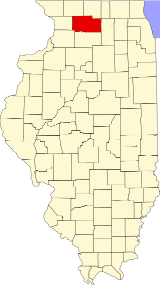
This is a list of the National Register of Historic Places listings in Ogle County, Illinois.

<span class="mw-page-title-main">National Register of Historic Places listings in Winnebago County, Illinois</span>

This is a list of the National Register of Historic Places listings in Winnebago County, Illinois.

<span class="mw-page-title-main">National Register of Historic Places listings in Sangamon County, Illinois</span>

This is a list of the National Register of Historic Places listings in Sangamon County, Illinois.

<span class="mw-page-title-main">National Register of Historic Places listings in Rock Island County, Illinois</span>

This is a list of the National Register of Historic Places listings in Rock Island County, Illinois.

<span class="mw-page-title-main">National Register of Historic Places listings in Coles County, Illinois</span>

This is a list of the National Register of Historic Places listings in Coles County, Illinois.

<span class="mw-page-title-main">National Register of Historic Places listings in Pike County, Illinois</span>

This is a list of the National Register of Historic Places listings in Pike County, Illinois.

<span class="mw-page-title-main">National Register of Historic Places listings in Randolph County, Illinois</span>

This is a list of the National Register of Historic Places listings in Randolph County, Illinois.

<span class="mw-page-title-main">National Register of Historic Places listings in Vermilion County, Illinois</span>

This is a list of properties on the National Register of Historic Places in Vermilion County, Illinois.

<span class="mw-page-title-main">National Register of Historic Places listings in Henry County, Illinois</span>

This is a list of the National Register of Historic Places listings in Henry County, Illinois.

<span class="mw-page-title-main">National Register of Historic Places listings in Jackson County, Illinois</span>

This is a list of the National Register of Historic Places listings in Jackson County, Illinois.

<span class="mw-page-title-main">National Register of Historic Places listings in Montgomery County, Illinois</span>

This is a list of the National Register of Historic Places listings in Montgomery County, Illinois.

<span class="mw-page-title-main">National Register of Historic Places listings in White County, Illinois</span>

This is a list of the National Register of Historic Places listings in White County, Illinois.

<span class="mw-page-title-main">National Register of Historic Places listings in Warren County, Illinois</span>

This is a list of the National Register of Historic Places listings in Warren County, Illinois.

<span class="mw-page-title-main">National Register of Historic Places listings in Hancock County, Illinois</span>

This is a list of the National Register of Historic Places listings in Hancock County, Illinois.

<span class="mw-page-title-main">National Register of Historic Places listings in Mercer County, Illinois</span>

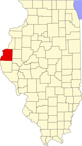
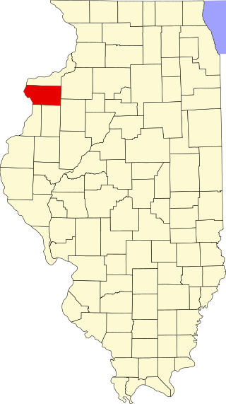
This is a list of the National Register of Historic Places listings in Mercer County, Illinois.

<span class="mw-page-title-main">National Register of Historic Places listings in Clark County, Illinois</span>

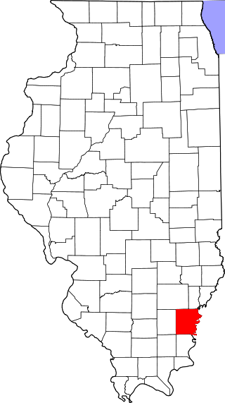
This is a list of the National Register of Historic Places listings in Clark County, Illinois.

<span class="mw-page-title-main">National Register of Historic Places listings in Monroe County, Illinois</span>

This is a list of the National Register of Historic Places listings in Monroe County, Illinois.

<span class="mw-page-title-main">National Register of Historic Places listings in Alexander County, Illinois</span>

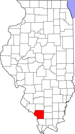
This is a list of the National Register of Historic Places listings in Alexander County, Illinois.

<span class="mw-page-title-main">National Register of Historic Places listings in Knox County, Illinois</span>

This is a list of the National Register of Historic Places listings in Knox County, Illinois.

References

  1. The latitude and longitude information provided in this table was derived originally from the National Register Information System, which has been found to be fairly accurate for about 99% of listings. Some locations in this table may have been corrected to current GPS standards.
  2. National Park Service, United States Department of the Interior, "National Register of Historic Places: Weekly List Actions", retrieved December 1, 2023.
  3. 1 2 Numbers represent an alphabetical ordering by significant words. Various colorings, defined here, differentiate National Historic Landmarks and historic districts from other NRHP buildings, structures, sites or objects.
  4. "National Register Information System". National Register of Historic Places . National Park Service. March 13, 2009.
  5. The eight-digit number below each date is the number assigned to each location in the National Register Information System database, which can be viewed by clicking the number.
  6. "Daily Herald | Electronic Archive".
  7. Ortiz, Vikki (2009) "DuPage Theatre gone, not forgotten", Chicago Tribune , July 31, 2009.