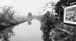
The Illinois and Michigan Canal connected the Great Lakes to the Mississippi River and the Gulf of Mexico. In Illinois, it ran 96 miles (154 km) from the Chicago River in Bridgeport, Chicago to the Illinois River at LaSalle-Peru. The canal crossed the Chicago Portage, and helped establish Chicago as the transportation hub of the United States, before the railroad era. It was opened in 1848. Its function was largely replaced by the wider and shorter Chicago Sanitary and Ship Canal in 1900, and it ceased transportation operations with the completion of the Illinois Waterway in 1933.

Joliet is a city in Will and Kendall Counties in the U.S. state of Illinois, 30 miles (48 km) southwest of Chicago. It is the county seat of Will County. At the 2010 census, the city was the fourth-largest in Illinois, with a population of 147,433. A population estimate in 2019 put Joliet's population at 147,344, which would make it the third-largest city in Illinois if accurate.

Lockport is a city in Will County, Illinois, United States, located 30 miles southwest of Chicago. The city was incorporated in 1853. It is situated along the Illinois and Michigan (I&M) Canal, and was the headquarters of the canal when the canal was operating. A section of the canal runs through Lockport, including the remains of the canal's Lock No. 1 from which the town received its name. The canal right-of-way is now the Illinois and Michigan National Heritage Corridor. Because of proactive efforts dating back several years, the city of Lockport is one of the best-preserved canal sites in existence today.

Plainfield is a village in Will and Kendall counties, Illinois, United States. The population was 39,581 at the 2010 census and an estimated 44,308 in 2019.

United States Steel Corporation, more commonly known as U.S. Steel, is an American integrated steel producer headquartered in Pittsburgh, Pennsylvania, with production operations in the United States and Central Europe. As of 2018, the company was the world's 27th-largest steel producer and the second-largest in the US, trailing only Nucor Corporation.

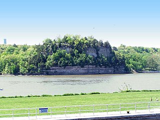
Starved Rock State Park is a state park in the U.S. state of Illinois, characterized by the many canyons within its 2,630 acres (1,064 ha). Located just southeast of the village of Utica, in Deer Park Township, LaSalle County, Illinois, along the south bank of the Illinois River, the park hosts over two million visitors annually, the most for any Illinois state park.

Fort Sheridan is a residential neighborhood within the cities of Lake Forest, Highwood, and Highland Park in Lake County, Illinois, United States. It was originally established as Fort Sheridan, an Army post named after Civil War cavalry general Philip Sheridan, to honor his services to Chicago.
The Potomac Heritage Trail, also known as the Potomac Heritage National Scenic Trail or the PHT, is a designated National Scenic Trail corridor spanning parts of the mid-Atlantic and upper southeastern regions of the United States that will connect various trails and historic sites in Virginia, Maryland, Pennsylvania, and the District of Columbia. The trail network includes 710 miles (1,140 km) of existing and planned sections, tracing the outstanding natural, historical, and cultural features of the Potomac River corridor, the upper Ohio River watershed in Pennsylvania and western Maryland, and a portion of the Rappahannock River watershed in Virginia. The trail is managed by the National Park Service.
Illinois Route 171 (IL 171) is a 38.61-mile-long (62.14 km) north–south state road in northeastern Illinois. It runs from U.S. Route 6 (US 6) in Joliet north to Illinois Route 72 at the Chicago–Park Ridge border. The section of IL 171 on Archer Avenue from Joliet to Summit is historically significant, originating as a Native American trail, and later serving for a time as part of the first numbered highway between St. Louis and Chicago.

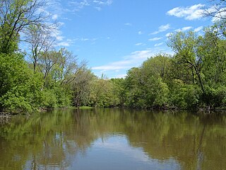
The Des Plaines River is a river that flows southward for 133 miles (214 km) through southern Wisconsin and northern Illinois in the United States Midwest, eventually meeting the Kankakee River west of Channahon to form the Illinois River, a tributary of the Mississippi River.

U.S. Route 66 was a United States Numbered Highway in Illinois that connected St. Louis, Missouri, and Chicago, Illinois. The historic Route 66, the Mother Road or Main Street of America, took long distance automobile travelers from Chicago to Southern California. The highway had previously been Illinois Route 4 (IL 4) and the road has now been largely replaced with Interstate 55 (I-55). Parts of the road still carry traffic and six separate portions of the roadbed have been listed on the National Register of Historic Places.

The Tannehill Ironworks is the central feature of Tannehill Ironworks Historical State Park near the unincorporated town of McCalla in Tuscaloosa County, Alabama. Listed on the National Register of Historic Places as Tannehill Furnace, it was a major supplier of iron for Confederate ordnance. Remains of the old furnaces are located 12 miles (19 km) south of Bessemer off Interstate 59/Interstate 20 near the southern end of the Appalachian Mountains. The 2,063-acre (835 ha) park includes: the John Wesley Hall Grist Mill; the May Plantation Cotton Gin House; and the Iron & Steel Museum of Alabama.

The Forest Preserve District of Cook County is a governmental commission in Cook County, Illinois, that owns and manages a network of open spaces, containing forest, prairie, wetland, streams, and lakes, that are mostly set aside as natural areas. Cook County contains Chicago, and is the center of the most densely populated urban metropolitan area in the Midwest. The Forest Preserve lands encompass approximately 70,000 acres (280 km2), about 11% of the county, providing open space within its urban surroundings. It contains facilities for recreation, as well as a zoo and a botanic garden.

The Delaware & Lehigh Canal National and State Heritage Corridor (D&L) is a 165-mile (266 km) National Heritage Area in eastern Pennsylvania in the United States. It stretches from north to south, across five counties and over one hundred municipalities. It follows the historic routes of the Lehigh and Susquehanna Railroad, Lehigh Valley Railroad, the Lehigh Navigation, Lehigh Canal, and the Delaware Canal, from Bristol to Wilkes-Barre in the northeastern part of the state. The backbone of the Corridor is the 165-mile (266 km) D & L Trail. The Corridor's mission is to preserve heritage and conserve green space for public use in Bucks, Northampton, Lehigh, Carbon, and Luzerne counties in Pennsylvania. It also operates Hugh Moore Historical Park & Museums, which includes the National Canal Museum.
The Ghost Town Trail is a rail trail in Western Pennsylvania that stretches 36 miles (58 km) from Black Lick, Indiana County, to Ebensburg, Cambria County. Established in 1991 on the right-of-way of the former Ebensburg and Black Lick Railroad, the trail follows the Blacklick Creek and passes through many ghost towns that were abandoned in the early 1900s with the decline of the local coal mining industry. Open year-round to cycling, hiking, and cross-country skiing, the trail is designated as a National Recreation Trail by the United States Department of the Interior.
The Old Plank Road Trail is a 21-mile (34 km) long public rail trail in Cook County and Will County within the U.S. state of Illinois. It stretches westward from Chicago Heights to Joliet, serving fast-growing suburbs such as Frankfort and New Lenox.
Joliet Iron and Steel Company was a steel manufacturer located in Joliet, Illinois.

Sag Bridge, Illinois is a populated place in southwestern Cook County, Illinois. Sag Bridge is an important waterway junction between the Calumet Sag Channel and the Chicago Sanitary and Ship Canal. It is also the junction of IL 83 and IL 171 which meet at Sag Bridge to cross the Calumet Sag Channel together on the eponymous bridge. The community was named for a predecessor of the present bridge. It is within the village limits and postal delivery zone of Lemont, Illinois.
The Illinois Steel Company was an American steel producer with five plants in Illinois and Wisconsin. Founded through a consolidation in 1889, Illinois Steel grew to become the largest steel producer in the United States. In 1898, several other steel and transportation companies were merged into it to form the Federal Steel Company, itself merged into U.S. Steel in 1901.

Bowerstown is an unincorporated community in Washington Township, Warren County, New Jersey near the Morris Canal and the Pohatcong Creek. It was founded in 1829 by Jesse Vanetta and Michael B. Bowers with the building of an iron foundry. The Bowerstown Historic District, encompassing the village, was listed on the state and national registers of historic places in 1996.


