
Angel Mounds State Historic Site, an expression of the Mississippian culture, is an archaeological site managed by the Indiana State Museum and Historic Sites that includes more than 600 acres of land about 8 miles (13 km) southeast of present-day Evansville, in Vanderburgh and Warrick counties in Indiana. The large residential and agricultural community was constructed and inhabited from AD 1100 to AD 1450, and served as the political, cultural, and economic center of the Angel chiefdom. It extended within 120 miles (190 km) of the Ohio River valley to the Green River in present-day Kentucky. The town had as many as 1,000 inhabitants inside the walls at its peak, and included a complex of thirteen earthen mounds, hundreds of home sites, a palisade (stockade), and other structures.

Shiloh Indian Mounds Site (40HR7) is an archaeological site of the South Appalachian Mississippian culture. It is located beside the Tennessee River on the grounds of the Shiloh National Military Park, in Hardin County of southwestern Tennessee. A National Historic Landmark, it is one of the largest Woodland era sites in the southeastern United States.

The Swan Island Site is an archaeological site in Crawford County, Illinois, located north of the point where the Wabash River crosses the Lawrence County line. The shell midden site, located on a sandstone ridge in the Wabash River flood plain, was inhabited by people of the Riverton culture in the Late Archaic period. As of 1978, it is one of three known sites associated with the culture, which lived in the central Wabash Valley and had distinct methods of making tools. Archaeologists first found the site in the 1950s, and Dr. Howard Winters of the Illinois State Museum began excavations there in 1961.
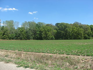
The Stoner Site is a substantial archaeological site in the far eastern portion of the U.S. state of Illinois. Discovered during the Great Depression, the site has produced large numbers of artifacts from a prehistoric village that was once located there, and archaeological investigations have shown it to be one of the area's most important archaeological sites for the Allison-Lamotte culture. After more than a decade of fruitful research and predictions of potentially rich results from future work, it has been designated a historic site.

Emma Township is located in White County, Illinois. As of the 2010 census, its population was 387 and it contained 235 housing units.

The Eaker site (3MS105) is an archaeological site on Eaker Air Force Base near Blytheville, Arkansas, that was declared a National Historic Landmark in 1996. The site is the largest and most intact Late Mississippian Nodena phase village site within the Central Mississippi Valley, with archaeological evidence indicating a palisaded village some 50 acres (20 ha) in size, with hundreds of structures. The site's major period of occupation was 1350–1450 CE, although evidence of occupation dates back to 600 CE. The site is also hypothesized to have been occupied by the Quapaw prior to a migration further south, after which they made contact with Europeans in the late 17th century.

The Kincaid Mounds Historic Site c. 1050–1400 CE, is a Mississippian culture archaeological site located at the southern tip of present-day U.S. state of Illinois, along the Ohio River. Kincaid Mounds has been notable for both its significant role in native North American prehistory and for the central role the site has played in the development of modern archaeological techniques. The site had at least 11 substructure platform mounds, and 8 other monuments.

Albany Mounds State Historic Site, also known as Albany Mounds Site, is a historic site operated by the Illinois Historic Preservation Agency. It spans over 205 acres of land near the Mississippi river at the northwest edge of the state of Illinois in the United States. In 1974, the site was added to the National Register of Historic Places list. The historical site is under the provision of the Illinois Historic Preservation Agency, a governmental agency founded in 1985 for the maintaining of historical sites within the state. In the 1990s, the site underwent a restoration project that aimed to return its appearance to its original condition.

Towosahgy State Historic Site (23MI2), also known as Beckwith's Fort Archeological Site, is a large Mississippian archaeological site with a Woodland period Baytown culture component located in Mississippi County, Missouri, United States. It is believed to have been inhabited from c. 400–1350 CE. The site is maintained by the Missouri Department of Natural Resources as a state historic site. The name Towosahgy is an Osage word which means "old town". It is not known if members of the historic Osage people, who dominated a large area of present-day Missouri at the beginning of the 19th century, ever occupied the site. The site was acquired by the Missouri state park system in 1967 and added to the National Register of Historic Places in 1969 as NRIS number 69000113.

The Ashworth Archaeological Site is a significant archaeological site in the extreme southwestern corner of the U.S. state of Indiana. Located near the confluence of the Ohio and Wabash Rivers, it lies near several similar archaeological sites. It was first examined by archaeologists in the middle of the twentieth century and found to be the site of a relatively recent Native American village, and it has been designated a historic site because of its archaeological value.
The Allison-Lamotte culture was an archaeological culture that inhabited the Wabash River valley in the United States during the later portion of the Woodland period. Flourishing approximately from AD 100 to 600, the culture's sites are common near the modern city of Vincennes, Indiana. First defined in 1963, the culture was originally described as being divided into two phases — Allison and LaMotte — although some later authors have taught a single unified phase.

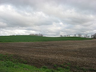
The Duffy site is a substantial archaeological site along the Wabash River in the southeastern part of the U.S. state of Illinois. Located near the village of New Haven in Gallatin County, it is the type site for the Duffy Complex, a group of similar sites on the Illinois side of the Wabash near its confluence with the Ohio River. Duffy is distinctive largely because of its pottery: the site's inhabitants typically produced ceramics of various thicknesses and comparatively few decorative elements, tempered with grog. What decorations exist are typically limited to one or two rows of simple lines or bars that have been incised or stamped on the side of the piece of pottery. Projectile points found at the site are small triangular "Mounds Stemless" points, and the inhabitants produced celts of a vaguely rectangular shape. The site is believed to have been inhabited circa AD 1000.

Pyramid Mound, designated 12k14, is a locally important archaeological site at the city of Vincennes in the southwestern part of the U.S. state of Indiana. Located on the city's edge, this substantial loess hill bears evidence of prehistoric occupation, and it is a landmark to the city's contemporary residents.
The Roland Site is an archaeological site located on Dry Lake, an extinct channel of the White River in Arkansas County, Arkansas. It was inhabited intermittently from the beginning of the common era to late prehistoric times, but its most intensive inhabitation was by peoples of the Plum Bayou culture, in a time known as the Late Woodland period.

The Hubele Mounds and Village Site are an archaeological site in the southeastern part of the U.S. state of Illinois. Located near the community of Maunie in White County, the site has received recognition from the federal government because of its archaeological value. Due to the lack of recent excavations, the site's dates of habitation are debated, ranging from 400 BC in some estimates to AD 1000 in others, but all agree on the site's significance to understanding the prehistory of the region.

The Yankeetown site (12W1) is a substantial archaeological site along the Ohio River in the southwestern part of the U.S. state of Indiana. Inhabited during the prehistoric Woodland period, the site has yielded important information about Woodland-era peoples in the region, but it has been damaged by substantial erosion. Despite the damage, it has been a historic site for more than thirty years.
The Ware Mounds and Village Site (11U31), also known as the Running Lake Site, located west of Ware, Illinois, is an archaeological site comprising three platform mounds and a 160-acre (65 ha) village site. The site was inhabited by the Late Woodland and Mississippian cultures from c. 800 to c. 1300. The village is one of the only Mississippian villages known to have existed in the Mississippi River valley in Southern Illinois. As the village was located near two major sources of chert, which Mississippian cultures used to make agricultural tools, it was likely a trading center for the mineral.
The Orr-Herl Mound and Village Site is an archaeological site located along the Ohio River in Hardin County, Illinois, United States. The site consists of a mound, which includes a sizable midden, and the remains of a village. The village was inhabited from roughly 900 to 1500 AD by Mississippian peoples. The site was an important source of fluorspar, which Mississippian peoples used for carvings and beads. The village was likely a manufacturing site for fluorspar items, which were then traded to other villages; this theory is supported by fluorspar artifacts recovered from the Kincaid Site, a Mississippian chiefdom center on the Ohio River in Illinois.

The Cleiman Mound and Village Site is a prehistoric archaeological site located near the Mississippi River in Jackson County, Illinois. The site includes an intact burial mound and the remains of a village site. The village was inhabited by a number of prehistoric cultures during the Archaic, Woodland, and Mississippian periods; settlement at the site began prior to 400 B.C. and lasted through 1300 A.D. The mound was built during the Middle Woodland Period by Hopewellian peoples and is likely the only Hopewell mound in the Mississippi Valley in Southern Illinois.
The White Site is a prehistoric archaeological site located northeast of Hickman in Fulton County in the southwestern corner of the U.S. state of Kentucky. Discovered in the 1980s, it was occupied during a long period of time by peoples of multiple cultures, and it has been named a historic site.


