Bath County is a United States county on the central western border of the Commonwealth of Virginia, on the West Virginia state line. As of the 2020 census, the population was 4,209, the second-least populous county in Virginia. Bath's county seat is Warm Springs.

Muleshoe is a city in Bailey County, Texas, United States. It was founded in 1913, when the Pecos and Northern Texas Railway built an 88-mile (142 km) line from Farwell, Texas, to Lubbock through northern Bailey County. In 1926, Muleshoe was incorporated. Its population was 5,158 at the 2010 census. The county seat of Bailey County, it is home to the National Mule Memorial.

Great Sand Dunes National Park and Preserve is an American national park that conserves an area of large sand dunes up to 750 feet (230 m) tall on the eastern edge of the San Luis Valley, and an adjacent national preserve in the Sangre de Cristo Range, in south-central Colorado, United States. The park was originally designated Great Sand Dunes National Monument on March 17, 1932, by President Herbert Hoover. The original boundaries protected an area of 35,528 acres. A boundary change and redesignation as a national park and preserve was authorized on November 22, 2000, and then established on September 24, 2004. The park encompasses 107,342 acres while the preserve protects an additional 41,686 acres for a total of 149,028 acres. The recreational visitor total was 527,546 in 2019.

Malibu Creek State Park is a state park of California, United States, preserving the Malibu Creek canyon in the Santa Monica Mountains. The 8,215-acre (3,324 ha) park was established in 1974. Opened to the public in 1976, the park is also a component of Santa Monica Mountains National Recreation Area.

Hot Springs National Park is an American national park in central Garland County, Arkansas, adjacent to the city of Hot Springs, the county seat. Hot Springs Reservation was initially created by an act of the United States Congress on April 20, 1832, to be preserved for future recreation. Established before the concept of a national park existed, it was the first time that land had been set aside by the federal government to preserve its use as an area for recreation. The hot spring water has been popularly believed for centuries to possess medicinal properties, and was a subject of legend among several Native American tribes. Following federal protection in 1832, the city developed into a successful spa town.

Hot Lake Hotel is a historic Colonial Revival hotel originally built in 1864 in Hot Lake, Union County, Oregon, United States. The hotel received its namesake from the thermal spring lakes on the property, and operated as a luxury resort and sanitorium during the turn of the century, advertising the medicinal attributes of the mineral water and drawing visitors worldwide. It is also the first known commercial building in the world to utilize geothermal energy as its primary heat source.

Dunton Hot Springs, also known as Dunton, Colorado (unincorporated), is a grouping of log buildings that sits at 8,600 feet on the West Fork of the Dolores River in the San Juan Mountains in the southwestern corner of Colorado. Dunton is 35 miles (56 km) northeast of Cortez, Colorado, and 25 miles southwest of Telluride. It is currently a ghost town and is historically known for its thermal mineral springs.

The San Pedro River is a northward-flowing stream originating about 10 miles (16 km) south of the international border south of Sierra Vista, Arizona, in Cananea Municipality, Sonora, Mexico. The river starts at the confluence of other streams just east of Sauceda, Cananea. Within Arizona, the river flows 140 miles (230 km) north through Cochise County, Pima County, Graham County, and Pinal County to its confluence with the Gila River, at Winkelman, Arizona. It is the last major, undammed desert river in the American Southwest, and it is of major ecological importance as it hosts two-thirds of the avian diversity in the United States, including 100 species of breeding birds and almost 300 species of migrating birds.

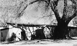
The Sierra Bonita Ranch, founded in 1872 by Henry C. Hooker, is one of the oldest cattle ranches in the United States and the ranch buildings have been designated a National Historic Landmark. It was the first permanent American cattle ranch in Arizona. Hooker bought neighboring ranches until his operation became the largest ranch in Arizona, totaling 800 square miles (2,100 km2), or about 30 by 27 miles. It is located in Sulphur Springs Valley about 27 miles (43 km) north of present-day Willcox, Arizona. The modern ranch is much smaller but is still operational and owned by Jesse Hooker Davis, the sixth generation to live and work on the ranch.

Henry Clay Hooker was a prominent and wealthy rancher during the American Old West who formed the first and what became the largest American ranch in Arizona Territory. After growing up on the east coast, he married and traveled to California, where he established a hardware store in Hangtown. When it burned, he left for Arizona Territory where he partnered with others to supply cattle to the Army and Indian Agencies. When one of the herds stampeded, he found them in a verdant valley. He established the Sierra Bonita Ranch there. It became one of the largest ranches in the Territory and state of Arizona and was held by family members for several generations. He was a personal friend of Wyatt Earp and aided him after the Earp Vendetta Ride.

Scovern Hot Springs is a thermal spring system, and former settlement in the Kern River Valley of the Southern Sierra Nevada, in Kern County, California.

Agua Caliente in Maricopa County, Arizona on the border with Yuma County, is a place north of the Gila River near Hyder, Arizona. Named 'Santa Maria del Agua Caliente' in 1744 by Father Jacob Sedelmayer. In 1775, Father Francisco Garces used the current short form. The location was the site of a resort established at the site of nearby hot springs. Agua Caliente, a name derived from Spanish meaning "hot water", received its name from nearby hot springs which were originally used by the local Indigenous population.

Black Mountain is located in north-central Maricopa County, Arizona, between the towns of Carefree and Cave Creek.

Lochiel is a populated place and former border crossing in southern Santa Cruz County, Arizona, United States, approximately 25 miles east of Nogales. Basically a ghost town, the townsite is located in the southwestern part of the San Rafael Valley on Washington Gulch, about 1.5 miles west of the Santa Cruz River. It was first settled in the late-1870s and mostly abandoned by 1986. The town served the ranches of the San Rafael Valley and the Washington Camp and Duquesne mining towns of the Patagonia Mountains, approximately five miles to the northwest up Washington Gulch.

The Hassayampa River Preserve is a 770-acre riparian nature reserve owned by The Nature Conservancy in the US state of Arizona, near Wickenburg in Maricopa County. The Hassayampa River has mostly subterranean flows for most of its 113 miles (182 km) length, the stretch contained within the preserve has year-round flowing water.
Valer Clark Austin is a permaculturalist involved with desert greening. Based in southern Arizona, she is known for promoting ecological restoration through water conservation and holistic land management.
Mission Creek Preserve is a Wildlands Conservancy nature preserve consisting of 4,760 acres (19.3 km2) of land in Riverside County, California west of Morongo Valley. Perennial Mission Creek flows through a desert canyon. The preserve is located within the San Bernardino Mountains and is part of the Sand to Snow National Monument.
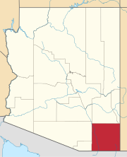
The Schilling Ranch Historic District is a tiny portion of a historic ranch in Cochise County, Arizona which was listed on the National Register of Historic Places in 2009. It consists of several structures built in the early to mid-1900s. It is representative of the infrastructure required by cattle ranching operations in the Southwestern United States. It was used as a central location for cattle roundups from the surrounding cattle ranches, before shipment to the Willcox cattle auctions.


