Hungry Beach

Last updated

Hungry Beach
Beach
Hungry Beach & Cowan Creek.JPG
Coordinates: 33°34′59″S151°16′33″E / 33.582970°S 151.275832°E / -33.582970; 151.275832 Coordinates: 33°34′59″S151°16′33″E / 33.582970°S 151.275832°E / -33.582970; 151.275832
Location Ku-ring-gai Chase National Park, Australia
Offshore water bodies Hawkesbury River
Geology Narrabeen Group of sedimentary rocks
Operator NSW National Parks & Wildlife Service
Dimensions
  Length0.13 kilometres (0.081 mi)
Patrolled?beach not patrolled
Campingnot allowed
Accessprivate boat

Hungry Beach is situated beside Cowan Creek and the Hawkesbury River in Ku-ring-gai Chase National Park in the northern part of Sydney, Australia. [1]

The north facing beach is about one kilometre from the ruins of the Flint & Steel Guesthouse. The beach is protected by steep cliffs. Above the beach are caves and middens, and a small densely vegetated gully with a fresh water stream. Access to the beach is by private boat; there is no formal bushwalking track but the beach can be reached by foot from Flint and Steel Bay. [2]

Hungry Beach was known as a fishing area, particularly for shark, turtle and mulloway. [3] [4] [5] In 1936, The Sydney Mail reported that an indigenous man was shot dead by shark fishermen at Hungry Beach. The newspaper says he was the last surviving member of the Barrenjoey people. [6] In 1899, the wreckage of the steam launch "Hatte", lying on Hungry Beach was sold for £25. [7]

The beach allegedly gets its name from a fisherman who became hungry, waiting for three days for a large shark to leave the area. Previously, the shark attacked his rowboat while fishing. [3] [6]

Royal Australian Navy in World War Two

Offshore and nearby, are concrete and brick relics of Indicator Loop & Controlled Mining Station number 285, constructed by the Royal Australian Navy during world war two. Mines were laid in this area. An indicator loop was an electrically charged cable, used to indicate shipping movements. In this case, the cable was situated from Hungry Beach to Juno Point at Patonga, two kilometres distant on the opposite side of the Hawkesbury River. The cable was used in the detection of Japanese submarines and to protect the railway bridge. An infra red photo electric beam shone 2.6 kilometres from Hungry Point to the Central Coast, in order to detect enemy shipping. [8] [9] [10]

A government auction sale was held in August 1945 for building related articles at Hungry Beach. Items included a 61 foot long mess hut, a 42 foot long sleeping hut, hot water boiler, 1,000 gallon tank, 300 gallon tank and stand, fuel range with double oven, doors, windows and linings. As well as fittings from the brick power hut, a latrine, moorings and a 25 by 7 foot boat. [11]

Brick power hut, built by the Royal Australian Navy, above Hungry Beach Brick building above Hungry Beach.jpg
Brick power hut, built by the Royal Australian Navy, above Hungry Beach

Related Research Articles

<span class="mw-page-title-main">Ku-ring-gai Chase National Park</span> Protected area in New South Wales, Australia

Ku-ring-gai Chase National Park is a national park on the northern side of Sydney in New South Wales, Australia. The 14,977-hectare (37,010-acre) park is 25 kilometres (16 mi) north of the Sydney central business district and generally comprises the land east of the M1 Pacific Motorway, south of the Hawkesbury River, west of Pittwater and north of Mona Vale Road. It includes Barrenjoey Headland on the eastern side of Pittwater.

<span class="mw-page-title-main">Marramarra National Park</span> Protected area in New South Wales, Australia

Marramarra National Park is a protected national park that is located in the Hawkesbury region of northwestern Sydney, New South Wales, in eastern Australia. The 11,785-hectare (29,120-acre) national park is situated approximately 40 kilometres (25 mi) northwest of the Sydney central business district.
<span class="mw-page-title-main">Port Hawkesbury</span> Town in Nova Scotia, Canada

Port Hawkesbury is a municipality in southern Cape Breton Island, Nova Scotia, Canada. While within the historical county of Inverness, it is not part of the Municipality of Inverness County.
<span class="mw-page-title-main">Geraldton</span> City in Western Australia

Geraldton is a coastal city in the Mid West region of Western Australia, 424 kilometres (263 mi) north of the state capital, Perth.

<span class="mw-page-title-main">Broken Bay</span> Bay in New South Wales, Australia

Broken Bay, a semi-mature tide-dominated drowned valley estuary, is a large inlet of the Tasman Sea located about 50 kilometres (31 mi) north of Sydney central business district on the coast of New South Wales, Australia; being one of the bodies of water that separate greater Metropolitan Sydney from the Central Coast. Broken Bay is the first major bay north of Sydney Harbour in the state capital of Sydney.

<span class="mw-page-title-main">Hawkesbury River</span> River in New South Wales, Australia

The Hawkesbury River, or Hawkesbury-Nepean River, is a river located northwest of Sydney, New South Wales, Australia. The Hawkesbury River and its associated main tributary, the Nepean River, almost encircle the metropolitan region of Sydney.

<span class="mw-page-title-main">Nepean River</span> River in New South Wales, Australia

Nepean River, is a major perennial river, located in the south-west and west of Sydney, New South Wales, Australia. The Nepean River and its associated mouth, the Hawkesbury River, almost encircles the metropolitan region of Sydney.

<span class="mw-page-title-main">Cape Breton and Central Nova Scotia Railway</span> Canadian railway line

The Cape Breton and Central Nova Scotia Railway is a short line railway that operates in the Canadian province of Nova Scotia. CBNS operates of main line and associated spurs between Truro in the central part of the province to Point Tupper on Cape Breton Island.

<span class="mw-page-title-main">Yamba, New South Wales</span> Town in New South Wales, Australia

Yamba is a town in northern New South Wales, Australia at the mouth of the Clarence River.

<span class="mw-page-title-main">Pittwater</span> Estuary in Sydney, Australia

Pittwater is a semi-mature tide dominated drowned valley estuary, located about 40 kilometres (25 mi) north of the Sydney central business district, New South Wales, Australia; being one of the bodies of water that separate greater Metropolitan Sydney from the Central Coast.

<span class="mw-page-title-main">Little Bay, New South Wales</span> Suburb of Sydney, New South Wales, Australia

Little Bay is a suburb in the Eastern Suburbs of Sydney, in the state of New South Wales, Australia. Little Bay is located 14 kilometres south-east of the Sydney central business district and is part of the local government area of the City of Randwick.

<span class="mw-page-title-main">Cattai, New South Wales</span> Historic suburb of Sydney, Australia

Cattai is an historic suburb of Sydney, in the state of New South Wales, Australia. It is located 44 kilometres north-west of the Sydney central business district and 30 kilometres north-west of Parramatta. It is in the local government areas of The Hills Shire and City of Hawkesbury. Cattai's state electoral district is Hawkesbury, and its federal electoral divisions are Berowra and Macquarie.

<span class="mw-page-title-main">Wisemans Ferry</span> Cable ferry in NSW, Australia

Wisemans Ferry is a cable ferry across the Hawkesbury River in New South Wales, Australia. The ferry operates from the eponymous community of Wisemans Ferry on the south bank, to a point on the north bank downstream of the Hawkesbury River's confluence with the Macdonald River, connecting with the old Great North Road. The crossing has remained in use on its current site since 1829, making it the oldest ferry crossing still in operation in New South Wales, and possibly in Australia.
<span class="mw-page-title-main">Patonga, New South Wales</span> Suburb of Central Coast, New South Wales, Australia

Patonga is a suburb of the Central Coast region of New South Wales, Australia, located on the north bank of the Hawkesbury River, southwest of Woy Woy. It is part of the Central Coast Council local government area.
<span class="mw-page-title-main">Geography of Sydney</span> Overview of the geography of Sydney

The geography of Sydney is characterised by its coastal location on a basin bordered by the Pacific Ocean to the east, the Blue Mountains to the west, the Hawkesbury River to the north and the Woronora Plateau to the south. Sydney lies on a submergent coastline on the east coast of New South Wales, where the ocean level has risen to flood deep river valleys (rias) carved in the Sydney sandstone. Port Jackson, better known as Sydney Harbour, is one such ria.

<span class="mw-page-title-main">Sackville, New South Wales</span> Suburb of City of Hawkesbury, New South Wales, Australia

Sackville (Doorumbolooa) is a suburb of Sydney, in the state of New South Wales, Australia. It is located in the City of Hawkesbury and at the 2016 census had a population of 298, thirteen of whom identified as Aboriginal and Torres Strait Islander.

<span class="mw-page-title-main">Peats Ferry Bridge</span> Bridge in New South Wales, Australia

The Peats Ferry Bridge is a steel truss bridge that carries the Pacific Highway (B83) across the Hawkesbury River, between Kangaroo Point and Mooney Mooney Point, located 40 kilometres (25 mi) north of Sydney in New South Wales, Australia. The bridge carries the Hornsby to Kariong section of highway, while the adjacent Brooklyn Bridge carries the Pacific Motorway (M1).

HMS <i>Torch</i> (1894) Sloop of the Royal Navy

HMS Torch was an Alert-class sloop of the Royal Navy, built at Sheerness Dockyard and launched in 1894. She served in Australia and New Zealand and was transferred to New Zealand as a training ship in 1917, being renamed HMS Firebrand at the same time. She was sold in 1920 and converted to a refrigerated ship with the new name Rama. She ran aground in the Chatham Islands in 1924 and was abandoned.
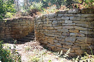
<span class="mw-page-title-main">Flint & Steel Guesthouse</span> Place in New South Wales, Australia

Flint & Steel Guesthouse was situated on Broken Bay, north of Sydney, Australia. It was constructed from 1920 to 1965. The guesthouse and nearby waterways were resumed by the navy during the second world war. Navy personnel at nearby Hungry Beach were known to have frequented "Flint & Steel". The guesthouse was destroyed by fire in 1971.

Nicolle Jane Flint is an Australian politician. She was a member of the House of Representatives from 2016 to 2022, representing the Division of Boothby in South Australia. She is a member of the Liberal Party and succeeded the previous member, Andrew Southcott, at the 2016 federal election.

References

  1. "Hungry Beach". Mapcarta. Retrieved 16 October 2019.
  2. Hiking the World (3 February 2019). "Hungry Beach, West Head" . Retrieved 27 April 2020.
  3. 1 2 Braemar (5 February 1936). "The House that Mac Built". The Sydney Mail 4 February 1936 page 37. Retrieved 16 October 2019.
  4. Wobbegong (23 October 1921). "Rod and Line". Sunday Times (Sydney) 23 October 1921 page 16. Retrieved 16 October 2019.
  5. Piscator (30 September 1916). "Weekend Prospects for Line and Rod". Arrow 30 September 1916 page 8 FISHING NOTES. Retrieved 16 October 2019.
  6. 1 2 "Flint And Steel Guesthouse - A Hand Built Home That Kept Growing". Pittwater Online News. Retrieved 16 October 2019.
  7. "The Wreck of the Steam Launch Hatte". Daily Commercial News & Shipping List 24 February 1899 page 4. 24 February 1899. Retrieved 22 October 2019.
  8. "Jane Louise Ainsworth. "Purely Defensive Measures". The Archaeological Network of Defence in the Sydney Region 1788 - 1945. Retrieved 18 October 2019.
  9. "Shepherds Hill Defence Group Military Installations Conservation Management Plan Final - OEH endorsed 16/7/19" (PDF). Heritage Council of New South Wales. Retrieved 18 October 2019.
  10. Peter Dunn. "Royal Australian Navy in and around Australia during WW2". Ozatwar; from Straczek, J.H., "Royal Australian Navy, A - Z , Ships, Aircraft and Shore Establishments", Navy Public Affairs, Sydney, 1996. ISBN 1876043784 . Retrieved 17 October 2019.
  11. "Auction Sale of Buildings for Removal". Sydney Morning Herald 8 August 1945 page 11. Retrieved 18 October 2019.