Related Research Articles

Yass is a town on the periphery of the Southern Tablelands and South West Slopes of New South Wales, Australia. The name appears to have been derived from an Aboriginal word, "Yarrh", said to mean 'running water'.
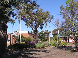
Binalong is a village in the Southern Tablelands of New South Wales, Australia, 37 km north-west of Yass in Yass Valley Shire. At the 2016 census, Binalong and the surrounding area had a population of 543.

Uriarra is a locality in the Southern Tablelands of New South Wales, Australia in the Yass Valley Shire. It is north of the locality of Uriarra in the Australian Capital Territory and north-west of Canberra. At the 2016 census, it had a population of 30. The locality is mostly located in the Urayarra parish of Cowley County, although part of it in Pabral parish, which lies further west.

Bowning is a small town in the South West Slopes, 14 kilometres (8.7 mi) west of Yass on the Hume Highway in Yass Valley Shire. Bowning is an aboriginal word meaning 'big hill'. At the 2016 census, Bowning and the surrounding area had a population of 573.

Murray County was one of the original Nineteen Counties in New South Wales and is now one of the 141 Lands administrative divisions of New South Wales. It included the area which is now part of Canberra and as far north as Lake George and Yass. It was originally bounded on the west by the Murrumbidgee River, on the east by the Shoalhaven River and on the north by the Yass River. A large area of the county was transferred to the Commonwealth government in 1909 in the Seat of Government Acceptance Act to make part of the Australian Capital Territory, along with land in Cowley County. Since then, the ACT border is now part of the western boundary. Part of the ACT border is determined by property boundaries in the Parish of Keewong, in the County of Murray; specifically the southern end of portions 177, 218, 211, 36, and 38. This is mentioned in the Seat of Government Acceptance Act of 1909.

Harden railway station is a heritage-listed railway station located on the Main Southern line in New South Wales, Australia. It serves the town of Harden. It was added to the New South Wales State Heritage Register on 2 April 1999.
Nubba is a locality and former railway station on the Main South railway line in New South Wales, Australia, located midway between Wallendbeen and Harden. The station was open between 1882 and 1975 and has now been demolished.
Napier is a locality in the Riverina district of New South Wales, Australia and also a civil parish of Buccleuch County, New South Wales.

The Binalong railway station and telegraph office is the older of two closed railway stations in Binalong on the Main Southern railway line in New South Wales, Australia. The station opened in November 1876 as the terminus of the Bowning-Binalong section of the line. Following a fire to the original wooden building in 1883, a new stone and brick building was constructed. This was in use until 1916 when the line was deviated in conjunction with duplication. The station house and telegraph office remain today as a building of important historical significance in the town.
Nanima is a locality in the Yass Valley Council area, New South Wales, Australia. It lies on both sides of the Murrumbateman Road between Murrumbateman and Gundaroo, about 37 km north of Canberra. At the 2021 census, it had a population of 252.
Mullion is a locality in the Southern Tablelands of New South Wales, Australia in the Yass Valley Shire. It lies north-west of Canberra on the western side of the Murrumbidgee River. At the 2016 census, it had a population of 84. It had a public school from 1959 to 1972. The locality is located in the Umburra parish of Cowley County, with a small part of it in Mullion parish, which lies further west.
Peppercorn, New South Wales is a civil parish of Buccleuch County in Snowy Valleys Council, New South Wales.
Clive, New South Wales is a civil parish of Buccleuch County in New South Wales, Australia.

Birrema, New South Wales is a civil parish of Harden County, New South Wales.
Currawong, New South Wales, is rural locality of Hilltops Council and is a civil parish of Harden County, New South Wales.
Coppabella, New South Wales is a rural locality of Hilltops Council and a civil parish of Harden County, New South Wales.
Bobbara, New South Wales is a rural locality just off the Burley Griffin Way in south New South Wales.
Cowcumbala, New South Wales is a rural locality and civil parish of Harden County, New South Wales.
Cumbamurra, New South Wales is a civil parish of Harden County, New South Wales.
Murrimboola, New South Wales is a rural locality and civil parish of Harden County, New South Wales. The parish is at Harden, New South Wales, on Currawong Creek.
References
- ↑ Illalong
- ↑ Robert McLean, The New atlas of Australia : the complete work containing over one hundred maps and full descriptive geography of New South Wales, Victoria, Queensland, South Australia and Western Australia, together with numerous illustrations and copious indices (Sydney :J. Sands, [1886) Map 11.
- ↑ "Harden County". Geographical Names Register (GNR) of NSW. Geographical Names Board of New South Wales.
- ↑ County of Cowley and Co. Buccleuch New South Wales, 1871 map, County of Cowley.
- ↑ Illalong Archived 7 November 2017 at the Wayback Machine at GEOGRAPHICAL NAMES REGISTER EXTRACT.
| Preceding station | Former services | Following station | ||
|---|---|---|---|---|
| Goondah towards Albury | Main Southern Line | Binalong towards Sydney | ||
| Towns and residential areas | |
|---|---|
| Localities | |
Main Article: Local government areas of New South Wales | |
| | This article about a railway station in New South Wales is a stub. You can help Wikipedia by expanding it. |