Jackson's Gap, Alabama

Last updated

Jackson's Gap, Alabama
Jacksons Gap Alabama.JPG
Jackson's Gap in 2008
Tallapoosa County Alabama Incorporated and Unincorporated areas Jacksons' Gap Highlighted 0138248.svg
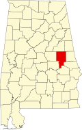
Location of Jacksons' Gap in Tallapoosa County, Alabama.
Coordinates: 32°52′54″N85°49′7″W / 32.88167°N 85.81861°W / 32.88167; -85.81861
Country United States
State Alabama
County Tallapoosa
Area
[1]
  Total8.54 sq mi (22.11 km2)
  Land8.52 sq mi (22.06 km2)
  Water0.02 sq mi (0.05 km2)
Elevation
640 ft (195 m)
Population
 (2020)
  Total747
  Density87.72/sq mi (33.87/km2)
Time zone UTC-6 (Central (CST))
  Summer (DST) UTC-5 (CDT)
ZIP code
36861
Area code 256
FIPS code 01-38248
GNIS feature ID0120788
Website https://jgap-al.com/

Jackson's Gap is a town in Tallapoosa County, Alabama, United States. It incorporated in 1980. [2] At the 2010 census the population was 828, up from 761.

Contents

Geography

Jackson's Gap is located in east- central Alabama. It includes land bordering Lake Martin. Jackson's Gap is located at 32°52′54″N85°49′7″W / 32.88167°N 85.81861°W / 32.88167; -85.81861 (32.881670, -85.818582). [3]

According to the U.S. Census Bureau, the town has a total area of 8.4 square miles (22 km2), all land.

History

Jackson's Gap was named for a local settler in the early 19th century. [4] The town got its name after a man erected a cabin and traded with the Creeks and local settlers and travelers, possibly in the 1810s or 1820s. Some time after , a fellow named Patterson established a blacksmith shop there, and more settlers began to arrive from Georgia and South Carolina in the 1830s.

Demographics

Historical population
CensusPop.Note
1890 207
1990 789
2000 761−3.5%
2010 8288.8%
2020 747−9.8%
U.S. Decennial Census [5]
2013 Estimate [6]

As of the census [7] of 2000, there were 761 people, 294 households, and 206 families residing in the town. The population density was 90.3 inhabitants per square mile (34.9/km2). There were 352 housing units at an average density of 41.8 per square mile (16.1/km2). The racial makeup of the town was 69.65% White, 29.04% Black or African American, 0.39% Native American, 0.26% Asian, and 0.66% from two or more races. 0.39% of the population were Hispanic or Latino of any race.

There were 294 households, out of which 32.7% had children under the age of 18 living with them, 51.7% were married couples living together, 13.6% had a female householder with no husband present, and 29.9% were non-families. 25.9% of all households were made up of individuals, and 8.5% had someone living alone who was 65 years of age or older. The average household size was 2.59 and the average family size was 3.12.

In the town, the population was spread out, with 27.5% under the age of 18, 7.5% from 18 to 24, 29.4% from 25 to 44, 23.5% from 45 to 64, and 12.1% who were 65 years of age or older. The median age was 36 years. For every 100 females, there were 101.3 males. For every 100 females age 18 and over, there were 92.3 males.

The median income for a household in the town was $23,027, and the median income for a family was $28,335. Males had a median income of $23,679 versus $18,185 for females. The per capita income for the town was $14,712. About 15.9% of families and 25.6% of the population were below the poverty line, including 28.8% of those under age 18 and 33.3% of those age 65 or over.

Related Research Articles

<span class="mw-page-title-main">Tallapoosa County, Alabama</span> County in Alabama, United States

Tallapoosa County is a county located in the east-central portion of the U.S. state of Alabama. As of the 2020 census, the population was 41,311. Its county seat is Dadeville. Its largest city is Alexander City.

<span class="mw-page-title-main">New Brockton, Alabama</span> Town in Alabama, United States

New Brockton is a town in Coffee County, Alabama, United States. At the 2020 census, the population was 1,428. The community was named for Huey E. Brock, a settler who came to the region in 1871.

<span class="mw-page-title-main">Powell, Alabama</span> Town in Alabama, United States

Powell is a town in DeKalb County, Alabama, United States. At the 2020 census, the population was 901. Powell is located atop Sand Mountain.

<span class="mw-page-title-main">Coffee Springs, Alabama</span> Town in Alabama, United States

Coffee Springs is a town in Geneva County, Alabama, United States. It was incorporated in 1900, and it is considered to be a part of the Dothan, Alabama Metropolitan Statistical Area. At the 2010 census the population was 228, down from 251.

<span class="mw-page-title-main">Gordon, Alabama</span> Town in Alabama, United States

Gordon is a town in Houston County, Alabama, United States. It was incorporated in February 1872. It is part of the Dothan, Alabama Metropolitan Statistical Area. At the 2010 census the population was 332, down from 408 in 2000.

<span class="mw-page-title-main">Pisgah, Alabama</span> Town in Alabama, United States

Pisgah is a town in Jackson County, Alabama, United States, and is included in the Huntsville-Decatur Combined Statistical Area. It incorporated in 1947. As of the 2020 census, the population of the town was 681, down from 722 in 2010. Pisgah is located atop Sand Mountain.

<span class="mw-page-title-main">Section, Alabama</span> Town in Alabama, United States

Section is a town in Jackson County, Alabama, United States and is included in the Chattanooga-Cleveland-Dalton, TN-GA-AL Combined Statistical Area. As of the 2010 census, the population of the town was 770, an increase of one person (769) from 2000. Section is located on top of Sand Mountain.

<span class="mw-page-title-main">Woodville, Alabama</span> Town in Alabama, United States

Woodville is a town in Jackson County, Alabama, United States. It was officially established by an act of the Alabama State Legislature on December 13, 1819, one day before Alabama became a state. It was later incorporated on May 12, 1890, but lost its charter in 1897. It reincorporated in 1912. As of the 2010 census, the population of the town is 746, down from 761 in 2000.

<span class="mw-page-title-main">Mosses, Alabama</span> Town in Alabama, United States

Mosses is a town in Lowndes County, Alabama, United States. At the 2010 census the population was 1,029, down from 1,101 in 2000. It is part of the Montgomery Metropolitan Statistical Area. It incorporated in 1979.

<span class="mw-page-title-main">Linden, Alabama</span> City in Alabama, United States

Linden is a city in and the county seat of Marengo County, Alabama, United States. The population was 1,930 at the 2020 census, down from 2,123 at the 2010 census.

<span class="mw-page-title-main">Douglas, Alabama</span> Town in Alabama, United States

Douglas is a town in Marshall County, Alabama, United States. Douglas, a part of the Huntsville–Decatur Combined Statistical Area, had a population of 761 as of the 2020 census. The town incorporated in 1978.

<span class="mw-page-title-main">Hurtsboro, Alabama</span> Town in Alabama, United States

Hurtsboro is a town in Russell County, Alabama, United States. At the 2010 census the population was 553, down from 592 in 2000. It was founded in 1857 as Hurtsville and named for Joel Hurt, Sr.. A railroad spur from Columbus, Georgia was completed the next year. It was incorporated in 1872 and in 1883 the town name was changed to Hurtsboro.

<span class="mw-page-title-main">Camp Hill, Alabama</span> Town in Alabama, United States

Camp Hill is a town in Tallapoosa County, Alabama, United States. It was incorporated in 1895. At the 2010 census the population was 1,014, down from 1,273 in 2000. Camp Hill is the home to Southern Preparatory Academy.

<span class="mw-page-title-main">Stanfield, Arizona</span> CDP in Pinal County, Arizona

Stanfield is a census-designated place (CDP) in Pinal County, Arizona, United States. The population was 651 at the 2000 census. Shamrock Farms operates a farm in Stanfield.

<span class="mw-page-title-main">Townville, Pennsylvania</span> Borough in Pennsylvania, United States

Townville is a borough in Crawford County, Pennsylvania, United States. The population was 326 at the 2020 census, up from 323 at the 2010 census.

<span class="mw-page-title-main">Redstone Township, Pennsylvania</span> Township in Pennsylvania, United States

Redstone Township is a township in Fayette County, Pennsylvania, United States. The population was 5,077 at the 2020 census, a decline from the figure of 5,566 tabulated in 2010. The Brownsville Area School District serves the region.

<span class="mw-page-title-main">Sylvester, West Virginia</span> Town in West Virginia, United States

Sylvester is a town in Boone County, West Virginia, United States, along the Big Coal River. The population was 166 at the 2020 census. Sylvester was incorporated on April 11, 1952, by the Boone County Circuit Court. Sylvester bears the name of a family of settlers.

<span class="mw-page-title-main">Friendship (village), Wisconsin</span> Village in Wisconsin, United States

Friendship is a village in Adams County in the U.S. state of Wisconsin. It is the county seat of Adams County. The population was 648 at the 2020 census.

<span class="mw-page-title-main">Rothschild, Wisconsin</span> Village in Wisconsin, United States

Rothschild is a village in Marathon County, Wisconsin, United States. It is part of the Wausau, Wisconsin Metropolitan Statistical Area. The population was 5,567 at the 2020 census. Rothschild is the northern terminus of Interstate 39, which starts in Normal, Illinois.

Bingham is a census-designated place (CDP) in the town of Bingham in Somerset County, Maine, United States. The population was 856 at the 2000 census.

References

  1. "2020 U.S. Gazetteer Files". United States Census Bureau. Retrieved October 29, 2021.
  2. Ford, Jess T. (March 1, 2008). State Department: Transparent Cost Estimates Needed to Support Passport Execution Fee Decisions. DIANE Publishing. ISBN   9781428988095.
  3. "US Gazetteer files: 2010, 2000, and 1990". United States Census Bureau. February 12, 2011. Retrieved April 23, 2011.
  4. Encyclopedia of Alabama: Jackson's Gap, accessed January 2015
  5. "U.S. Decennial Census". Census.gov. Retrieved June 6, 2013.
  6. "Annual Estimates of the Resident Population: April 1, 2010 to July 1, 2013". Archived from the original on May 22, 2014. Retrieved June 3, 2014.
  7. "U.S. Census website". United States Census Bureau . Retrieved January 31, 2008.

32°52′54″N85°49′07″W / 32.88167°N 85.818582°W / 32.88167; -85.818582