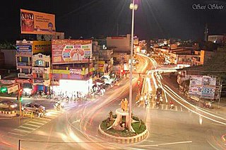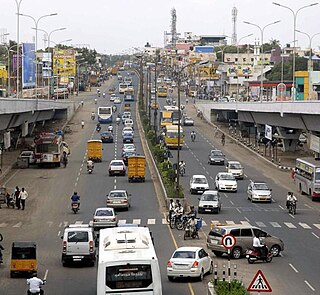
Coonoor(pronunciation ) is a Taluk and a municipality of the Nilgiris district in the Indian State of Tamil Nadu. As of 2011, the town had a population of 45,494.

Attur or Aathur is a town, municipality and headquarters of Attur taluk in the Salem district in the state of Tamil Nadu, India. As of the 2011 census, the town had a population of 61,793.

Tenkasi is a Town and headquarters of the newly created Tenkasi district in the Indian state of Tamil Nadu. Tenkasi District Formed as the 33rd District of Tamil Nadu

Dharmapuri, is a town in the western part of Tamil Nadu, India. The town is located at 50 km from Krishnagiri, 69 km from Salem, 126 km from Bangalore, 200 km from Coimbatore, and 300 km from the state capital Chennai. It is located between latitudes N 11 47’ and 12 33’ and longitudes E 77 02’ and 78 40’. It is one of top leading Mango cultivator and producer of state.

Paramakudi is a city in India and a municipality since 1964 located in the Ramanathapuram district of the Indian state of Tamil Nadu. The river Vaigai flows through Paramakudi on its way to the Bay of Bengal. NH 87 and AH 43 passes through this town, which connects the rest of the district to Sivaganga. Notable persons from this place include actors Kamal Haasan and Chiyaan Vikram.

Pallavaram is a major residential neighborhood in Chennai, Tamil Nadu, India. It is a selection-grade municipality located to the South of the metropolitan city of Chennai. It was a part of Alandur till August 2015 and since then a new taluk under the headquarters of Pallavaram was created. Pallavaram is now a taluk and is known for its cantonment and bustling residential colonies. The neighbourhood is served by Pallavaram railway station of the Chennai Suburban Railway Network.

Ambur is a town and municipality in newly announced Tirupattur District, Tamil Nadu, India. It is located on the banks of the Palar River between Chennai and Bangalore. Ambur has a sizeable leather industry, and is known for its spicy non-vegetarian biryani and for the sweet, makkhenpeda. Ambur was the site of two major military actions in the 18th Century. The first was the 1749 Battle of Ambur that opened the Second Carnatic War between the Arcot State and the Mughal Empire. In 1767, the Siege of Ambur took place during the First Anglo-Mysore War, with local troops and a British force successfully resisting an attack by the Kingdom of Mysore and by the Hyderabad State.

Thiruverkadu is a western suburb of Chennai, Tamil Nadu. It comes under Thiruvallur district administration. It is famous for its Devi Karumariamman Temple. There is also Vedapureeswarar Temple in Thiruverkadu, where Lord Shiva and Goddess Parvathi are seen in their wedding pose inside the sanctum sanctorum. As of 2011, the town had a population of 62,289.

Perambalur is a town in the Indian state of Tamil Nadu. It is the headquarters of Perambalur district and Perambalur taluk (sub-district). Perambalur district is bounded on the North by Cuddalore and Salem, South by Trichy, East by Ariyalur, West by Trichy and Salem. As of 2011 census, the town had a population of 49,648. There are a set of 11th century Buddhists images around the villages of Perambalur called Perambalur Buddhas.

Rasipuram is a town in the Indian state of Tamil Nadu. It is the headquarters for the Rasipuram taluk. As of 2015, the town had a population of 88,584 and an area of 24 km2 (9.3 sq mi). It has 27 wards and steps have been taken to increase the wards to 33. Rasipuram is known for ghee and tapioca sago.

Maduravoyal is a residential neighbourhood located in the west of Chennai, India. As of 2011, the town had a population of 86,195.

Kavundampalayam is an area located in Coimbatore, Tamil Nadu, India. It is within the Coimbatore Corporation, about 6 km north of the city centre. Goundampalayam is along Mettupalayam road in Coimbatore, one of the arterial roads of the city. As of 2011, the town had a population of 83,908.

Katthivakkam was a town and a municipality formerly of Thiruvallur district, but has been absorbed by Chennai district in Sep 2011, in the Indian state of Tamil Nadu. The neighbourhood is served by Katthivakkam railway station. As of 2011, the town had a population of 36,617.

Nelliyalam is a panchayat town in The Nilgiris district in the Indian state of Tamil Nadu. As of 2011, the town had a population of 44,590.

Thiruparankundram is a new town in Madurai district(created in 2011) in Tamil Nadu, India. The area is part of Madurai Municipal Corporation and the first local body election for the corporation was held on 18 October 2011. Tirupparaṅkuṉṟam is known for the Thirupparamkunram Murugan temple, which is one of the Six Abodes of Murugan. It is one of the most visited tourist places in Madurai, next only to the Meenakshi Amman Temple. The Tirupparankunram Dargah is located atop the Tirupparankunram Hill. As of 2011, the town had a population of 48,810.

Valasaravakkam is a neighbourhood in the Chennai district of the Indian state of Tamil Nadu and a residential suburb of the city of Chennai. It is located in the Poonamallee Taluk at a distance of approximately 15 kilometres from the Kilometer Zero stone. Valasaravakkam lies on the Arcot Road, one of Chennai's arterial roads. It is under the Maduravoyal election constituency. In October, 2011 Valasaravakkam Municipality ceased to exist and the area became part of Chennai Corporation as Ward Nos 149 and 152, Southern Region, Corporation of Chennai. As of 2011, the town had a population of 47,378. Famous Sivan temple is in Kesavardhini.
Narasingapuram is a Municipality in Attur Taluk, Salem district in the Indian state of Tamil Nadu. As of 2011, the town had a population of 23,084.

Maraimalai Nagar is a town of Chengalpattu district, near Chennai, Tamil Nadu, India. It is a municipality town in Chengalpattu district. It lies in the southern part of the Chennai metropolitan area around 50 km from downtown Chennai Egmore and about 15 km from Vandalur. Maraimalar Nagar is a part of the Chennai metropolitan area. It is a satellite town developed by the CMDA in 1980. Many heavy industries are located in Maraimalai Nagar. The Ford India and BMW car factories are located within a mile from Maraimalai Nagar and the Indian software giant Infosys also has an office within eight kilometers of Maraimalai Nagar. SRM University has its main campus in the neighbouring Potheri. As of 2011, Maraimalai Nagar had a population of 81,872.

Sengottai is a town in the Tenkasi district, of Tamil Nadu, India. It is the gateway to southern Tamil Nadu and Kerala. Spread over an area of 2.68 km2 with a population of over 26,823, the economy of the town revolves around the cultivation of rice.


