Bongadobhan is a village development committee in Baglung District in the Dhaulagiri Zone of central Nepal. At the time of the 1991 Nepal census it had a population of 4,537 and had 904 houses in the town.
Hatiya is a Village Development Committee in Baglung District in the Dhaulagiri Zone of central Nepal. At the time of the 1991 Nepal census it had a population of 6,015 and had 1131 houses in the town.
Chittpol is a village and former Village Development Committee in Bhaktapur District in the Bagmati Zone of central Nepal. In 2014, it was merged into the newly formed Suryabinayak Municipality by the Government of Nepal in order to remove all Village Development Committees in the Districts of Kathmandu and Bhaktapur. At the time of the 1991 Nepal census it had a population of 4689 with 819 houses in it.
Lapsiphedi is a village and former Village Development Committee that is now part of Shankharapur Municipality in Kathmandu District in Province No. 3 of central Nepal. At the time of the 1991 Nepal census it had a population of 5040 and had 919 households in it.
Mahamadpur is a Village Development Committee in Bardiya District in the Bheri Zone of south-western Nepal. At the time of the 1991 Nepal census it had a population of 8,191 and had 1152 houses in the town.
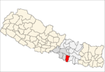
Mukhiyapatti Musharniya is a village development committee in Dhanusa District in the Janakpur Zone of south-eastern Nepal. At the time of the 1991 Nepal census it had a population of 4,621 persons living in 436 individual households.
Bhumidanda is a village development committee in Kabhrepalanchok District in the Bagmati Zone of central Nepal. At the time of the 1991 Nepal census it had a population of 3383 and had 630 houses in it.
Khopasi is a village development committee in Kabhrepalanchok District in the Bagmati Zone of central Nepal. At the time of the 1991 Nepal census it had a population of 3453 in 676 individual households.
Malpi is a village development committee in Kabhrepalanchok District in the Bagmati Zone of central Nepal. At the time of the 1991 Nepal census it had a population of 3033 in 571 individual households.
Sunthan is a village development committee in Kabhrepalanchok District in the Bagmati Zone of central Nepal. At the time of the 1991 Nepal census it had a population of 3491 in 650 individual households.
Rajpur is a town and Village Development Committee in Dang Deokhuri District in the Rapti Zone of south-western Nepal. At the time of the 1991 Nepal census it had a population of 8,811 persons residing in 1454 individual households.
Chapakot is a village and Village Development Committee in Kaski District in the Gandaki Zone of northern-central Nepal. At the time of the 1991 Nepal census it had a population of 2,966 persons residing in 574 individual households.
Madanpur, Nepal is a Village Development Committee in Nuwakot District in the Bagmati Zone of central Nepal. At the time of the 1991 Nepal census it had a population of 7995 people residing in 1334 individual households.
Jibjibe is a village development committee (VDC) in Rasuwa District in the Bagmati Zone of northern Nepal. At the time of the 1991 Nepal census it had a population of 4944.
Gilung is a village development committee in Lamjung District in the Gandaki Zone of northern-central Nepal. At the time of the 1991 Nepal census it had a population of 2110 people living in 419 individual households.
Kolhusa Bagaiya is a village development committee in Mahottari District in the Janakpur Zone of south-eastern Nepal. At the time of the 1991 Nepal census it had a population of 5193 people living in 947 individual households.
Dhyaurali is a village development committee in Ramechhap District in the Janakpur Zone of north-eastern Nepal. At the time of the 1991 Nepal census it had a population of 3111 people living in 616 individual households.
Lagadigoth is a village development committee in Siraha District in the Sagarmatha Zone of south-eastern Nepal. At the time of the 1991 Nepal census it had a population of 2799 people living in 482 individual households.
Nanda Nagar is a village development committee in Kapilvastu District in the Lumbini Zone of southern Nepal. At the time of the 1991 Nepal census it had a population of 4740 people living in 808 individual households.
Rampurwa is a village development committee in Nawalparasi District in the Lumbini Zone of southern Nepal. At the time of the 1991 Nepal census it had a population of 3689 people living in 542 individual households.