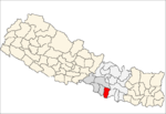
Aurahi is a municipality in Mahottari District in Province No. 2 of Nepal. It was formed in 2016 occupying current 9 sections (wards) from previous 9 former VDCs. It occupies an area of 35.73 sq. km with a total population of 31,751.

Loharpatti is a municipality in Mahottari District in Province No. 2 of Nepal. It was formed in 2016 occupying current 9 sections (wards) from previous 9 former VDCs. It occupies an area of 50.06 sq. km with a total population of 39,571.

Ramgopalpur is a municipality in Mahottari District in Province No. 2 of Nepal. It was formed in 2016 occupying current 9 sections (wards) from previous 9 former VDCs. It occupies an area of 39.54 sq. km with a total population of 29,612.

Rajdevi is a municipality in Rautahat District, a part of Province No. 2 in Nepal. It was formed in 2016 occupying current 9 sections (wards) from previous 9 former VDCs. It occupies an area of 28.21 sq. km with a total population of 31,212.

Bideha is a municipality in Danusha District in Province No. 2 of Nepal. It was formed in 2016 occupying current 9 sections (wards) from previous 9 VDCs. It occupies an area of 45.51 sq. km with a total population of 32,266.

Sahidnagar is a municipality in Danusha District in Province No. 2 of Nepal. It was formed in 2016 occupying current 9 sections (wards) from previous 9 VDCs. It occupies an area of 57.37 sq. km with a total population of 43,007.

Hansapur is a municipality in Danusha District in Province No. 2 of Nepal. It was formed in 2016 occupying current 9 sections (wards) from previous 9 VDCs. It occupies an area of 48.71 sq. km with a total population of 39,145.

Kamala is a rural municipality in Danusha District in Province No. 2 of Nepal. It was formed in 2016 occupying current 9 sections (wards) from previous 9 VDCs. It occupies an area of 65.85 sq. km with a total population of 20,052.

Haripur is a rural municipality in Sarlahi District, a part of Province No. 2 in Nepal. It was formed in 2016 occupying current 9 sections (wards) from previous 9 former VDCs. It occupies an area of 66.86 sq. km with a total population of 47,187.

Chakraghatta is a rural municipality in Sarlahi District, a part of Province No. 2 in Nepal. It was formed in 2016 occupying current 9 sections (wards) from previous 9 former VDCs. It occupies an area of 25.16 sq. km with a total population of 27,952.

Budhimai is a municipality in Rautahat District, a part of Province No. 2 in Nepal. It was formed in 2016 occupying current 9 sections (wards) from previous 9 former VDCs. It occupies an area of 35.34 sq. km with a total population of 36,268.

Brindaban is a municipality in Rautahat District, a part of Province No. 2 in Nepal. It was formed in 2016 occupying current 9 sections (wards) from previous 9 former VDCs. It occupies an area of 95.40 sq. km with a total population of 42,735.

Dewahi Gonahi is a municipality in Rautahat District, a part of Province No. 2 in Nepal. It was formed in 2016 occupying current 9 sections (wards) from previous 9 former VDCs. It occupies an area of 33.99 km2 with a total population of 32,143.

Gadhimai is a municipality in Rautahat District, a part of Province No. 2 in Nepal. It was formed in 2016 occupying current 9 sections (wards) from previous 9 former VDCs. It occupies an area of 49.44 km2 with a total population of 40,410.

Ishanath is a municipality in Rautahat District, a part of Province No. 2 in Nepal. It was formed in 2016 occupying current 9 sections (wards) from previous 9 former VDCs. It occupies an area of 35.17 km2 with a total population of 41,435.

Madhav Narayan is a municipality in Rautahat District, a part of Province No. 2 in Nepal. It was formed in 2016 occupying current 9 sections (wards) from previous 9 former VDCs. It occupies an area of 48.53 sq. km with a total population of 35,175.

Maulapur is a municipality in Rautahat District, a part of Province No. 2 in Nepal. It was formed in 2016 occupying current 9 sections (wards) from previous 9 former VDCs. It occupies an area of 34.75 sq. km with a total population of 26,431.

Pacharauta is a municipality in Bara District in Province No. 2 of Nepal. It was formed in 2016 occupying current 9 sections (wards) from previous 9 former VDCs. It occupies an area of 44.01 sq. km with a total population of 34,175.

Parsagadhi is a municipality in Parsa District in Province No. 2 of Nepal. It was formed in 2016 occupying current 9 sections (wards) from previous 9 former VDCs. It occupies an area of 99.69 sq. km with a total population of 38,067.

Bahudarmai is a municipality in Parsa District in Province No. 2 of Nepal. It was formed in 2016 occupying current 9 sections (wards) from previous 9 former VDCs. It occupies an area of 31.55 sq. km with a total population of 39,763.


