The 1991 Nepal census was a widespread national census conducted by the Nepal Central Bureau of Statistics.

Irkhu is a village and market center of Chautara Sangachowkgadi Municipality in Sindhupalchok District in the Bagmati Zone of central Nepal. The formerly Village Development Committee was merged to the new Municipality in 2017. At the time of the 1991 Nepal census it had a population of 2628 and had 480 houses in the village.
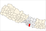
Satungal is a village and former Village Development Committee that is now part of Chandragiri Municipality in Kathmandu District in Province No. 3 of central Nepal. Satungal is also known as Satyapur. At the time of the 1991 Nepal census it had a population of 2730 and had 464 households in it. At the time of the 2001 Nepal census Satungal had a population of 5834 and had 1375 households in it. Satungal had 5173 literate people i.e. 88.66%..
Lakshmanpur is a town in Banke District in the Bheri Zone of south-western Nepal. At the time of the 1991 Nepal census it had a population of 3,416 and had 668 houses in the town.
Naubasta is a town in Banke District in the Bheri Zone of south-western Nepal. At the time of the 1991 Nepal census it had a population of 11,160 and had 1663 houses in the town.
Dolalghat is a village development committee in Kabhrepalanchok District in the Bagmati Zone of central Nepal.
Ugratara Janagal is a village development committee in Kabhrepalanchok District in the Bagmati Zone of central Nepal. At the time of the 1991 Nepal census it had a population of 5197.
Johang is a Village Development Committee VDC in Gulmi District in the Lumbini Zone of Western Nepal. At the time of the 2011 Nepal census it had a population of about 10000 living in 1509 individual households.
Situated on the bank of Kaligandaki river, Khadgakot is a town and Village Development Committee, in Gulmi District in the Lumbini Zone of central Nepal. At the time of the 1991 Nepal census it had a population of 4297 persons living in 808 individual households.

Chulachuli is a rural municipality (gaunpalika) out of six rural municipality located in Ilam District of Province No. 1 of Nepal. There are a total of 10 municipalities in Ilam in which 4 are urban and 6 are rural.
Laxmipur is a former town and Village Development Committee in Ilam District in the Mechi Zone of eastern Nepal.
Mirchaiya formerly known as Ramnagar Mirchaiya is a municipality in Siraha District in the Sagarmatha Zone of south-eastern Nepal. The municipality was established on 18 May 2014 by merging the existing Rampur Birta, Malhaniyakhori, Radhopur, Ramnagar Mirchaiya, Phulbariya, Sitapur PraDa and Maheshpur Gamharia Village Development Committees. At the time of the 2017 municipality records, it had a population of approx. 52,000 people living in approx 8,496 individual households. This is one of the main business markets for Katari and the southern part of the Siraha district. Raw material produced here includes padday, miazem, and sugar cane. Frequently used Language of Mirchaiya is Maithali. However, People of this locality is well educated they can speak English, Nepali, Hindi and some other local language according to their ethnicity. The famous festival of Mirchaiya is Durgapuja, Jhanda Mela, Holi, Chhat puja, Shreepanchami, Dipawali. The mode of transportation mostly used include: bus, car, bike, bicycle, rickshaw, tempo, and mini bus.
Baraipur is a village development committee in Kapilvastu District in the Lumbini Zone of southern Nepal. At the time of the 1991 Nepal census it had a population of 2769.
Jayanagar is a village development committee in Kapilvastu District in the Lumbini Zone of southern Nepal. At the time of the 1991 Nepal census it had a population of 5886.Recently government of Nepal has integrated jayanagar,mahendrakot and dubiya V.D.C in to buddhanhumi municipality
Mahuwa is a village development committee in Kapilvastu District in the Lumbini Zone of southern Nepal. At the time of the 1991 Nepal census it had a population of 4666.
Manpur is a village development committee in Kapilvastu District in the Lumbini Zone of southern Nepal. At the time of the 1991 Nepal census it had a population of 3273.
Dubiya is a village development committee in Kapilvastu District in the Lumbini Zone of southern Nepal. At the time of the 1991 Nepal census it had a population of 4,443.
Pathari Sanischare (पथरी-शनिश्चरे) is a Municipality in Morang District in the Koshi Zone of south-eastern Nepal. It was formed by merging two existing village development committees i.e. Pathari and Sanischare in May 2014.
The 2001 Nepal census was conducted by the Nepal Central Bureau of Statistics. According to Census, the population of Nepal in 2001 was 23,151,423. Working with Nepal's Village Development Committees at a district level, they recorded data from all the main towns and villages of each district of Nepal. The data included statistics on population size, households, sex and age distribution, place of birth, residence characteristics, literacy, marital status, religion, language spoken, caste/ethnic group, economically active population, education, number of children, employment status, and occupation.
Garuda is a Municipality in Rautahat District in the Narayani Zone of south-eastern Nepal. It is a newly created municipality by merging 7 former Village development committees namely Garuda Bairiya, Malahi, Basbiti Jingadiya, Gedahiguthi, Jayanagar, Mahamadpur and Pothiyahi. Garuda is situated between Gaur and Chandrapur Municipality. The district headquarter Gaur is situated 20 KM South from this place. Similarly, Chandrapur Municipality is situated 22 KM North from this place. Roadways is easy mean of travelling for this place.