Arani is a province in Cochabamba Department, Bolivia. Its capital is Arani, situated about 53 km from Cochabamba. Arani is known for its bread but also for the town's artisan wickerwork.

Carrasco is a province in the Cochabamba Department in central Bolivia. Its capital is Totora.

Nor Chichas is a province in the Eastern parts of the Bolivian Potosí Department. Its seat is Cotagaita.

Oropeza is a province in the Chuquisaca Department, Bolivia. Its seat is Sucre which is also the constitutional capital of Bolivia and the capital of the Chuquisaca Department.

Chayanta is a province in the northern parts of the Bolivian Potosí Department. Its capital is Colquechaca.
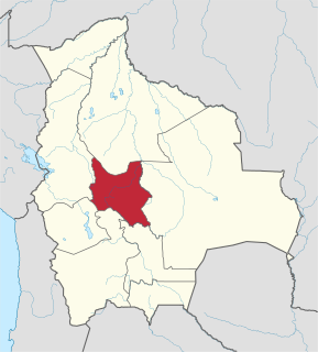
Pocona Municipality is the third municipal section of the Carrasco Province in the Cochabamba Department in Bolivia. Its seat is Pocona. At the time of census 2001 the municipality had 13,488 inhabitants.

Sacabamba is a town in the Cochabamba Department in central Bolivia. It is the capital of Sacabamba Municipality, the fourth municipal section of Esteban Arce Province. At the time of census 2001 it had a population of 636.

Yocalla Municipality is the second municipal section of the Tomás Frías Province in the Potosí Department in Bolivia. Its seat is Yocalla.

Ravelo Municipality is the second municipal section of the Chayanta Province in the Potosí Department in Bolivia. Its seat is Ravelo.

Jatun Mayu is a Bolivian river in the Cochabamba Department, Esteban Arce Province, in the Anzaldo and Sacabamba Municipalities. Its waters flow to Laguna Angostura.

Jatun Q'asa is a mountain in the Khari Khari mountain range of the Bolivian Andes, about 5,023 m high. It is located in the Potosí Department, Tomás Frías Province, Potosí Municipality. It lies north of the plain called Jatun Molino Pampa and the Sip'uruni River. Jatun Q'asa lies near Q'illu Q'asa, Q'illu Urqu and Yuraq Yuraq.
Jatun Kunturiri is a mountain in the Potosí mountain range of the Bolivian Andes, about 5,008 m (16,430 ft) high. It is situated south-east of Potosí in the Potosí Department, José María Linares Province, in the south-west of the Puna Municipality. It lies between the Sip'uruni River in the north and the Khunurana in the south, north-west of the lake T'ala Qucha and the village Talaco.
Hatun Urqu or Jatun Urqu may refer to:
Jatun Urqu is a mountain in the Bolivian Andes which reaches a height of approximately 3,440 m (11,290 ft). It is located in the Cochabamba Department, Mizque Province, Vila Vila Municipality. Jatun Urqu lies south of Tikrasqa and southwest of Iskay Ch'utu.
Jatun Urqu is a 3,552-metre-high (11,654 ft) mountain in the Bolivian Andes. It is located in the Cochabamba Department, Esteban Arce Province, Sacabamba Municipality, northeast of the village of Matarani.
Pukara is a mountain in the Bolivian Andes which reaches a height of approximately 3,760 m (12,340 ft). It is located in the Cochabamba Department, Esteban Arce Province, Sacabamba Municipality. Pukara lies southwest of Atuq Wachana and northwest of Jatun Urqu, southwest of the village of Yana Rumi.
Jatun Urqu is a mountain in the Bolivian Andes which reaches a height of approximately 3,680 m (12,070 ft). It is located in the Cochabamba Department, Mizque Province, Alalay Municipality. It lies northeast of Jatun Urqu.
Puka Qallpa is a 3,886-metre-high (12,749 ft) mountain in the Bolivian Andes. It is located in the Cochabamba Department, Mizque Province, Alalay Municipality. It lies northwest of Kachi Q'asa and northeast of Inka Pirqa. The Puka Urqu Mayu flows along its western slope. Its waters flow to the Jatun Mayu in the south.
Jatun Urqu is a 2,629-metre-high (8,625 ft) mountain in the Bolivian Andes. It is located in the Potosí Department, Chayanta Province, Ravelo Municipality. It lies east of the Quri Mayu.
Qallu Urqu is a mountain in the Bolivian Andes which reaches a height of approximately 3,580 m (11,750 ft). It is located in the Chuquisaca Department, at the border of the Jaime Zudáñez Province, Icla Municipality, and the Tomina Province, Sopachuy Municipality.