Jefferson, Greene County, Pennsylvania | |
|---|---|
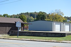 Site of the former Monongahela College on Pennsylvania Route 188 | |
| Etymology: Thomas Jefferson | |
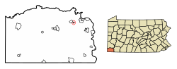 Location of Jefferson in Greene County, Pennsylvania. | |
 Jefferson  Jefferson | |
| Coordinates: 39°55′49″N80°3′32″W / 39.93028°N 80.05889°W | |
| Country | United States |
| State | Pennsylvania |
| County | Greene |
| Established | 1795 |
| Named after | Thomas Jefferson |
| Government | |
| • Body | Jefferson Borough Council |
| • Mayor | Dale E. Harshman (Democrat) |
| • Tax Collector | Signa Coneybeer (Democrat) |
| Area | |
• Total | 0.19 sq mi (0.49 km2) |
| • Land | 0.19 sq mi (0.49 km2) |
| • Water | 0.00 sq mi (0.00 km2) |
| Elevation | 960 ft (290 m) |
| Population | |
• Total | 253 |
| 241 | |
| • Density | 1,345.74/sq mi (519.98/km2) |
| Time zone | UTC-4 (EST) |
| • Summer (DST) | UTC-5 (EDT) |
| ZIP code | 15344 |
| Area code | 724 |
| FIPS code | 42-37880 |
Jefferson is a borough in Greene County, Pennsylvania, United States. The population was 253 at the 2020 census, [2] a decline from the figure of 270 tabulated in 2010. [3] The borough was named after Thomas Jefferson. [4]
