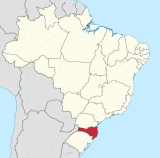
Santa Catarina is one of the 27 federative units of Brazil. It is located in the centre of the country's Southern region. It is bordered to the north by the state of Paraná, to the south by the state of Rio Grande do Sul, to the east by the Atlantic Ocean, and to the west by the Argentine province of Misiones.

Florianópolis is the capital and second largest city of the state of Santa Catarina, in the South region of Brazil. The city encompasses Santa Catarina Island and surrounding small islands, as well as part of the mainland. It has a population of 508,826, according to the 2020 IBGE population estimate, the second-most populous city in the state, and the 47th in Brazil. The metropolitan area has an estimated population of 1,111,702, the 21st largest in the country. The city is known for having the country's third highest Human Development Index score among all Brazilian cities (0.847).

Limeira is a city in the eastern part of the Brazilian state of São Paulo. With a population of approximately 291,869 people and covering an area of 581 square kilometers, it sits at an elevation of 588 meters. The city is situated 154 kilometers from São Paulo, the capital of the state, and 1011 kilometers from Brasilia, the capital of Brazil. Limeira is conveniently accessible from São Paulo via two highways: Rodovia Anhanguera and Rodovia dos Bandeirantes.

Blumenau is a city in Vale do Itajaí, Santa Catarina state, in the South Region of Brazil, 130 km (81 mi) from the state capital Florianópolis.

Chapecó is a municipality in the state of Santa Catarina, in the Southern Region of Brazil. Being a major industrial, financial and educational center, it is a major producer of industrialized food products. Considered a medium city, with a population estimated at 224,013 inhabitants, it is among the four most important cities in the state. It belongs to the Meso-region of Western Santa Catarina and to the Microregion of Chapecó.
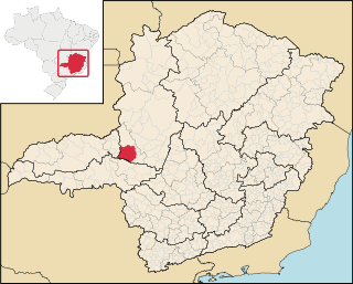
Patrocínio is a municipality in the state of Minas Gerais in Brazil. The population is 91,449 in an area of 2874 km2. The elevation is 965 m.

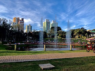
Cascavel is a municipality in the state of Paraná in Brazil. It is the fifth most populous city in the state with 348 051 inhabitants, according to IBGE 2022 Census. The distance to Curitiba, the state capital, is 491 kilometers by freeway.

Francisco Beltrão, established on December 14, 1952, is a municipality in the state of Paraná in Brazil. In 2010, the population was 80,727, of which 85% lived in the city proper and 15% on the surrounding land. Francisco Beltrão is very close to two other cities, Marmeleiro and Renascença. Its economy is based on agriculture, corn crops, turkey and chicken meat exports, textiles, aluminium pans, mobile industries, public services and small commerce.
Passo Fundo is a municipality in the north of the southern Brazilian state of Rio Grande do Sul. It is named after its river. It's the twelfth largest city in the state with an estimated population of 204,722 inhabitants living in a total municipal area of 780 km2.

Itajaí is a municipality in the state of Santa Catarina, Brazil. It is located on the northern central coast of Santa Catarina and is part of the Vale do Itajaí Mesoregion, on the right bank of the Itajaí-Açu river mouth. It lies at the mouth of the Itajaí River, at 20 feet above sea level. The city has the 2nd largest gross domestic product and the highest per capita income in the State of Santa Catarina.

Campos Novos is a city in Santa Catarina, in the Southern Region of Brazil. Campos Novos is a pioneer in production of pollen and the biggest grain and oat producer of Santa Catarina. The municipality invests also into fat stock and poultry farming.

Oeste Catarinense is a mesoregion in the Brazilian state of Santa Catarina.

São Joaquim is a municipality in the state of Santa Catarina, situated in southern Brazil. Its population in 2020 was 27,139 inhabitants. Located in the Planalto Serrano, it lies 136 km from Tubarão, 81 km from Lages and 227 km from Florianópolis. The town is home to a variety of ethnic groups, including Italian, German, Portuguese, Japanese and Afro-Brazilians. There are also many people from other states in Brazil, especially from Rio Grande do Sul.

Tabira is a city in the state of Pernambuco, Brazil. The population in 2020, according to the Brazilian Institute of Geography and Statistics, was 28,704 inhabitants. Its land area is 388 km2.
Santa Terezinha is a city in the state of Pernambuco, Brazil. The population in 2020, according with IBGE was 11,865 inhabitants and the total area is 200.32 km².

Faxinal dos Guedes is a municipality located in the west of the state of Santa Catarina, in the South Region of Brazil. Its population, according to the 2022 Brazilian Institute of Geography and Statistics Census, was 11 192 inhabitants. With an area of 340,070 km2, part of its territory is located on the western edge of a meteoritic crater, the Vargeão Dome.

Caçador is a municipality in the state of Santa Catarina in the South region of Brazil.
SAVAG – Sociedade Anônima Viação Aérea Gaúcha was a Brazilian airline founded in 1946 that operated mainly in the state of Rio Grande do Sul. It was absorbed by Cruzeiro do Sul in 1966.
TAC – Empresa de Transportes Aéreos Catarinense S/A was a Brazilian airline founded in 1947 that operated mainly in the south and southeast regions of Brazil. It was absorbed by Cruzeiro do Sul in 1966.
Helisul Linhas Aéreas S/A was a Brazilian airline founded in 1994. In 1996, it was sold to TAM Transportes Aéreos Regionais, which incorporated the airline in 1998.


